Other years
2006
2005
2004
2003
2002
2001
1998-99
Thirsty City Self Guided Tours
Past Walks
The premiere of Beverley McIver's composition "Lost Rivers" suite for the Wychwood Clarinet Choir will take place on Sunday, May 25 at St. Michael's and All Angels Church, 611 St. Clair Ave West at 4:00 p.m.
See WYCHWOODCLARINETCHOIR.CA for details. Tickets $25, Students, Seniors $15 or Pay What You Can.
The work is in three parts:
1. "What Does the Water Say?" - inspired by a conversation with Helen Mills
2. "Isphadinaa" - inspired by Beverley's walk with Jane Wolff up Spadina to the top of the Baldwin Steps
3. "Song for the Guardians of the Water" - inspired by people such as Helen and Jane, the Water Walker movement and anyone who cares about the water.
"It has been a joy to write this composition and to learn about the Lost Rivers of Toronto. I feel my composition is only a glimpse into this important topic, and I am very thankful for you and others who have helped me bring this creation to fruition."

Sunday, November 24, 2024
11:00 AM to 1:30 PM EST
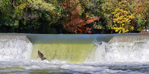
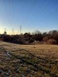
Autumn Walk Along the East Don River
Join Lost Rivers for a fall excursion as we hike the historic and scenic East Don Trail from Moccasin Trail Park south to Wigmore Park
Location:
Meet at: 1 Green Belt Drive, Toronto, ON M3C 1W3
Click here for GoogleMap: https://maps.app.goo.gl/wUpgEHtGXPbpCXw19
The walk ends at Eglinton and Sloan Ave (Bermondsey)
Walk leaders: Floyd Ruskin and friends
Accessibility: Paved trails with some steep grades; approx 5 km.
Washrooms at beginning and end at neighbourhood restaurants.
Rain or shine.
Don't forget to wear comfortable shoes and dress for the weather.
About this event
Though the leaves and salmon may be gone for the season, the East Don Trail is still a place of wonder and exploration in the city.
We will be walking through an area that resonates with both Indigenous as well as settler history along with the beautiful natural features of the East Don
Mills, dams, railroads, highways, ecological restoration and art will all be part of our narrative.
The city and TRCA have connected this part of the trail with bridges and paving and installed much anticipated wayfinding.
This a linear (one way) walk as we will begin at the S/E corner of Don Mills Road and Greenbelt Drive and end at Eglinton and Sloan Ave (Bermondsey). There are terrific transit connections at both ends.
This event is a great opportunity to connect with nature, enjoy the crisp autumn air, and take in the stunning views along the river. Whether you're a nature enthusiast or just looking for a relaxing outdoor activity, this walk is perfect for all ages and most fitness levels.
Hope to see you there!
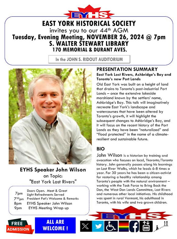
Tuesday, November 26, 2024
7:00 PM
A Presentation about the Lost Rivers of East York, Ashbridge's Bay, and Toronto's New Portlands
Join Lost Rivers' John Wilson for a presentation to the East York Historical Society
Location: John S Ridout Auditorium, S. Walter Stewart Library, 170 Memorial Park Avenue at Durant Avenue
All welcome and admission is free
Sunday, October 20, 2024
2:00 PM - 4:30 PM EDT
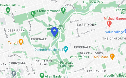
The Five Creeks of Rosedale
The leaves and seasons are changing so let’s get together with a Lost Rivers autumn ramble with John Wilson, Ed Freeman and friends.
Location: Meet outside the Rosedale Subway Station (Crescent Road at Yonge St)
End at Evergreen Brick Works
Details:
Back by popular demand, and hopefully timed for some great fall colours. We will be wending our way through Rosedale’s maze of streets and ravines, we will share observations of the landscape and recollections of the inhabitants who have shaped the neighbourhood. The walk will include both city sidewalks and rough, off-trail sections – palatial “great homes” and woodland refuges.
We will distinguish and characterize five lost creeks and learn how to navigate them. (Hint: The acronym of their names forms a palindrome.)
Come prepared for a challenging walk, with good hiking equipment, water and clothing to match the weather.
Rest rooms at the beginning and end only.
Getting Home: Free shuttle from Brickworks to Broadview Station; or a 15 minute walk to Castle Frank Station or #28 TTC bus to Davisville Station
Sunday, September 15, 2024
2-4pm EDT
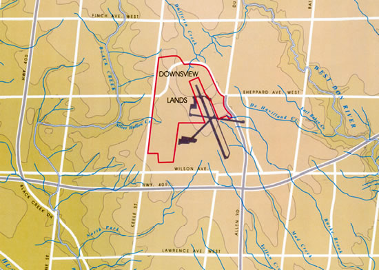
A Fresh Way to Look at the Downsview Lands
Discover a fresh perspective on the Downsview Lands as we walk the site of a former Air Force base and city airport
Walk Leaders: Rene Fan, Pim Pettibone
Location:
The walk starts at the southwest entrance of Downsview Park, near Keele St and Downsview Park Blvd, serviced by the 101 bus. The route is flat and paved, under 2 km in length, finishing at George Butchart Drive near Keele St, near the start.
Washroom facilities: There is a washroom in Stanley Greene Park, after the second stop.
Accessibility: Paved sidewalks and trails, easy grades. The area is open, sunny and can be windy. Please dress for the weather, and bring sunscreen, water and a hat if it is a sunny day.
Join Lost Rivers for a walk at Downsview, a former Air Force base and soon to be the site of the largest redevelopment project in North America. Explore Downsview Park and learn about green infrastructure initiatives in the new Stanley Greene neighbourhood, which are important considering that the area was once the headwaters for several small streams on the west and south of the Downsview site: Meadow Creek, Frog Creek, Mill Creek, Silver Hollow Creek and others with no name had their headwaters here, and flowed into Black Creek. The Green Infrastructure helps create a more natural water cycle and can reduce flooding downstream. It is very important to catch the water where it falls. To the east Yellow Creek, Mud Creek, DeHavilland Creek, Dufferin Creek, and Burke Brook are just a few of the creeks that flowed into the Don River.

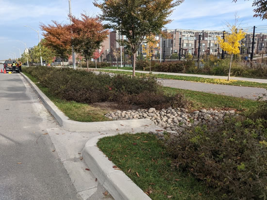
Green infrastructure on Stanley Greene Blvd.
Sunday, July 21 · 2 - 4pm EDT
WHY PUBLIC WORKS MATTER
In this walk along lost Castle Frank Brook, we will explore some of the watery infrastructure which makes life in the city possible…but that we may take for granted or not even recognize is right under our feet.
Using examples from the South Hill area of Toronto, there will be stories that connect with drinking water filtration and distribution, transportation and electricity.
Walk leader: Paul Overy
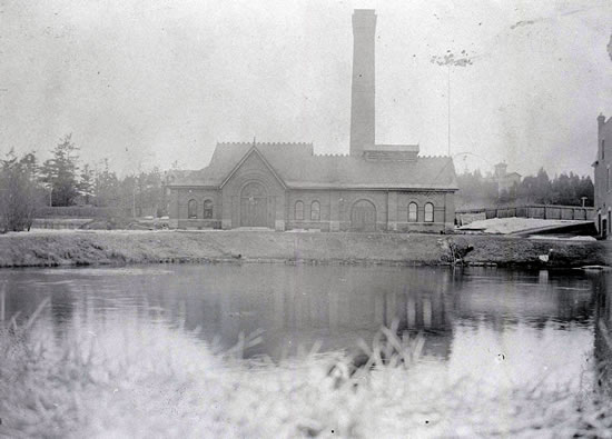
Meet at: The High Level Pumping Station, two blocks north of the intersection of Dupont Street and Davenport Road.
35 Poplar Plains Rd Toronto, ON M4V 2M7
The nearest TTC access is from the intersection of Dupont Street and Davenport Road, which can be reached by either the #19 Bay bus or the #26 Dupont Bus. The Dupont subway station is 4 blocks to the west.
There are no public parking lots nearby, but there is limited paid street parking on nearby streets.
End point: Just south of the entrance to the St. Clair West subway station, 2 blocks east of Bathurst Street.
If driving, there is a Green P Parking lot at 1445 Bathurst St, Toronto, which people could use if they are willing to walk to the start point and pick up their car after the walk.
Washroom facilities: in Wells Hill Park, one block to the west.
Accessibility: There are no steps other than on and off sidewalks.
There are, however, three modest inclines on the route. The first is on a sidewalk, while the other two in the latter part of the walk are on a gravel surface that may be challenging to someone using a mobility device.
The tour will be approximately half on soil/gravel trails, which could be muddy in the event of rain. If conditions are muddy, we will take a route on sidewalks part way.
Saturday, June 22 · 2 - 4pm EDT
Street Trees of Summerhill on Lost Mashquoteh Creek
Come join us for this free, fun and educational event exploring the beautiful street trees of Summerhill on Lost Mashquoteh Creek. June is a wonderful time to stroll or roll the tree-lined streets of the Summerhill neighbourhood.
Meet at: Glenn Gould Park. Northwest corner of St Clair and Avenue Road
480 Avenue Road Toronto, ON M4V 2J4
Ends at: Summerhill Station
Walk Leaders: John Wilson (Lost Rivers) and Stephen Smith (Urban Forestry Associates)
Walk Details:
This walk will give you the opportunity to learn about the different types of trees in the area and their importance to the local ecosystem. We will walk over the brow of the lost Lake Iroquois escarpment, taking in the landscape and urban forest along the course of lost Mashquoteh Creek. This is perhaps the least remembered, but one of the most dramatic, of the downtown buried watercourses.
We’ll make a linear walk from Glen Gould Park at St. Clair and Avenue Road to Summerhill Station on Yonge Street.
Our course will comprise residential streets with sidewalks, and it will include a healthy dose of tree identification and appreciation along with local history.
The walk is accessible to all, although washrooms are in short supply only in businesses near the end.
Please register at:
https://www.eventbrite.ca/e/street-trees-of-summerhill-on-lost-mashquoteh-creek-tickets-924484517077?aff=ebdsshother&utm_share_source=listing_android
Sunday April 28, 4:30 PM to 6:30 PM
Spring in the Mud Creek Ravine
Join us for an early evening stroll featuring SPRING alongside Mud Creek in the Moore Park Ravine.
It has been 30 years since we first walked Mud Creek! At that time the Don Valley Brick Works Park did not exist, just an abandoned quarry with a lot of landfill from the excavations for the Scotiabank Tower downtown.
A lot has changed, in a very good way. Fingers crossed for migrating birds, spring ephemerals, turtles, and spring blossoms.
Walk ends at Evergreen Brick Works where we can gather to warm up at Picnic Restaurant.
Meet at the entrance to the Moore Park Ravine, Moore Avenue approximately 3 blocks east of Mount Pleasant Road
Walk Leaders: Helen Mills, Rene Fan and Eric Davies
Accessibility: mainly paved trails some steep slopes
Please dress for the weather
Rain or shine
Please follow Lost Rivers on Facebook, Twitter, Instagram and Eventbrite
Sunday March 17
2-4 p.m.
Kensington Market tour featuring buried Russell Creek
Join us for a journey through the vibrant streets of Kensington Market! Discover hidden gems and hear fascinating tales.
Meet at the south/west corner of College Street and Bellevue Ave
Accessibility: mainly paved sidewalks
Please dress for the weather
Rain or shine
Walk Leaders: Helen Mills and Adam Wynne
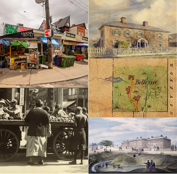
We will discover lost Russell Creek through stories and rumours of springs trickling through basements, sinking houses, an old brick sewer, and a brewery.
This was the first part of the city where working farms gave way to urban uses, and it is packed with history. The Market is a designated National Historic Site of Canada, for its unique architecture and streetscapes, and for the diverse ethno-cultural communities who came here in waves from all over the world. Behind this is the much older 11,000 year Indigenous history that goes back to the time that Russell Creek first began to flow.
On this walk, Adam Wynne will share his incredible research, and Helen Mills will talk about the origin story of the creek. You will hear stories of the colony, the gentleman farmers, the demise of the forests, the Churches and Synagogues, Red Emma and the Labour Lyceum, the Brewery, the Chicken Factory, the Amazon Workshop, Tiger’s Coconut Grove. As well we will have an update on the new Heritage Conservation District and the Indigenous Engagement process that the City of Toronto is undertaking and visit the latest proposed site for the Kensington Market Land Trust – part of the community response to intense development pressures.
Your Tour Guides:
Helen Mills is the founder and co-director of Toronto Green Community’s Lost Rivers program. Now in its 30th year, Lost Rivers has named and mapped hundreds of lost creeks and accumulated a treasure trove of information about Toronto’s water, land, people, ecosystems and neighbourhoods. Helen was the recipient of the Wellington Water Watchers Lifetime Water Protection Award in 2021.
and
Adam Wynne is the Interim Director of the Church-Wellesley Village BIA and the elected Chair of the Toronto and East York Community Preservation Panel. He was a 2023 nominee for the Architectural Conservancy of Ontario's Stephen A. Otto Award in Research and Documentary and is presently the historian for the Church-Wellesley Village Neighbourhood Association. He has some very interesting information about Kensington Market and Russell Creek.
Sunday, February 25, 2024
4:00 PM to 5:30 PM
Two Eyed Seeing Wetland Walk
Meet at the NE Corner High Park Avenue and Bloor St West
Walk Leaders: Carolynne Crawley with guest Helen Mills of Lost Rivers
Visit Spring Creek and find out more about the story of the lost creeks and historic bio-cultural ecosystems of High Park.
At least one giant Snapping Turtle calls the retention ponds located in the north east corner of High Park home but where did this water come from? Join Helen Mills and Carolynne Crawley to learn the answer as you walk along Spring Creek. On your wander you'll meet some of the beings that Spring Creek supports (including you!) and learn about ways you can support Spring Creek. You'll leave knowing that in Toronto some rivers were lost and found again!
Please Register at:
https://www.eventbrite.ca/e/two-eyed-seeing-wetland-walk-with-guest-helen-mills-from-lost-rivers-tickets-824219752467
If this event sells out please email directly for tickets at info@turtleprotectors.com
Thank you to TD Friends of the Environment Foundation for supporting all of High Park Turtle Protector's 2024 Wetland Walks.
Thanks so much and talk soon:)
Saturday, February 17, 2024
1.30 PM to 4:00 PM
Rumours of a River!
Start at the ArQuives, 34 Isabella Street
End at O'Grady's Restaurant, 518 Church St.
Please Register HERE.
Did you know there's a river buried under Church Street? Lost Rivers and The Church-Wellesley Village BIA are offering a joint neighbourhood walking tour on Saturday, February 17 at 1.30 PM! Helen Mills and Adam Wynne will be your guides.
In this exploration of historic houses we'll bring lost Moss Park Creek to life through stories and rumours of wet basements, soaked core samples, sinkholes, sinking houses and houses built above street level to stay above the muddy mire of the former creek path. We will share Queer histories and present day stories as we stroll down the valley of lost Moss Park Creek from Isabella to Granby Street. Helen will connect the stories back to the deeper origins of the creek in time - about 11,000 years ago, and to the evolution of biocultural ecosystems over time.
There will be a wealth of fascinating architectural information about the buildings of the neighbourhood, about current real estate activities, and Adam will introduce us to the amazing community, businesses, activities and local history of The Village. We'll stay warm and drop in for free hot chocolate at a local business along the way!
We will end at O'Grady's Restaurant, 518 Church St, with free appetizers for anyone who wants to stay for stories and something to eat and drink
Your tour guides:
Helen Mills is the founder and co-director of Toronto Green Community’s Lost Rivers program. Now in its 30th year, Lost Rivers has named and mapped hundreds of lost creeks and accumulated a treasure trove of information about Toronto’s water, land, people, ecosystems and neighbourhoods. Helen was the recipient of the Wellington Water Watchers Lifetime Water Protection Award in 2021.
and
Adam Wynne is the Interim Director of the Church-Wellesley Village BIA and the elected Chair of the Toronto and East York Community Preservation Panel. He was a 2023 nominee for the Architectural Conservancy of Ontario's Stephen A. Otto Award in Research and Documentary and is presently the historian for the Church-Wellesley Village Neighbourhood Association.
Thursday, February 1, 2024
6:30 pm to 8:00 pm
LOST RIVERS at Toronto Reference Library
Toronto Reference Library
789 Yonge St
Beeton Hall (Main Floor)
Helen Mills is the indefatigable force behind, and face of the Lost Rivers project. She will be talking about the past, present and future of the Lost Rivers, about the GTA as a bio-region and about early mapping of lost rivers in Toronto. She'll show how to investigate the historical, archeological and topographical clues to the pre-built landscape in our city, and in your own neighbourhood.
Sunday, January 18, 2024
1-4 pm
The Five Creeks of Rosedale
A midwinter ramble with John Wilson, Ed Freeman and friends
Meet on Crescent Road at Yonge, outside the Rosedale Subway station
End at Evergreen Brick Works
Rid ourselves of the blues, and challenge the season together.
Wending our way through Rosedale’s maze of streets and ravines, we will share observations of the landscape and recollections of the inhabitants who have shaped the neighbourhood. The walk will include both city sidewalks and rough, off-trail sections – palatial “great homes” and woodland refuges. We will distinguish and characterize five lost creeks and learn how to navigate them. (Hint: The acronym of their names forms a palindrome.) Come prepared for a challenging walk, with good hiking equipment, water and clothing to match the weather. Rest rooms at the beginning and end only.
Sunday, November 26
2 PM to 4 PM
Saving the Bur Oak of Harbord Village
Meet at: Margaret Fairley Park, corner of Ulster St. and Brunswick Ave.
Walk Leaders: Helen Mills, Tim Grant and Friends
Please register at eventbrite
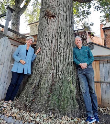
Photo: Susan McDonald & Tim Grant
from Harbord Village Residents newsletter (photo Tom Cordiero)
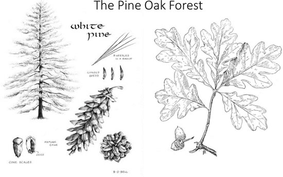
There is a beautiful and ancient bur oak in a laneway near Brunswick and College. It is a remnant from the ancient Pine Oak forests and Oak Savannas that once grew in the neighbourhood, and it is fighting for its life. We will visit the oak and hear from community members about efforts to save the tree, then head out to find Russell Creek and explore local urban forest and laneway ecosystems.
Along the way, you'll hear about the historical ecosystems of the neighbourhood, the demise of the creeks and the forests, and the ways that people are beginning to "Bring Nature Home“ in this urban neighbourhood with the least amount of public green space in the city. We will end at Bellevue Square in Kensington Market close to lots of wonderful spots to warm up if it is a cold day.
For more about the oak:
https://streetsoftoronto.com/community-pushes-to-save-massive-300-year-old-oak-tree-starved-for-water/
Sunday, October 29, 2023
11:00 AM
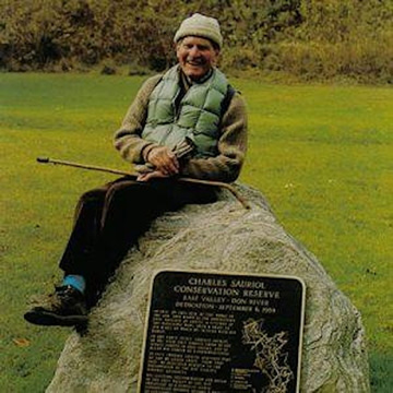
Stories of Charles Sauriol's Don Valley
Back by popular demand!
A Bilingual walk - Stories of Charles Sauriol’s Don Valley- offered jointly by Lost Rivers and la Société d’histoire de Toronto
Since the path is quite narrow in some places, we are limiting the numbers to 20 participants per group (English and French).
Please sign up here:
Meet at the S/E corner of Don Mills Road and Gateway Blvd. (705 Don Mills Road Toronto, ON M3C 1S1).
Travel: Bus 25 or 100 from Pape station or points north.
End: 73 Thorncliffe Park, about a 5-minute walk from multiple TTC bus options at Overlea Blvd.
Leaders: Floyd Ruskin (Lost Rivers) Christine Pilotte (Société) and Paul Overy from both groups.
Accessibility: Paved or Granular paths. There are long hills into and out of the Don Valley, and a few stairs along the way.
Washrooms: At the end of the walk at East York Mall or in area restaurants.
Sunday, October 1, 2023
1-4 pm EDT
Two-Eyed Seeing on the Humber; Explore the Salmon Runs
An InTO Ravines event. This public, community event will bring together Anishinabek and Western Science perspectives on the salmon runs
Location: 2125 Lawrence Ave W Weston Lions Park Toronto, ON M9N 1H7
Eventbrite Sign Up Link: Two-Eyed Seeing on the Humber
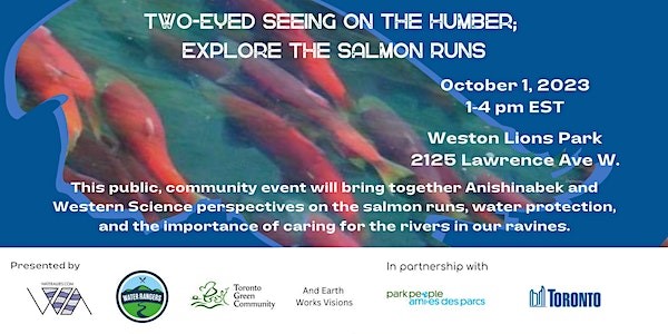
Event Details
Hands on with Water Rangers: learn how to test the water
Join in an art project led by Star Nahwegahbo (Earth Works Visions)
Co-sponsored by: Toronto Green Community, Earth Works Visions, Water Rangers, Water Allies.
Presented in part by: Park People and City of Toronto.
About our partners and guest speakers
Elder Whabagoon:
Elder Whabagoon is an Ojibway Elder, a member of the Lac Seul First Nation, and sits with the Loon Clan. Born in Hudson, ON, she is a Keeper of Sacred Pipes, active community member, speaker, land defender and water protector. Whabagoon is the co-founder and Elder of Nikibii Dawadinna Giigwag, a University of Toronto Access program that works with Indigenous youth to re-connect their spirit with the land and the water through land based teachings, ceremonies and green infrastructure.
She has been awarded for her strong commitment to educating the community. Never far from water, Whabagoon leads Sunrise Water Ceremonies and Gatherings by the Fire, to hold space for those who want to listen and share about ceremony, land and the water.
Star Nahwegahbo (Earth Works Visions):
Star Nahwegahbo is Anishinaabe, Scottish and English from Aundeck Omni Kaning First Nation, Ontario, Robinson Huron Treaty, currently living in Toronto. Star is a mother, interdisciplinary artist, former Social Service Worker of 12 years, grassroots community organizer, entrepreneur and expressive arts facilitator. She combines her passion for art and social change into her practice, she also acknowledges that her work is guided and co-created with ancestral and land based intelligence.
https://www.createtolearn.ca/creatives/star-nahwegahbo
Toronto Green Community:
Toronto Green Community aims to inspire, facilitate and support diverse communities in developing an environmentally sustainable city through education, engagement and joint neighbourhood initiatives.
https://www.torontogreen.ca/
Water Rangers:
Water Rangers imagines a world where every waterbody’s community has the tools they need to take care of them. Plus, every lake, river, or stream should have enough data to know whether or not they are healthy. Our ability to design beautifully integrated water testing experiences means that our tools are easy-to-use and accessible. That means custom water quality test kits, an open-data platform to manage data, and specially designed resources so that anyone can get started.
https://www.waterrangers.ca/about/
Saturday September 30, 2023
10:00 AM - 12:30 pm EDT
Celebrate Ravine Days with a Lost Rivers walk to honour Charles Sauriol
This walk is dedicated to Mr. Sauriol with great admiration and appreciation for the legacy of conservation and stewardship he has provided
Meet at Coxwell Avenue & O'Connor Drive. 500 O'Connor Drive. (This is a linear walk ending at Gateway Blvd and Don Mills Rd)
Sign up with Eventbrite
Through Charles Sauriol's love and fascination for the Don Valley as a child and later boy scout, hiker, valley resident, storyteller, steward, bee keeper, author and advocate, his dedication led to the beginning of understanding and protection for much of our ravines and greenspace....including what today is the Greenbelt.
From our meeting spot at the N/W corner of Coxwell and O'Conner we will descend a long staircase into the valley.
Crossing over Taylor Creek we will explore the natural trails that wind around the hillside above the East Don.
Viewing beautiful large oaks, maples, white pine, cedar, beech and others as well as a DV wetland that has not yet seen the ravages of phragmites (an aggressive invasive wetland plant) we can hope to visualize a Don Valley that existed not only in Sauriol's time, but throughout our Indigenous history.
Returning along a granular path south along the Don to the old Don Mills bridge and up Degrassi Hill to finish at Don Mills Road and Gateway Blvd.
Along the way, we will share history, nature, along with stories and tales of Sauriol's life and immense contribution and lasting legacy to conservation and stewardship in Toronto and beyond.
This is a linear walk with with a different start and finish location
Walk leader: Floyd Ruskin and friends
Accessibility: Stairs along with rough and uneven terrain
Transit:
Start- #70 bus from Coxwell Station. Get off at O'Connor (Please note: the #8 bus from Broadview will not be operating from Broadview Station until mid-Nov);
Finish- #100 or 25 bus to Pape Station from Gateway Blvd and Don Mills Road.
Distance: 5.4km. 2.5 hour walk
Rain or shine
Washrooms only at start and finish at local businesses
Hiking shoes or other footwear for uneven terrain recommended.
Please follow us on Eventbrite to get notice of Lost Rivers walks.
September 16, 2023
3:00 PM to 4:30 PM
WALK AND TALK: WATER STORIES
Lost Rivers Found Gardens at the Bain Co-op,
a walk that is part of the Bain Co-op Annual Street Festival
Meet at the northwest corner of Logan ave and Bain Ave (Pines Courtyard).
Walking mostly on pathways and sidewalks, with a few stairs.
A walking tour with Helen Mills of Lost Rivers, Zora Ignjatovic of 100 Bain and other Bain residents, tells the story of the transformation of the land over 11,000 years and of the creation of an urban paradise since 1973.
Come and discover lost forests, the new urban forest, the lost rivers that once flowed here through a cedar swamp, and explore pollinator and organic food gardens. We’ll also pass by the CMHC Healthy House.
We will end at the South Oaks Courtyard.
Stay on afterwards to enjoy the Street Festival!
Bain Tree Tour June 15 2008, with Todd Irvine (LEAF) and Dagmar Baur
Bain Tree Tour June 15 2008, with Todd Irvine (LEAF) and Dagmar Baur
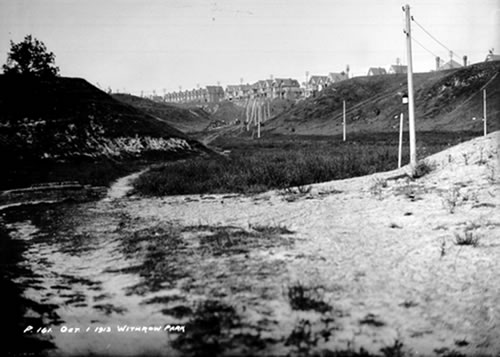
Lost Creek at Withrow Park
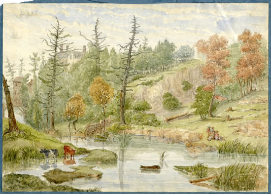
(City of Toronto Archives, Series 372, s0373_ss0052_R0161)
Sunday July 23, 2023
10:15 AM to 2:30 PM
SPECIAL EVENT WITH AGA KHAN MUSEUM
https://agakhanmuseum.org/programs/water-stories
Embark on a unique excursion as you explore the connections between water, land, culture, and agriculture.

WALK AND TALK: WATER STORIES
Price: $60 Regular, $54 Friends
Tickets include Museum admission, a one-hour urban walk and farm visit, roundtrip bus ride, a light lunch, and a guided Museum tour.
Reserve Tickets
The Aga Khan Museum, Toronto Green Community's Lost River, and Flemingdon Community Farm invite you to join a unique urban excursion and guided tour through the Don Valley neighbourhood, the Aga Khan Park and the Aga Khan Museum.
Discover the fascinating world of the watershed beneath our feet as you explore the long history and connections between water, land, culture, and agriculture in our neighbourhood.
Start with an immersive journey through 12,000 years of history from the time of the retreating ice sheets to the present, including stories of the ancient Lake Iroquois — the lost rivers that flowed through this area. Listen to personal memories of when the Don Mills neighbourhood was first developed and learn about the exciting innovations being pioneered at Flemingdon Community Farm.
Then, journey back to the Aga Khan Museum and enjoy a light lunch (included in the ticket price) followed by a tour of the Museum's current themed installation, Water by Associate Curator Bita Pourvash and the Museum's Education team. From intricate ceramics and paintings to architectural elements and metalwork, the tour will explore the story of water through its ;various applications and representations in Muslim art and literature.
Combine your interest in nature and history while learning from Helen Mills, the founder of Toronto Green Community’s Lost Rivers program, community experts Tara Ramkhelawan and Anne Fleming, and Bita Pourvash, Associate Curator at the Aga Khan Museum.
Please note:
- Families and seniors are welcome.
- Strollers can be accommodated.
- Due to the nature of the pathways, there may be limitations for mobility devices.
- Limited spots are available.
Schedule
| 10:15 am | Registration and welcome at the Museum |
| 10:30–11 am | Aga Khan Museum Park and history |
| 11 am | Depart from the Museum |
| 11:15 am–12:15 pm | Walk and visit Flemingdon Farm |
| 12:30 pm | Depart from Flemingdon Farm to the Museum |
| 1–1:45 pm | Light lunch at the Museum (included) |
| 1:45 pm - 2:30 pm | Gallery tour and conclusion of the event |
The Museum reserves the right to postpone or cancel this event in case of inclement weather. Ticket holders will be contacted with further information.
Sunday July 9, 2023
2 PM to 4:30 PM
Re-imagining the Land and the City in the Watershed of Lost Russell Creek
Join Lost Rivers and Green 11 for a tour of lost Russell Creek, from the headwaters at Monsignor Fraser Park to Bellevue Park in Kensington. The walk is all about nature based climate resilience in Ward 11 with an emphasis on Trees and Pocket Forests. We reimagine urban spaces by returning to the template of the forests that grew here for 11,000 years.
Pocket forests originated in Japan, and we will visit a few on this tour - tiny densely planted oak forests designed for a diversity of soil life, layers of plant life, that grow into thriving natural communities in a short time.
We will begin in an amazing park that was once a prison like tarmac playground. Then we will follow Russell Creek south, visit the pocket forests and talk about trees and earth-friendly front yards. Along the way there will be stories of past and present communities.
Finally, at Bellevue Square in Kensington Market we will hear about and celebrate the ground breaking work being done to create land trusts. Shawn Grey will share a beautiful banner....it is all about finding your place in a Colonial land, and we will have a chance to add our own contributions.
A joint walk with Green 11 https://www.facebook.com/green11TO
Walk Leaders: Helen Mills, Rene Fan, Shawn Grey, and Anjum Chagpar
Walk starts: NW corner of Markham St. and London St., ends at Bellevue Square
Time: 2 PM to 4.30 PM
Accessibility: City Streets and accessible parks
Washrooms: at the end and at stores along the way
Rain or Shine
Sunday June 11, 2023
2:00 PM - 4:00 PM
Stories of Charles Sauriol’s Don Valley
A Bilingual walk offered jointly by Lost Rivers and la Société d’Histoire de Toronto
You are invited to join us in an exploration of the legacies of Charles Sauriol, through a linear walk in the Don Valley, starting and ending at different locations.Charles Sauriol was a tree planter, a bee keeper, a community gardener, a naturalist, a committed Franco-Ontarian, a historian and a prolific writer. His life work led to the restoration and protection of many areas of the Don Valley, and ultimately the creation of the Toronto and Region Conservation Authority (TRCA), which continues to protect and manage watersheds in the Toronto region.
Walk starts at 2 PM ends at 4 PM EST
Location:
Meet at the S.E. corner of Don Mills Road and Gateway Blvd South (just north of the gas station at 705 Don Mills Road) Toronto. We will meet at the grassy area near that corner, beside the gas station, and will enter the Don Valley from there.
Travel to the meeting point:
That intersection can be reached via the 25 Don Mills bus from Pape subway station or the 100 Flemingdon Park bus from Broadview station, or points north.
If arriving by car, there may be street parking on Gateway Blvd.
Travel from the end point:
73 Thorncliffe Park is about a 5-minute walk from multiple TTC bus options at Overlea Blvd.
Leaders:
Floyd Ruskin (Lost Rivers) Christine Pilotte (Société) and Paul Overy from both groups.
Accessibility:
Paved or Granular paths. There are long hills into and out of the Don Valley, and a few stairs along the way.
Washrooms:
At the Shell station near the start point and at the end of the walk at East York Mall or in area restaurants.
Rest Stop:
Along the way.
Languages:
This entire walk will be led in both French and English, with groups by language.
Please register for your choice of language:
English sign-up: https://www.eventbrite.ca/e/642299704707
French sign-up: https://www.eventbrite.ca/e/642349212787
Additional Information:
We recommend bring a water bottle, a snack, a hat or umbrella, depending on the weather. Some may wish to bring binoculars and/or a small bag and gloves to pick up litter along the way.
Since the path is quite narrow in some places, we are limiting the numbers to 20 participants per group (English and French). If the registration waitlist has many names, we may offer this walk again later this year.
Contact for information:
Paul Overy via text message at 647-229-1191.
Sunday, May 7, 2023 10:00 AM - 12:00 PM
Don Valley: Past, Present and Future Opportunities
A Jane's Walk by Floyd Ruskin, Lost Rivers and A Park for All
Join Lost Rivers as we take part in Janes Walk 2023 with a look at past history, where we are today and what opportunities await the Don
Toronto's Don River is Canada's most urbanized river. Stretching south from its headwaters in the Oak Ridges Moraine and running 36km before emptying into Lake Ontario, the Don has been profoundly changed by overuse, pollution, industry, road and railways and urbanization since the beginning of Toronto as a colonial city.
Before the 1790s, the Don Valley was wild and unspoiled. Over the next two centuries, the river was harnessed, channelled, polluted, moved and ignored. This walk will look at how humans have impacted the valley and how it is being reclaimed as a vital green space at the heart of the city.
The river was renamed by the first colonial Governor - Lieutenant Governor John Graves Simcoe. This was just one of many re-namings that obscured 11,000 years of Indigenous history with an overlay of colonial “reality”. We will talk on the walk about versions of the original name, Wonscotanach, and possible English translations.
The walk will discuss lessons learned, lessons forgotten and opportunities that can be realized that remained to be addressed along this unique urban watershed.
Walk Details:
Date and Time: Sunday, May 7, 2023 10:00 AM - 12:00 PM
Walk leaders: Floyd Ruskin and Friends
Walk Start Location: St Matthews Clubhouse, 450 Broadview Ave at Langley. Easily accessible by transit.
Walk End Location: Evergreen Brickworks 550 Bayview Avenue
Eventbrite: https://www.eventbrite.ca/e/don-valley-past-present-and-future-opportunities-tickets-622702950287
Distance: A linear walk of 3.5 km, concluding at Evergreen Brickworks to enjoy the site or then take the free shuttle back to Broadview Station.
Accessibility: Mostly flat on paved trails with one set of stairs and some uneven surfaces and terrain
Public washrooms at the start. at Todmorden and at Evergreen.
About 1.5 to 2 hours.
Rain or shine
JANE'S WALK DETAILS
Language: English
Area: Don Valley
Theme: Advocacy and Politics, Arts and Culture, Environment and Sustainability, History and Community
Accessibility: Uneven terrain, Stairs or other barriers, Family-friendly walk, Walk leader will use audio amplification
Link to May 7 Janes Walk listing: https://www.janeswalkfestivalto.com/donvalley
Sunday April 30, 2023 10:30 AM -12:30 PM
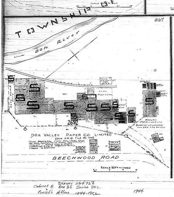
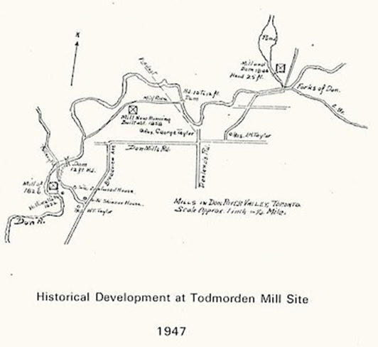
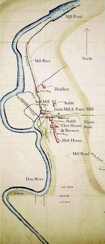
Part 3 of the Three Mill Series, the last of three walks about the mills of the Taylor Family in the Don Valley
The Taylor Family were industrialists/entrepreneurs that owned vast acreage in the Don Valley and surrounding area (approx 4,000 acres) through the mid 19th century into the early 20th century.
Among other enterprises, most notably the Don Valley Brick Company, the family also operated three mill complexes within the Don Valley with the largest being the "Upper Mill" located just north of the Forks of the Don. The Taylor "Middle Mill" was located by Beechwood Drive and the "Lower Mill " (Todmorden) at Pottery Road.
In the first of the 'Mill' series, we explored and searched for the remains of the 'Upper Mill', the largest of three Taylor Family mills on the Don River. Among it's features were a 30 acre mill pond and 20' high mill dam.
Part 2 moved us south to the 'Middle Mill', the last of the paper factories the Taylors established. Water was the source of power for the mills, but as the Don River's flow is erratic, a 12' high dam, mill pond along with a mill race were constructed to maintain a consistent water flow to the mill the way,
Part 3 moves further south
Leaving from the MIddle Mill area, the walk will take us through the ravine and along this historic and beautiful part of the Don Valley. Once a major industrial area, through years of ongoing restoration and stewardship the ravine is slowly regaining its lost appearance. Before heading south to Todmorden, a visit to both Cottonwood Flats and nearby Sun Valley, both once again were heavily industrialized but today enjoy active stewardship by a number of groups
Walk ends at Todmorden Mills, the oldest mill site on the Don River
Walk Details:
Date and Time: Sunday April 30, 2023. 10:30 AM-12:30 PM
Walk leaders: Floyd Ruskin and John Wilson
A linear (one way) walk of approx 3km along either paved or granular surfaces, ending at Todmorden Mills
Meeting Place: 44 Beechwood Drive
Directions to get there:
Walking/biking: Lower Don Trail approx 1.5km north of Pottery Road
Transit: #8 or #100 bus from Broadview station to Hopedale stop. Cross O'Connor and head west one block to Beechwood Drive then go down the hill along Beechwood to #44 which is the Police Dog Training Station
Drive: Plenty of free parking at 44 Beechwood, but note that this is a linear walk so you will have to walk back to the car.
Washrooms: at end of walk at Todmorden
Accessibility: Both Beechwood and Pottery Road are steep, but paved. Otherwise on paved or granular surfaces that are relatively flat
Rain or shine.
Register at: https://www.eventbrite.ca/e/taylor-family-three-mill-series-part-3-tickets-622715116677
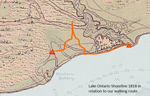
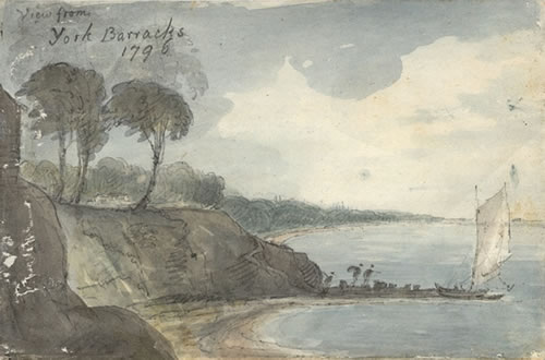
The St. Lawrence District- Looking for a Past Shoreline
Join Lost Rivers and St Lawrence Neighbourhood Residents as we walk the lost lakeshore of Lake Ontario in downtown Toronto
About this event:
We will share and learn how this contested waterfront has been seen and reinterpreted over the years, and uncover the footprints of the past where land met water and peoples from across Turtle Island and the world meet today to find common ground. We will explore both Indigenous and Colonial stories and settings of the Lake Ontario shoreline.
Attended by 37 people.
When and Where:
Sunday April 16 2:00-4:00 PM EDT
Location: Meet at 1 Front St E (Meridian Hall) at the S/E corner of Yonge and Front
Distance: 2 km linear walk ending at the Distillery District
Time: 2 hours
Walk leaders:
Helen Mills, John Wilson, and members of the St Lawrence Community.
Fully accessible on mostly flat paved sidewalks with a few gentle slopes.
Washrooms available in the St Lawrence Market, Distillery District and businesses along the route.
Rain or shine.
Please Register here.
Thanks
Sunday March 19, 2023, 2:00 PM – 4:00 PM EST
Spring Equinox Walk at Flemingdon Park
Location
Meet at the NE Corner of Rochefort Drive & Don Mills Road (note that the Eventbrite map shows the nearest building as the meeting point, but we will be meeting at the corner).
Join Lost Rivers, Flemingdon Community members and Evergreen to explore the Flemingdon Park neighbourhood searching for lost creeks and streams, and those first hopeful signs of spring!
We chose the date closest to the spring equinox for this walk as it takes place this year on March 20 at 5:24pm. The spring equinox marks the point in time when the sun sits directly over the earth's equator as it heads northward. Both hemispheres share the sun's rays equally at the equinox, and night and day are roughly the same duration.
But more than that, the equinox symbolizes new life and light, new beginnings, paths and seeds. As the day and the night will be equal on the 20th of March, the equinox will also be the representation of our needs for balance during this period. It marks the start of a time of new beginnings, renewal, and growth.
To mark the "arrival" of spring, we will explore the Flemingdon Park neighbourhood. The diverse Flemingdon Park community is quite unique in Toronto, as it is one of few neighbourhoods designed using the "garden cities" concept of incorporating green space into new communities. A unique feature is that it sits on a flat table land peninsula between the East and West Don Rivers. The area was once the large farm of R.J. Fleming (a Toronto mayor) after whom this neighbourhood is now named.
Our walk will meander through the community and at times we will be able to follow the course of buried Flemingdon Creek. With discussions around the natural and built world, our walk will conclude with a visit to Flemo Farm, an award-winning community farm and social enterprise.
We'll begin at the northeast corner of Rochefort Drive and Don Mills Road (closest street address is the Foresters Building at 789 Don Mills Road) and will walk approximately 3km over mainly flat, paved surfaces. Please wear weather-appropriate clothing and appropriate footwear.
The walk will take place rain, snow or shine, so please dress for the weather.
Questions? Email Mac Rogers at mrogers@evergreen.ca
Time: Sunday March 19 from 2:00-4:00pm
Start Point: Meet at the N/E corner of Rochefort Drive and Don Mills Road (closest street address is the Foresters Building, 789 Don Mills Road, North York, ON M3C 1T9)
End Point: Flemo Farm
Length: Approx. 3km over mainly flat, paved surfaces
Walk Leaders: Helen Mills and Floyd Ruskin from Lost Rivers with Flemo Ravine Champions Riffat Fatima, Lubna Rehman, Seema Khan and Flemo Farm Communications Coordinator, Javad Mozafari
Please register at
https://www.eventbrite.ca/e/spring-equinox-walk-with-lost-rivers-tickets-570794360297
Sat, 11 February 2023
2:00 PM – 4:00 PM EST
Walking Toronto's Winter PATH, A "City Beneath our Feet", the downtown PATH system of underground walkways protects us from the worst of the winter elements.
Location
Meet at the temporary skating rink, outside of Union Station
at
65 Front Street West, Toronto, ON M5J 1E3
The walk will end at the Sheraton Centre, 123 Queen St. West.
Please register at:
https://www.eventbrite.ca/e/walking-torontos-winter-path-tickets-530653738617
The downtown PATH system of underground walkways protects us from the worst of the winter elements. It’s also loaded with proxies, or “stand-ins”, for the natural world – a world largely excluded from our public indoor spaces. This walk highlights cultural expressions of Nature and attitudes towards Place that we can see along the PATH.
Examining building materials, architectural devices and public art installations, we will explore unexpected corners of the PATH system to consider our complex relationship with our northern landscape and its Indigenous peoples. We will look hard for references to lost landscapes and waterways in a largely manufactured environment.
John Wilson and Ed Freeman will lead a walk of approximately two hours, mostly indoors with secure footing, but with many stairs. (The PATH is far from universally accessible.) Occasionally we will step outdoors onto streetscapes, but primarily we will walk through labyrinthine interior spaces.
Washrooms are available along the route.
Public transit to starting point via Line 1 subway to Union Station. End near Queen or Osgoode stations.
Sunday November 20, 2022
2:00-4:00 pm
Rain or shine
Lost Rivers' Three Mills Series: Part One
Description
The Taylor Family were industrialist/entrepreneurs that owned vast acreage in the Don Valley and surrounding area (approx 4,000 acres) through the mid 19th century into the early 20th century.
In the first of the 'Mill' series, we will explore and search for the remains of the largest of three Taylor Family mills on the Don River.
Among other enterprises, most notably the Don Valley Brick Company, the family also operated three mill complexes within the Don Valley with the largest being the "Upper Mill" located just north of the Forks of the Don. The Taylor "Middle Mill" was located by Beechwood Drive and the "Lower Mill " (Todmorden) at Pottery Road
Water was the source of power for the mills, but as the Don River's flow is erratic, a dam with a huge mill pond was created to maintain a consistent water flow to the Upper Mill turbine.
Today, part of ET Seton Park covers the site and almost all vestiges (including the pond) of this huge complex are long gone. Decommissioned early in the 1900s, the complex was finally dismantled in the 1930s for the valuable 40' pine rafters, other timber and stonework. The area was further altered when the land became a public park with much landscaping.
Leaving from just south of the Ontario Science Centre, the walk will take us down into the ravine and through this historic and beautiful part of the Don Valley where using archival maps along with new maps we will search for the remnants of the mill. We will also discuss the settler history of the people that made the area home.
Walk leaders: Floyd Ruskin and John Wilson
Meet at 760 Don Mills Rd, Toronto - S/W corner of Don Mills Road and Gateway Blvd.
Getting here:Transit #25 bus from Pape subway station, get off at Gateway Blvd. Car: there is free parking alongside the Tim Hortons and Subway on the east side of Don Mills Road
Accessibility:
A loop of approx 4.3km on paved, gravel and dirt paths with two steep hills and a short set of stairs. Washroom at beginning and end of walk at nearby restaurants. The public washroom along the trail may not be open.
Register for your free ticket(s):
https://www.eventbrite.ca/e/465204367787
Rain or shine

Toward the Mouth of the Rouge:
A Bilingual walk
Offered jointly by Lost Rivers and la Société d’histoire de Toronto
Sunday, October 2 from 2:00 pm - 3:30 pm,
with an optional additional exploration of the Rouge wetlands.
To mark both World Rivers Day and Franco-Ontarian Day, you are invited to join us in an exploration of the natural and human history surrounding the area near the mouth of the Rouge River. Learn about its evolution as well as the dynamic presence of Indigenous peoples and French explorers until the time of British colonisation.
Departure: 2:00 pm from inside the Rouge Hill GO station (on the Lakeshore East Route). If you are planning to take GO Transit, please travel on the train which arrives at 1:53 pm to be on time for the 2 pm start.
Note: If using a PRESTO card, tap-off terminals are located at the tunnel exit very close to the station building.
If arriving by car, there will be ample parking near the station.
Arrival: Rouge Hill GO station- It is a circuit route.
Leaders: John Wilson (Lost Rivers) Christine Pilotte (Société) and Paul Overy from both.
Accessibility: Complete, from the accessibility coach on the GO train, the tunnel equipped with elevators and the washrooms in the GO station. The path itself is paved, even and wheelchair accessible.
Washrooms: Located inside the GO station. There are portable toilets at the mouth of the Rouge.
Rest Stop: On the beach near the Rouge if it is open, for those who wish to have a snack.
Return: Christine will accompany the participants back to the GO station who wish to take a shorter 90-minute walk just to the Rouge. For interested participants, John and Paul will continue on to the wetlands just to the north and west of the mouth of the Rouge for about 45 minutes more. John will lead this portion in English and Paul in French.
Languages: This entire walk will be led in both French and English.
Additional Information: If desired: a water bottle, a snack, a hat or umbrella, depending on the weather. Some may wish to bring binoculars and/or a small bag and gloves to pick up litter along the way.
Please register (free) on Eventbrite at:
Marche Rivière Rouge River Walk/ Vers l'embouchure de la Rouge: Tickets, Sun, 25 Sep 2022 at 2:00 PM | Eventbrite
October 02, 2022, 12 noon to 4 pm
Planting Seeds of Reconciliation
Welcoming Indigenous & non-Indigenous community members to help us plant the seeds of awareness & engagement on the path to reconciliation!
Circles for Reconciliation and the Toronto Green Community in support of the Growing Our Roots project, are collaborating to raise awareness of Indigenous issues and engage community members in Indigenous culture and initiatives including:
- #94in94 (social media) campaign to engage the public in the Truth & Reconciliation Commission’s 94 Calls to Action
- Orange Shirt Day and National Day of Truth and Reconciliation
- National Day of Action on Missing & Murdered Indigenous Women & Girls
We invite our participants, volunteers, and the wider community to join us in supporting local Indigenous artists and organisations.
By Circles for Reconciliation in collaboration with Toronto Green Community
Sunday Oct 09, 2022, 2 pm
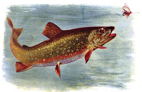
Great Fall Migration Walk with Lost Rivers
Join Floyd Ruskin of Lost Rivers and Evergreen's April Nicolle to learn about the great fall migrations that take place in the Don River.
Date and time
Sun, October 9, 2022, 2:00 PM – 4:00 PM EDT
Location
Evergreen Brick Works 550 Bayview Avenue Toronto, ON M4W 3X8
About this event
The fall is a busy and wondrous time as migratory species prepare for their long journey ahead to their destinations. Some species take flight and others swim upstream to spawn. On this guided walk we’ll look for winged friends who are embarking on their journey and salmon in the Don River who are migrating upstream to spawn. Gain a greater understanding of the nature of the Don watershed along with the historical how and why the salmon run is so much different here than Toronto's other watersheds.
The actual timing of when salmon migrate is largely dependent on weather, including rainfall and temperature, so cross your fingers and toes that they choose to be active in migration during our walk.
We'll begin at Evergreen Brick Works in front of the Watershed Wall in Tiffany Commons and walk along the Bayview Multi Use Lane towards Pottery Road Bridge where we'll look for signs of salmon swimming upstream and evidence of birds on their way south. (The walk will be a total of 3km on mostly flat terrain.)
At the end of the walk we will return to Evergreen Brick Works for a salmon feast. To be as sustainable as possible, please bring your own feast kits. (bowl, cutlery, cups)
Please note that unfortunately, pets are not permitted on this walk.
This is a rain or shine walk!
Getting to Site: Please see here for details on how to get to Evergreen Brick Works.
Register on Eventbrite (Sold Out – waiting list available)
Walk Partners: Evergreen
Since 1991, Evergreen, a not-for-profit, has provoked bold action in transforming public landscapes into thriving community spaces. We believe that connecting people, natural and built worlds create flourishing cities for the future. For more than 30 years Evergreen has connected, collaborated, and catalyzed Canadians to do amazing things positively affecting attitudes and behaviours that lie at the core of a sustainable city. For more information visit www.evergreen.ca.
Toronto Green Community and Lost Rivers
Lost Rivers is a project of the Toronto Green Community, www.torontogreen.ca. The mission of the Green Community is to inspire, facilitate and support diverse communities in developing an environmentally sustainable city through education, engagement and joint neighbourhood initiatives.
The Lost Rivers/ Rivers Rising Walks are storytelling tours about the human and natural heritage of the city’s buried creeks, and the website is a field guide to many of the lost rivers. Grounded in historical connections of the place to indigenous, settler, and immigrant communities, we travel through time to envision a future for the city that connects us all.
Sunday, October 16, 2022 from 2:00 pm – 4:00 pm
The Bentway and Garrison Common - Past Present Future
Stories of the Garrison Common and the creeks surrounding Old Fort York
Description
Join us in an exploration of the Bentway and Garrison Common. There will be stories about lost histories - warriors, squatters, gardeners, wolves at the gate of the fort, 11,000 year old footprints in the lake, rain gardens and the remarkable changes that are happening at the Bentway and in the neighbourhood! We will end with a visit to “Love Song to the Great Lakes” by artist Olivier Bonnard and a short walk to the Strachan Gate.
Meet at: 2 pm at the northwest corner of Bathurst St and Fort York Blvd
Walk ends at 4 pm at the Strachan Gate, Bent 52.
Leaders: Helen Mills (Lost Rivers)
Accessibility: Mostly paved with some slopes and grassy surfaces. One set of stairs – there is an alternative accessible way up the slope
Washrooms/ Rest Stop : Located in the Fort York Visitor Centre (about one third of the way through the walk)
Additional Information: Dress for the weather (hat, layers etc) comfortable walking shoes recommended, bring water and a snack if desired.
Eventbrite Registration Link will be available shortly
Event by Lost Rivers and Toronto Field Naturalists in partnership with the Bentway.
August 28, 2022 at 2 PM
Lost Crookshank Creek and Corktown Common
Joint walk Lost Rivers with Toronto Field Naturalists
Location: Meet at southeast corner of Queen Street and Power Street, end at Corktown Common (Canary District)
Leader: Helen Mills
Duration: 2 hours
Distance (kms): 1.75 km
Linear Route with TTC access at start and finish
Accessibility: Mostly paved or grassed, some stairs
Washrooms available at Corktown Common
Several cafes and restaurants in the Canary District
Description:
We will follow the course of lost Crookshank Creek to the Don River, passing interesting historical sites and new developments, ending with a lingering visit to Corktown Common and the Don River. It’s a good season for pollinators.
What participants should bring:
Possibly binoculars could be helpful at Corktown Common
Sunday, August 21, 2022, 2-4 pm (rain or shine)
The Ever-Changing Eastern Waterfront
Future Parliament St Slip, current home of the Taddle Creek outfall
Location: Meet at Queen’s Quay, south side at Jarvis; end at Parliament Square Park, Parliament and Mill streets (TTC bus access at start and end).
Linear walk approx. 2.5 km.
Leader: John Wilson, West Don Lands Committee (with friends)
Accessibility: Level, mostly paved surfaces, some unpaved, turf areas; public washrooms on route.
Description:
The Eastern Waterfront is rapidly changing into an intensely urban landscape with new developments every month. If you want to see the future of Toronto’s love affair with its Lake, join us. Highlights include: Sherbourne Common, with its stormwater management blue/green infrastructure; Quayside lakefront water park, still in Waterfront Toronto’s planning stages; Views of developments at the Mouth of the Don naturalization and flood protection; First Parliament site at the mouth of lost Taddle Creek.
Thurs, August 11, 2022, 5-7pm
Nearshore Gatherings: "Serson Creek: Reconnecting a Lost River".
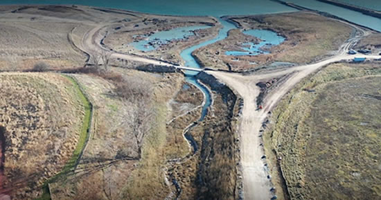
Photo: Credit Valley Conservation.
Register to attend on Eventbrite.
Location: Lakeview Village Discovery Centre
985 Hydro Rd, Mississauga, ON L5E 0A8
Description:
The fourth Nearshore Gathering is this coming Thursday, titled "Serson Creek: Reconnecting a Lost River".
Join us for a conversation with Lakeview Community Partners and Helen Mills of Lost Rivers to learn about the daylighting of Serson Creek, a Mississauga-based tributary and natural habitat that has suffered from years of industrial use.
For the first time in sixty years, fish are able to swim freely between the Serson Creek and Lake Ontario as the creek was disconnected from the lake in the mid-1960s when it was buried and piped underground, becoming one of Mississauga’s "lost rivers."
Presented alongside Lyfeboat prototype, a floating sculpture and platform for community engagement with ecology and Nearshore Gatherings, a five-part event series on environmental activism and stewardship.
Also see: https://cvc.ca/conversations/serson-creek-reconnecting-a-lost-river/
Sunday afternoon July 24, 2022 at 2:00 pm
LOST RIVERS LOST LAKESHORE: Reconnecting to Lake Ontario
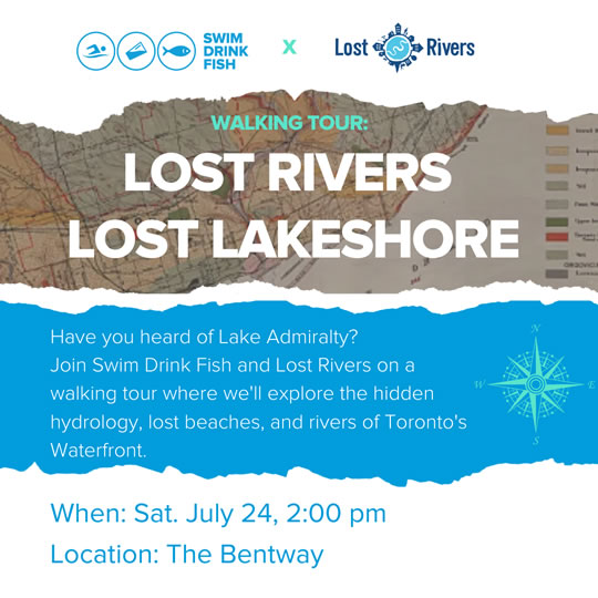
Location: 250 Fort York Blvd at the Bentway. The Bentway is located under the Gardiner Expressway on the lands of Fort York National Historic Site, running from just east of the Fort York Visitor Centre to Bastion St.
Please register for this free event at:
https://www.eventbrite.ca/.../lost-rivers-lost-lakeshore...
Public: Anyone on or off Facebook
Explore a portion of Toronto's Lost Lakeshore and Lost Creeks from the Bentway to the Rees St Slip at Queens Quay. Hear about two other long lost Lost Lakeshores
About this event:
Come walk with Lost Rivers and Swim Drink Fish on an exploration of a lost beach near the mouth of lost Garrison Creek. From there we move across an expanse of lakefill that is now home to many and on to Queen's Quay to the Rees Street slip.
We'll start the walk at the Blue Pillar (Bent 53) west of the Visitor Centre at the Bentway, and make our way along the beach to the former mouth of Garrison Creek. Then we will follow the path of the sewer that extended from the mouth of Garrison Creek to Bathurst Quay. We will continue along the Quay to discover a second outfall from the Garrison Relief sewer and yet another from a sewer that joined water from Taddle and Russell Creeks.
Swim Drink Fish will be demonstrating how they measure water quality and we will hear a bit about the current state of the water in the harbour!
Of course there will be many stories about the old lakeshore, squatters, gardeners, wolves at the gate of the fort, 11,000 year old footprints in the lake and the remarkable changes that continue to happen along the lake!
Walk Leaders: Helen Mills and Floyd Ruskin with special guest Isabel Fleisher from Swim Drink Fish
Distance: Approximately 2.5km on mostly flat paved sidewalks
Washrooms available along the route
rain or shine
Sunday afternoon July 17, 2022
Think Like an Ecosystem - Permaculture on Lavender Creek
Walk Leader/s: Helen Mills and Nate Charach
Start time: 2:00 pm
Duration: approx. 2 hours
Distance: 1.7 km (approx.)
Location: Circular walk starts at Fairbank Memorial Park, and ends at Dufferin and Gibson just south of the park
Map location for starting point:
Fairbank Memorial Park
2213 Dufferin St
43.69135883, -79.44804988
Accessibility: Paved sidewalks and garden pathways, grassed surfaces. Some steep hills and stairs
Stairs: Yes
Washrooms available: at the start and end of the walk
Questions: lostrivers@torontogreen.ca
Safety:
- Any attendees not fully vaccinated against COVID-19 please wear a mask throughout the walk.
- Please keep a safe distance
- Dress for the weather and wear comfortable walking shoes
Arched junction east (?) of Weston Road. The left tunnel carries Lavender Creek,
the right tunnel is fed by a drop shaft. Courtesy Michael Cook
http://www.vanishingpoint.ca/lavender-creek-and-grand-trunk-railway-drain
In this walk we’ll be exploring a small part of the headwaters of lost Lavender Creek, once known for fresh trout and spring water year-round. We will start at Fairbank Memorial Park, a former brickyard (like so many other parks in Toronto). At Lavender Creek several tiny headwater streams used to converge from just south of Eglinton. From the park we will make our way to a new permaculture garden on the steep slopes of the Lavender Creek ravine, and then to Charles Caccia Park where a huge water tank is hidden below the surface – designed to help prevent the intense flooding that has plagued this neighbourhood. We will return to Dufferin and end near Doce Minho Pastry and Bakery.
Permaculture (permanent agriculture) is a grassroots, ecological design movement inspired by observations of natural ecosystems and traditional agricultural systems. The idea is to create a sustainable, low labour, self-supporting food system that reduces food and water waste, and uses no fossil fuel energy. Perennial plants and trees are used and there are multiple interlinking functions in the system that usually includes animals such as chickens or fish. Finally eco earth works “allow for the use of every drop of rain water”. Permaculturists have developed many interesting approaches to conserving water and managing gardens on steep hills.
Along the way we will be talking about the geology, historic ecosystems and agroecosystems, forests, and people of Lavender Creek over 15,000 years to the present. All this is a part of permaculture design and weaves into the story of the flood prone neighbourhood and the garden we are visiting. What might Lavender Creek become in a future sustainable neighbourhood? It is all connected to the modern food system – come and find out more.
![1926 - May 16 - York Mills - John Boyd [?] fishing in Don - Vintage Fishing Photographs](troutfishingcreek.jpg)
Lavender Creek was known for its excellent trout fishing.
This isn’t Lavender Creek but perhaps this is how it may have looked!

Sunday May 22, 2 pm
Biodiversity & Climate Change Walk along Humber Creek in Central Etobicoke for International Biodiversity Day
Meet at 2 pm on NE corner of The Westway & Wincott Dr.
Walk Leader: Brian MacLean (and others)
This Sunday is #Biodiversity Day around the world, and we're celebrating with a Biodiversity & #ClimateChange walk along Humber Creek in Etobicoke.
https://www.cbd.int/idb/activities/22actions-public-en.pdf
Duration: approx. 2 hours
Distance: 4 km (approx.)
Location: From Wincott Park in central Etobicoke east to the Humber River
Meeting spot: In front of New Gate Presbyterian Church, 240 The Westway at Wincott Dr. (Wincott Dr. is located about halfway between Islington and Kipling, within walking distance from their north-south bus lines)
By TTC, take #53G Lawrence bus to the Wincott Dr. stop on The Westway. Or if coming on a north-south bus line, take either #45 Kipling bus, get off at The Westway and walk east 3 blocks; or #37 Islington bus, get off at The Westway and walk west 4 blocks.
Map to starting point: 43.687542, -79.549709
Ending spot: On Royal York Rd, in Douglas B. Ford Sr. Park (opposite 1500 Royal York Plaza)
Type of route: On paved path for the most part.
Stairs: No
Type of surface: Mostly paved path alongside creek but some soggy ground through bush along the way so BOOTS RECOMMENDED. Also recommend long sleeves & long pants to avoid insect bites.
Slope of surfaces: Fairly flat. Two small hills where we’ll descend.
Washrooms available: Yes, midway at a Starbucks at Royal York & The Westway, or inside the Metro grocery store 2 blocks further south.
Friday May 27, 6-9 pm
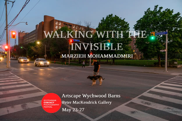
Lost Rivers - Walking with the Invisible at the Contact Photography Festival
Artscape Wychwood Barns, Peter MacKendrick Gallery
601 Christie Street, Toronto
Join artist Marzieh Mohammadmiri for a screening of the film Taddle Creek: Flowing into Parliament, followed by a Lost Rivers walk and talk with Helen Mills and Lost Rivers community members from the exhibition to find Taddle Creek at the Wychwood Pond..
The Exhibit “Walking with the Invisible” is on from May 23 to May 27. https://scotiabankcontactphoto.com/2022/registration/marzieh-mohammadmiri-walking-with-the-invisible
Artscape Wychwood Barns, Peter MacKendrick Gallery
601 Christie Street, Toronto
This documentary project explores the course of the buried Taddle Creek in today’s Toronto. It encourages looking and listening to what cannot be immediately seen or heard - a lost piece of nature and Indigenous history retrieved through a video and cyanotypes. It explores how humans have reshaped the natural environment of the city and represents a present absence, a spatial memory of a lost landscape. Mohammadmiri’s counter-mapping journey is also their own search for a lost sense of home.
On the last day of the exhibition there will be a talk and walk by Helen Mills, founder of Lost Rivers, followed by a Q and A
Black Creek Walks, Talks and Dances in April
 |
Public events in Jane-Finch/ York University Neighbourhood during Myseum Intersections April 2022 & beyond |
APRIL 2022: Myseum Intersections
Our three different walking tours along Black Creek and one workshop will weave together community history, visits to community gardens, thousands of years of Indigenous history in the area, music and dance to celebrate the aliveness of the Creek and its ravine.
Saturday, April 16 – 2-4 PM
• The Living Creek walking tour: an immersive dance experience taking place along Black Creek in Toronto’s Jane-Finch community. Centred around the themes of animism and art,
MAP: Bit.ly/3sM7Amv
REGISTER HERE
• Meet at 2pm in parking lot of Derrydowns Park, 1715 Finch Ave. West (near Tobermory Dr.)
• Via TTC: take Finch West bus #36 to Tobermory Dr., walk east on south side to park entrance
• Tour ends within Derrydowns Park at its firepit at 4pm.
Sunday, April 17 – 2-5 PM (Easter Sunday)
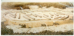
• Food, Land & Waterwalking tour: a food-themed walk exploring connections between growing food, land, water and our own health. We’ll visit community gardens and Black Creek Community Farm, and speak to leaders about their food-growing and developing food sovereignty with culturally appropriate foods for all. The tour will end at the site of the 15th century Wendat longhouse village beside Black Creek where their large fields grew the “Three Sisters” of corn, beans and squash to support their community, asking what we can learn about supporting our community’s food needs today. Walk led by Adjowa Karikari, Brian MacLean, Ayesha Khan and Joshua Recollet.
Maximum 50 registrants.
MAP: bit.ly/3pGVaKG
REGISTER HERE
• Meet at 2pm on southeast corner of Jane and Steeles West at entrance to Black Creek Community Farm.
• Via TTC: take Jane bus #35 or Steeles West bus 60.
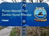
• Tour ends at Rudy’s Garden where Black Creek meets the Huron-Wendat Trail in the Finch hydro corridor, near Tobermory Dr.
Saturday, April 23
(one 2-part event, individuals can register for one or both)
• PART 1 – 11 AM-1 PM
uⁿdawaʔ (“current”) workshop: A participatory art-making workshop/activation especially for those attending the afternoon’s Indigenous History Walk. Facilitated by Wyandot Tradition Keeper and artist Catherine Tàmmaro, participants will explore through creative expression our sacred connection to moving water and its vast importance in our lives. Art supplies provided.
Maximum 25 registrants,
face-masks will be required for this indoor event.
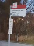
•Meet at 11am at Skennen’kó:wa Gamig (“The house of Great Peace”), 35 Nelson Rd. on northeast corner of Nelson Rd. & The Pond Rd, on York University campus. (Note: On Google Maps it may still be called Hart House.)
•Via TTC take Bus 106 Sentinel (from either Pioneer Village subway station or Sheppard West subway station, or north on Sentinel from Finch Bus 36 West.)
• PART 2 – 2-5 PM
We Are All Treaty People walking tour
Learn about the meaning of the treaty relationship – one that exists between nations but also between human beings and all other beings inhabiting the land, water and air we share. This Indigenous history walk will link stories about the Huron-Wendat, Seneca, and the Mississaugas to places and people along Black Creek. By learning this history of where we live, we will deepen our understanding of how we can protect our home and each other. We will begin at Skennen'kó:wa Gamig house on YorkU campus and end on the “Huron-Wendat Way” where a Huron-Wendat village of longhouses existed in the 1400s, surrounded by corn fields. We’ll use the “Moccasin Identifier” with its developer, Carolyn King of the Mississaugas of the Credit First Nation, to help show the connection to the land of each major Indigenous group linked to Toronto from long ago to today and connect to the way we live today. Led by Joshua Recollet, Carolyn King, Anders Sandberg and Brian MacLean.
Maximum 50 registrants.
MAP: bit.ly/3MtbWXy
REGISTER for Workshop and/or Walk
•Meet at 2pm at Skennen’kó:wa Gamig (“The house of Great Peace”), northeast corner of Nelson Rd. & The Pond Rd, on York University campus. (Note: On Google Maps it's still called Hart House.)
•Via TTC take Bus 106 Sentinel (from either Pioneer Village subway station or Sheppard West subway station, or north from Finch Bus 36 West.)
• Tour ends at 5pm along Black Creek at Shoreham Dr. entrance to Black Creek Parklands.
Saturday, April 16
The Living Creek
• Meet at 2pm in parking lot of Derrydowns Park, south side of Finch Ave. West.
• Via TTC, take Finch West bus #36 to Tobermory Dr.
• Tour ends within Derrydowns Park at its firepit at 4pm.
Maximum 50 registrants.
The Living Creek walking tour will be an immersive dance experience taking place along Black Creek in Toronto’s Jane-Finch community. Centred around the themes of animism and art, M-DO/KathakToronto instructor Joanna de Souza, spoken word poet Ayesha Khan, and a troupe of talented Kathakas will teach those joining this walk about the ancient Goddess Saraswati. We’ll share tales of this goddess of art, wisdom and nature who is also the namesake of a long-disappeared river in India. Honouring the feminine and the sacredness of water, the walk will culminate in a multicultural moon ceremony including Wendat dancer Nichole Leveck, performed under the April full moon around a sacred fire. 2-4 PM
Sunday, April 17 (Easter Sunday)
Food, Land & Water walking tour
• Meet at 2pm on the southeast corner of Jane and Steeles West at the entrance to Black Creek Community Farm.
• Via TTC take Jane bus #35 or Steeles West bus 60.
• Tour ends at Rudy’s Garden along Black Creek near Tobermory Dr.
Maximum 50 registrants.
Food, Land & Water will be a food-themed walk exploring connections between growing food, land, water and our own health. We’ll visit community gardens and Black Creek Community Farm, and speak to leaders about their food-growing and progress in developing food sovereignty with culturally appropriate foods for all. The tour will end at the site of the 15th century Wendat longhouse village beside Black Creek where their large fields grew the “Three Sisters” of corn, beans and squash to support their community, asking what can we learn about supporting our community’s food needs today. Led by Adjowa Karikari, Joshua Recollet and Brian MacLean. 2-5 PM
Saturday, April 23
Workshop and Walk (one 2-part event, separate registration for each)
Part One 11:00 AM-1:00 PM: Workshop - uⁿdawaʔ (“current”)
• Meet at 11am at Skennen’kó:wa Gamig (“The house of Great Peace”), northeast corner of Nelson Rd. & The Pond Rd, on York University campus. (Note: On Google Maps it's still called Hart House.)
• Via TTC, take Bus 106 Sentinel (from either Pioneer Village subway station or Sheppard West subway station, or north from Finch Bus 36 West.)
Maximum 25 registrants.
• uⁿdawaʔ (“current”) workshop: A participatory art-making workshop/activation especially for those attending the afternoon’s Indigenous History Walk. Facilitated by Wyandot Tradition Keeper and artist Catherine Tàmmaro, participants will explore through creative expression our sacred connection to moving water and its vast importance in our lives. Art supplies provided.
Part Two: 2 to 5 PM: Walking Tour — We Are All Treaty People
• Meet at 2pm at Skennen’kó:wa Gamig (“The house of Great Peace”), northeast corner of Nelson Rd. & The Pond Rd, on York University campus. (Note: On Google Maps it's still called Hart House.)
• Via TTC take Bus 106 Sentinel (from either Pioneer Village subway station or Sheppard West subway station, or north from Finch Bus 36 West .)
• Tour ends at 5pm along Black Creek at Shoreham Dr. entrance to Black Creek Parklands.
Maximum 50 registrants.
We Are All Treaty People walking tour
Learn about the meaning of the treaty relationship - one that exists between nations but also between human beings and all other beings inhabiting the land, water and air we share. This Indigenous history walk will link stories about the Huron-Wendat, Seneca, and the Mississaugas to places and people along Black Creek. We will visit the Four Directions garden, Skennen'kó:wa Gamig house on YorkU campus, and the area where a Huron-Wendat village of longhouses existed in the 1400s, surrounded by corn fields. We’ll use the “Moccasin Identifier” with its developer, Carolyn King of the Mississaugas of the Credit First Nation, to help show the connection to the land of each major Indigenous group linked to Toronto from long ago to today and connect to the way we live today. Led by Joshua Recollet, Carolyn King and Brian MacLean.
LOST TADDLE CREEK IN THREE!
Let's Hike T.O. is partnering with Lost River Walks to offer three events on the rich history of one of Toronto's forgotten rivers, Taddle Creek, that once flowed through a deep ravine in what is now downtown Toronto.
The walks will take place at 2 PM on Sunday April 10, April 24 and May 8.
Registration available at: eventbrite.com/o/lets-hike-to-33722495553 or just click on the blue dates (underlined above) for the direct link to that event.
Taddle Creek at Philosopher’s Walk, 1871 Fowler, Joseph Ades, 1850-1921
Sunday April 10
*Sold Out*
A Lost River and the Last 15,000 Years of Toronto’s Land and Peoples
from Tollkeepers Cottage to College and McCaul Streets (sold out)
On this first of three walks, we will travel in time from the end of the last Ice Age to the present. As we walk along the path of lost Taddle Creek, you will hear stories of the land, the waters, the Indigenous peoples, the settlers and immigrant communities. You will learn about ancient Lake Iroquois and its shoreline, the creeks that flowed into it, the animals hunted by the First Peoples, and the Indigenous trading route that ran along Davenport for thousands of years. As we head south we will rush forward in time to the last 200 years. The fate of the creek, the people and the city building process since then have been intertwined, each impacting the other. Social, political and development interests have influenced the neighbourhoods we will walk through. These stories will be revealed to you on the walk.
We'll pause for a washroom break and something to drink along the way. We will end at the NE corner of King’s College Road and College St. People who are interested in something to drink or eat can enjoy the fare at a coffee shop nearby.
This tour will be led by Lost Rivers walk leaders Paul and Ambika.
Let's Hike T.O. is a hiking community open to everyone with a focus on newcomers, people of colour, and young adults aged 20-40. All are welcome on our walks.
What To Expect
Hike leaders: Paul (he/him), Ambika (she/her) and Kajen (he/him)
Registration fee: $5 though if you cannot afford it, please contact us at letshiketo@gmail.com to request a complimentary registration based on your circumstance.
COVID-19 safety: Hikers will be encouraged to keep socially distant where possible and to wear masks when 2 metres distance is not possible on the trails.
Limited tickets: This hike is restricted to 15 registrants. Tickets will be provided on a first-come, first-serve basis and are non-refundable.
Pre-hike email: Registrants will receive additional details by email the day before the hike, such as what to bring on the day, what to wear, etc.
Weather precautions: The hike will take place regardless of rain, wind, or snow so please dress accordingly! We will only cancel or postpone the hike if weather conditions are considered extreme or dangerous, in which case registered hikers will be informed 48 hours in advance.
Questions? Email letshiketo@gmail.com
Sunday April 24 (click the date to register)
A Lost River and Toronto's First Immigrant Neighbourhood
from Holy Trinity Church to the Distillery District
On this second of three walks, we’ll explore the social history of The Ward, also known to be Toronto’s worst place to live a century ago, and hear about the demise of Taddle Creek.
The Ward was one of Toronto's worst places to live for over a century and yet was key to many immigrants' ability to survive and integrate into broader Toronto society. There are remarkable links between life in the Ward over a century ago and the events and dynamics of today.
This tour will be led by Helen, Ambika and Paul.
We'll stop for a washroom break and a hot drink en route. The walk will end at the Holy Trinity Church, and we will choose a place nearby, for those who are interested in something to drink or eat.
Let's Hike T.O. is a hiking community open to everyone with a focus on newcomers, people of colour, and young adults aged 20-40. All are welcome on our walks.
Start Point: 155 College Street (2 minute walk from Queen Park's Station).
End Point: Church of the Holy Trinity (19 Trinity Square), beside the Eaton Centre
Length: 1.5km
Pace of hike: 2km per hour - Relaxed
Difficulty: Beginner
Dog-friendly: No
Family-friendly: (suitable for young people 17 and under) Yes
Stroller-friendly: (paved trails accessible for strollers) Yes
What To Expect
Hike leader: Helen (she/her), Ambika (she/her), Paul (he/him), and Linh (she/her)
Registration fee: $5 though if you cannot afford it, please contact us at letshiketo@gmail.com to request a complimentary registration based on your circumstance.
COVID-19 safety: Hikers will be encouraged to keep socially distant where possible and to wear masks when 2 metres distance is not possible on the trails.
Limited tickets: This hike is restricted to 15 registrants. Tickets will be provided on a first-come, first-serve basis and are non-refundable.
Pre-hike email: Registrants will receive additional details by email the day before the hike, such as what to bring on the day, what to wear, etc.
Weather precautions: The hike will take place regardless of rain, wind, or snow so please dress accordingly! We will only cancel or postpone the hike if weather conditions are considered extreme or dangerous, in which case registered hikers will be informed 48 hours in advance.
Questions? Email letshiketo@gmail.com
Sunday May 8 (click date to register)
A Lost River and Toronto's Muddy History Walk
On this last of three walks, join us as we follow the creek through Downtown East, Moss Park, Corktown and to the Distillery District - the “Muddy York” reach of Taddle Creek. It was so muddy and cut through by deep ravines that for a long time, Yonge Street could not be built. We will continue the story of the demise of Taddle Creek, the forests and historic ecosystems and hear more about the people of these neighbourhoods, past and present. We'll also share some stories about the cultural connections of cities with water here and around the world...
This tour will be led by Helen and Ambika.
We'll stop for a washroom break and a hot drink en route. We will end at the Distillery District, where those who are interested in a beer or food can stay to enjoy.
Let's Hike T.O. is a hiking community open to everyone with a focus on newcomers, people of colour, and young adults aged 20-40. All are welcome on our walks.
Start Point: 19 Trinity Square, outside Holy Trinity Church
End Point: Distillery District
Length: 3 km
Pace of hike: 2km per hour - Relaxed
Difficulty: Beginner
Dog-friendly: No
Family-friendly: (suitable for young people 17 and under) Yes
Stroller-friendly: (paved trails accessible for strollers) Yes
What To Expect
Hike leader: Helen (she/her), Ambika (she/her), and Danny (he/him)
Registration fee: $5 though if you cannot afford it, please contact us at letshiketo@gmail.com to request a complimentary registration based on your circumstance.
COVID-19 safety: Hikers will be encouraged to keep socially distant where possible and to wear masks when 2 metres distance is not possible on the trails.
Limited tickets: This hike is restricted to 15 registrants. Tickets will be provided on a first-come, first-serve basis and are non-refundable/
Pre-hike email: Registrants will receive additional details by email the day before the hike, such as what to bring on the day, what to wear, etc.
Weather precautions: The hike will take place regardless of rain, wind, or snow so please dress accordingly! We will only cancel or postpone the hike if weather conditions are considered extreme or dangerous, in which case registered hikers will be informed 48 hours in advance.
Questions? Email letshiketo@gmail.com
Together at the Small's Creek Ravine for the Spring Equinox
Sunday, March 20. 2022 2:00 pm
A very fine first day of Spring walk with about 40 participants.
From the headwaters of Small's Creek, through East Lynn Park and along the walkway and around to Williamson Ravine. Joined by the nearby concerned community, we saw the devastation of the mature trees along Small’s Creek and learned that much could have been done by Metrolinx to minimize the impact. Thanks to Birgit Sibir and Matt Canaran for their passionate insight.
A special treat was the acknowledgment of the Spring Equinox by Nolan Sharper with some simple, but restful Chi Gong movements.
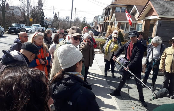
Meet at the WEST (secondary) exit from the Woodbine TTC subway station
Length: approximately 2-3 km route that will take 2 to 2.5 hours. This is a linear walk that ends at Gerrard east of Coxwell
Accessibility:
Please note staircases are part of the walking route, and there may be icy or muddy sections that restrict access to the ravines
Leaders: Helen Mills, John Wilson, Friends of Small’s Creek
Join Lost Rivers to explore and learn about Small’s Creek and its significance to environment and community. We will celebrate the Spring Equinox and community efforts to protect the ravine.
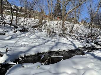
(above)
A family of mallard ducks swimming in the water of Small’s Creek, winter 2022. (Picture credit: Cleo Buster) https://sprucelab.ca/blog/why-a-rare-urban-wetland-matters
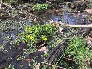
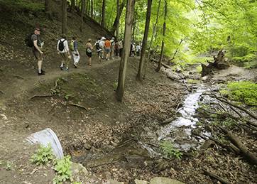
Come mark the Spring Equinox with Lost Rivers as we walk Small's Creek from the Danforth to Gerrard Street. On this first day of spring, with equal hours of darkness and light, we will connect with nature’s resilience and visit some of the precious fragments of the creek that are still above ground.
The story begins 11,000 years ago, at the edge of an ancient gravel bar. From here, Small's Creek flowed south into Ashbridge’s Bay about where the Coatsworth Cut is now. The long history of waves of destruction on the Creek began just 229 years ago with the removal of forests in the colonial era. Later the northern ravine became a huge dumpsite, and the area began to be developed for housing and industry as the railway pushed through. In 1913 the city approved funds to build a sewer system for Midway and East Toronto and most of the creek system disappeared into pipes. Since then the impacts of development and infrastructure on the land have continued, including the recent devastation above the Small’s Creek wetland north of the railway line. (https://sprucelab.ca/blog/why-a-rare-urban-wetland-matters)
Despite the outsized influence of buildings, industry, the rail corridor, and East York’s network of roads and sewers that encroach on and degrade the ravine systems, local communities treasure the small fragments of nature in nearby ravines and parks. We will talk about ways that ecologically sensitive design can help mitigate the worst impacts of development and the future possible role of natural linkages in the fabric of the city - the eco-city of our dreams.
Nature being resilient, the remaining remnants of East Lynn Park, Small’s Creek, and Williamson Park Ravine harbour habitat for owls, foxes, native wildflowers, and the endangered Butternut tree. Following the cycling of the seasons, we mark the first day of spring as a sign of rebirth, and recognize the life-giving power of light, water, and warmth to come.
Peak Power Water and Energy Walk – Helen with Ambika and Sadia – Sept. 24
Downtown from King and Simcoe to Roundhouse Park and back
- Walk commissioned by Imran Noorani Chief Strategic Officer of Peak Power, and an ex-Board member of TGC
- 23 walk participants from that organization.
- Revisited the 2012 walk that John wrote.
- Helen noted that we no longer have coal power.
- There has been a 38% reduction in GHGs since 2012.
- Socio-economic content, urban forestry, industrial, social and immigrant history as well.
- The walk went well, with Helen, Ambika and Sadia co-leading.
- ACTION: Will follow up to update and publish the walk
- Here is the link for first draft of ppt:
Salmon Walk along the Don River – Floyd – Oct. 2
- Opening day of the Ravines festival, with DMWTD (Don’t Mess with the Don)
- 50+ people.
- No/Few fish were seen. Floyd still told the story.
“The Toronto Purchase” Treaty Walk at Neilson Park
Saturday, October 16, 2021, 1 pm – 3 pm
Rain Date: October 23, 2021, 1 pm – 3 pm
Became 2 walks:
- (1) on Oct. 17, thru NPCC, who made arrangements with Humber Valley United Church.
- 45 people walked along Renforth Creek and another tributary of Etobicoke Creek, the western boundary of treaty 13 land
- Good discussion.
- (2) on Oct 23: 10 participants.
- A videographer filmed and is editing the 2-hour walk, to share with the Etobicoke green community.
$100 donations collected
Lost Mud Creek from Eglinton Park to Evergreen Brickworks
Saturday October 23 at 10:00 AM
- About 20 people, with Brian, Floyd and Paul.
- 3 hours, from Eglinton Park to Brickworks.
- Learned a lot.
- Now doing the paperwork for the Park People grant.
- Brian: most participants stayed until the end; there were good conversation circles along the way.
- Videotaped one person; will do more of that on future walks.
- Relationships were created on the walk.
Taddle Creek at University of Toronto
Nov 16 and Nov 30 2021
Two walks were held on Taddle Creek, first for an Anthropology class and then for a course on Ecology and Spirituality. 15 students on the first and 18 on the second. Very well done. Leaders Helen Mills and Nolan Scharper
Community Nature Walk with Black Creek Alliance
Sun, 17 October 2021, 1:30 PM – 4:00 PM EDT
- Walk was great, with incredible stories from long-time residents who remember the era of burying rivers, plus stories of flooding, plus Madeleine MacDowell telling the story of Bluebell Creek.
- About 46 people on the walk, including kids and babes in arms.
- Bulges in the creek beds are where the flooding is worst…some of the most substantial flooding in the city.
- ACTION: Follow-up will be to get the storytellers together to record their stories - via Tanya of Black Creek Alliance. Will try to link them to places in the landscape.
- Anna Richardson films their events…a good resource.
Other Events in October
Betty Carpick was inspired by the Luminato Taddle Creek audio walk to focus on Taddle Creek for her project called Stream of Consciousness. This was part of an artist’s residency at Jumblies Theatre.
- Betty Carpick is multidisciplinary artist based in Thunder Bay. She works with multiply abled people, creating art public pieces.
- "Stream of Consciousness" with Betty Carpick, Jumblies Theatre, and the Gather Round Singers helped elevate the interconnectivity of the biosphere by exploring story and metaphor through lost Indigenous ancestral waterways such as Taddle Creek in Toronto.
- A lengthy fabric "stream" with participants’ handprints was stitched with embroidery thread, sponge marked with artisanal inks, and sewn together with a stitch used for sutures.
- On Saturday, October 16, 2021 a performative art piece with the soundscape loop amplified the voices of water, nature, Indigenous peoples, histories, and much more in an ephemeral way. http://www.jumbliestheatre.org/jumblies/event/4th-community-drop-in-with-betty-carpick
- http://www.jumbliestheatre.org/jumblies/jumblies-artist-in-residence
- also: https://www.facebook.com/betty.carpick
Humber River Salmon Conservation Walk
Sunday November 21, 2021 2 PM
Meet at Etienne Brule Park
Joint event with Ontario Streams. Walk leaders: Kat Lucas and Brian MacLean
12 Participants
We love watching the salmon swim upstream to spawn. Join us to find out more about them and how we can work to protect them on the Humber.
Some topics that were covered:
- History of the Humber River
- Restoration/restocking of locally extinct Atlantic Salmon in the Humber River
- Lake Ontario Atlantic Salmon Restoration Program – collaborative project
- In-stream incubation research
- Classroom hatchery program
- Habitat restoration of the Humber River (from the headwaters to the mouth)
- Combatting erosion
- Removing garbage
- Creating notches through dams/weirs
- Rebuilding wetlands
- How we all can help protect our local environment
“The Toronto Purchase” Treaty Walk at Neilson Park
Saturday, October 16, 2021, 1 pm – 3 pm
Rain Date: October 23, 2021, 1 pm – 3 pm
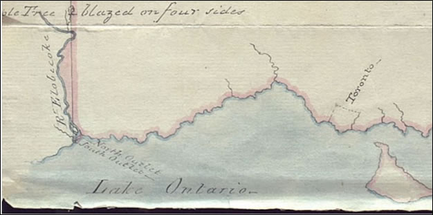
All Ages, Pay What You Can
Facilitator: John Wilson
Location: Meet at the Neilson Park Creative Centre (NPCC)
TTC access by 112 West Mall bus from Kipling station, to the Dundas-and-West Mall Crescent bus stop; cross Dundas at the lights and walk north and west 500 meters on Neilson Drive.
John Wilson of Lost Rivers will introduce “The Toronto Purchase” Treaty Walk at Neilson Park exploring part of the Etobicoke Creek trail.
Etobicoke Creek forms part of the boundary between Toronto and Mississauga. More than two centuries ago, a treaty, called the Toronto Purchase (Treaty 13), was concluded between the Mississaugas of the Credit First Nation and the Crown, opening Toronto to British colonial settlers. Participants will explore the landscape and waterways of Neilson Park, walking through paved paths and forest trails suitable for all ages and abilities. Outdoor clothing and footwear are recommended.
About John:
John has led over 100 Lost River Walks from the Rouge River in the east to Etobicoke Creek in the west. For 15 years, John served on and chaired the Task Force to Bring Back the Don. He has developed outdoor programming for Evergreen, Toronto Field Naturalists, Toronto & Region Conservation and the Toronto Biennial of Art.
NPCC has a Covid Entry policy in effect, beginning September 22, 2021. To ensure you have access to their facilities, please click here to view their health and safety measures.
Difficulty: Moderate. This is a circular walk on park paths and some uneven ground.
Community Nature Walk with Black Creek Alliance
Sun, 17 October 2021, 1:30 PM – 4:00 PM EDT
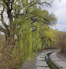
Come Meet Your Neighbours, and Explore the Unknown Waters In Our City.
Learn about the history and ponder the future of Black Creek, Lavender Creek, as we search for other buried streams right here in our neighbourhood.
Refreshments and snacks will be served at 1:30 with walk starting promptly at 2:00.
Free family oriented and safe outdoor activity with all welcome
Walk Leaders: Helen Mills, Tanya Connors, Brian MacLean
Lost Mud Creek from Eglinton Park to Evergreen Brickworks
Saturday October 23 at 10:00 AM
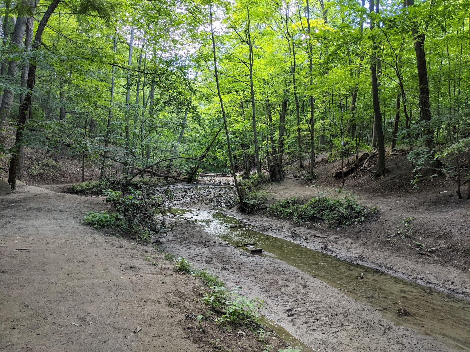
Come explore Lost Mud Creek from Midtown to Evergreen Brick Works
Join Lost Rivers as we follow a portion of the long buried Mud Creek.
Mud Creek’s headwaters were near Downsview Park (near the Allen north of Wilson Ave). It is almost totally buried underground as its flow crosses the city captured in sewers.
We will follow the lower portion of the original path of Mud Creek as we walk the streets of midtown to the creek's short daylit segment in Moore Park Ravine and down to Evergreen Brickworks.
With information and historical references along the way, the 5km 'walk' will wind through Davisville, Mount Pleasant Cemetery, and a portion of the former Beltline and end at the Brickworks before Mud Creek enters the Don River.
Walk starts at the Eglinton Park Community Garden north of the outdoor swimming pool -
200 Eglinton Avenue West, Toronto, ON M4R 1C3
- meet at the community garden north of the outdoor pool at Eglinton Park ;
-5km on mostly paved sidewalks and granular paths;
Walk leaders: Rene Fan, Paul Overy and Floyd Ruskin
Accessibility: a 5K hike that will take 3 to 4 hours.
Mostly city streets and granular paths. Some stairs.
This is a one way walk. The #28 Davisville Bus leaves from the Brickworks and Castle Frank Subway is a 15 min walk away
Funding for this walk via:


Check out our brand new audio tour and web map for Taddle Creek!
Anthropocene Immersion:
Unearthing Lost Taddle Creek
(web map)
 |
Commissioned by and produced in association with Luminato Festival Toronto for the Illuminating Ideas Series Find out more here. |
Anthropocene Immersion, Unearthing Lost Taddle Creek is an audio walk from Ryerson University to Toronto City Hall.
Walking time is approximately an hour to 75 minutes.
The distance is approximately 2 km.
You can access the audio tour below.
You can access the transcript here.
Sunday Aug 1, 2021 at 10:00 AM
Don Valley 2021: Threats and Opportunities
Toronto's Don River is Canada's most urbanized river. Stretching south from its headwaters in the Oak Ridges Moraine and running 36km before emptying into Lake Ontario, the Don has been profoundly changed by overuse, pollution, industry, road and railways and urbanization since the beginning of Toronto as a colonial city.
The river was renamed by the first colonial Governor - Lieutenant Governor John Graves Simcoe. This was just one of many re-namings that obscured over 15,000 years of Indigenous history with an overlay of colonial “reality”. We will talk on the walk about versions of the original name, Wonscotanach, and possible English translations. The walk will discuss lessons learned, lessons forgotten and lessons that remained to be addressed along this unique urban watershed.
Walk leaders: Floyd Ruskin and friends
Start at St Matthews Clubhouse, 450 Broadview Ave at Langley. Easily accessible by transit.
A mostly flat walk of 2.5km, concluding at Todmorden Mills at Pottery Road, there is one set of stairs to navigate with public washrooms at the start of the walk.
About 1.5 to 2 hours.
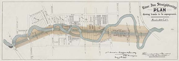
River Don Straightening Plan 1886. City of Toronto Archives, Series 725, File 12.
To see an enlarged version of the plan, click here.
Sunday December 20, 2020, 2 pm
Solstice Celebration Storytelling Walk with Evegreen
cancelled due to COVID.
Sunday December 13, 2020, 10 am
In Search of Charles Sauriol's Don Valley
cancelled due to COVID.
 Charles Sauriol, Toronto's home grown conservationist and lifelong resident of the Don and surrounding community wrote 5 books describing his experiences and what are today long lost features. We will attempt to locate some of these reminders of the past.
Note: This walk will take place on uneven terrain and some steep slopes.
Leader: Floyd Ruskin @dontrailtalkerTO
Sunday, November 15, 2020, 2 pm
A Treaty Walk of Etobicoke Creek
cancelled due to COVID.
The Mouth of Etobicoke Creek has marked the western border of Toronto since Treaty # 13 (“The Toronto Purchase”) was first concluded in 1805. We will trace the former courses of Etobicoke Creek and explore the renaturalizing ravine of the creeks lost “Long Branch”. We will locate the treaty boundary that settlers termed the “Indian Line”, separating British Toronto from Indigenous lands of the Mississaugas of the Credit.
Leader: John Wilson.
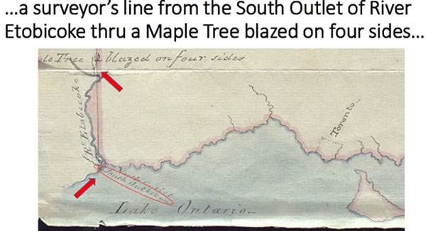
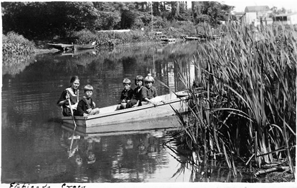
Read: "The first engineered alteration of Etobicoke Creek began in 1929 to allow for the westward extension of Lake Promenade" in preservedstories.com
Thursday October 29, 2020, 4.30 pm
Flemingdon Park Neighbourhood Tour
in partnership with the Flemingdon Park Health Centre
Take a tour of this amazing neighbourhood to discover the new Flemo Farm, the community garden, the Flemo Lost River, and much much more.
Walk leaders: Mussarat Ejaz, Ambika Tenneti, Helen Mills, Paul Overy.
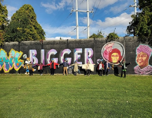
Thursday October 21, 2020, 5.00 pm
Flemingdon Park Ravine Leaders Webinar # 3 on Local Urban Nature
in partnership with the Flemingdon Park Health Centre
Join us for the third webinar in the series, exploring neighbourhood nature and urban nature in Flemingdon Park. All welcome.
Sunday, October 18, 2020, 2 pm - 27 attendees
ZOOM VIRTUAL TOUR Port Lands Naturalization: Bringing Back the Don.
You can view the recording at this this link.
Passcode: .XpaGi8c
Join us for our first experimental online tour with John Wilson. This will be a chance to hear from John Wilson about the role of community in getting to where we are now at the new mouth of the Don, and to see the progress being made by Waterfront Toronto to naturalize the Mouth of the Don River as essential climate- and flood-mitigation resilience strategy. In some ways the online venue with drone footage will work better because there is little to see at street level as Rocky works behind construction hoarding to remake a river. You will hear from John Wilson about the Waterfront goals for Toronto to become an exemplar of climate adaptation, see some amazing footage of the engineering works being placed in the ground, and get tips for where to walk to see glimpses of what is going on on the ground.
Leader: John Wilson @donofthedon
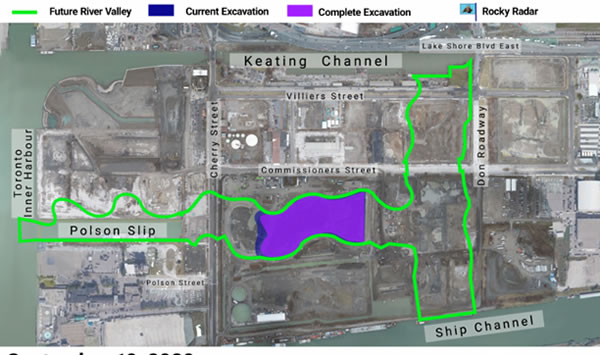
Thursday October 8, 2020, 4.30 pm
Discover Nature in the Woodlands and Wetlands behind the Ontario Science Centre
A walk in partnership with the Flemingdon Park Health Centre. Come enjoy the fall colours and explore nearby nature in ET Seton Park.
Walk leaders: Mussarat Ejaz, Ambika Tenneti, Helen Mills, Paul Overy, Lindi Jahiu,.
14 total including 5 leaders.
Mussarat did phone pre screening for all.
Great feedback received from the group.
Saturday October 3, 2020, 10 AM
**POPUP POPUP POPUP** The Lost Rivers Salmon Walk in partnership with Evergreen
With cooler temps and some rainfall in the forecast, we should enjoy a show. Sightings are happening now! Leaving from the Watershed Consciousness Wall at Evergreen Brickworks, we will hike over to the Lower Don River overlook above Pottery Road. Don history along with salmon facts are on the agenda.
For those that would like to continue, we will return via Beechwood Marsh, Cottonwood Flats, Crothers Woods and the abandoned Belleville rail line.
Leader: Floyd Ruskin @dontrailtalkerTO
Covid guidlines and physical distancing will be maintained. Face covering are recommended. No need to preregister, but contact info will be collected for contact tracing.
Note: EBW shuttle is not operating, but TTC #28 bus to and from Davisville station runs frequently.
Report: I had 19+ 2 helpers for a total of 22. Walked in two separate groups
Is it still a Salmon Walk when the stars of the show don't make an appearance?
Today's group said yes. A beautiful autumn day along with the glory of the Don Valley make up for the shy fish. Our extended fall colour walk made the difference Disclaimer: they had been out for the previous four days....sorry folks, but thats the way nature works. ![]()
![]()
![]()
Thxs Nancy, Catherine, Marie, Andrew, Laurel and Gord and everyone that participated for the great time.
September 19, 2 pm and repeated September 20 2020 at 2 pm
Sept. 19, 8 people, Sept. 20, 7 people
The complete videos on YouTube.
A City Within a Park – Centennial Park & the Etobicoke Creek Watershed, a Lost Rivers walk exploring parts of Etobicoke Creek and Centennial Park, the city's 2nd largest.
After a Land Acknowledgement and overview of the area’s 12,000+ years of Indigenous history, we'll walk along a tributary of Etobicoke Creek that winds through a suburban neighbourhood and learn about the park benefactor known as "a friend to all" who lived in that area, and we’ll discuss the contrast in “land use” between those two forms of settlement. Then we'll visit Etobicoke Creek itself seen from on high, and learn about its watershed and the Atlantic salmon and passenger pigeons once prevalent there. We'll also share some proposals from the park's new Master Plan in development that envisages naturalizing areas, planting more trees, and ensuring that the many sports and picnic facilities are refreshed.
Check out the video on Instagram: Check out video on Instagram
Sunday, August 16, 2020 2 pm
A Celebration of Lost Rivers 26th Anniversary
Sunday, August 16 was the 26th anniversary of the very first Lost Rivers Walk in August 1994. In celebration, we tested out our new Covid-19 protocols with a private walk, revisiting the first walk ever along Mud Creek at Eglinton Park.
Most people only know Mud (Spring) Creek as the small stream by Evergreen Brickworks. Fascinating to learn its source is by Downsview Airport, running SE underground across the city, continuing below North Toronto, Eglinton Park, then under Mount Pleasant Cemetery and Moore Avenue. It is finally visible as it flows through Moore Park ravine and the Brickworks site before emptying into the Don.
Meeting at Eglinton Park gave us an opportunity to learn of a Wendat settlement from the 1400s. According to Ron Williamson of ASI Heritage, about 300 people lived on the high hill above the creek, and their fields may have extended from Eglinton Ave. to Cortleigh Blvd, Castleknock Road to Duplex Ave. Imagine huge fields of corn all around you in the area surrounding Eglinton Park. We enjoyed the small stand of corn that is thriving in the community garden too.
We somehow avoided the forecast downpour and also got to enjoy a surprise anniversary cake provided by Setayesh. Helen Mills shared stories about the history of Lost Rivers and the mapping of Mud Creek, and Brian MacLean led us on a walk to the site of the Wendat village at Allenby School. Much to think about as a new Master Plan for Eglinton Park is nearing completion
Sunday, Mar 15, 2018, 2 pm - Garrison Creek (Christie to Queen)
This walk will follow the section of Garrison Creek from Christie Pits to Queen St. Walk begins at NW corner of Christie & Bloor, close to the Christie TTC station, and terminates at Trinity Bellwoods Park.
Led by Richard Anderson and others.
Sunday, February 16, 2020, 2:00 pm – Lower Don Lands: Natural and Human Heritage
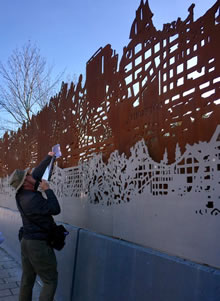 Meeting at the site of Lucie and Thornton Blackburn’s home, a touchstone for heritage in Black History Month, we will walk through the Lower Don Lands to see the impacts of brownfield redevelopment and infrastructure planning on natural and cultural heritage resources in the rapidly-changing Lower Don Lands. A linear walk dictated by weather conditions, starting at Eastern and Cherry streets.
Leader: John Wilson.
Sunday, January 19, 2020, 2 pm – Ice Walk at Evergreen Brick Works
A seasonal walk inspired by our frozen winter waterways. We will learn about the Ice Ages that shaped the geology of the Don Valley Brick Works; we will consider the life of the frozen creeks and ponds in the Weston Quarry Garden; we will visit Evergreen’s skating trail and share warm midwinter reminiscences. A circular walk on surfaces chosen in light of the conditions we encounter.
Meet at the Watershed Wall, Evergreen Brick Works.
Leaders: Floyd Ruskin, John Wilson, Ed Freeman.
Saturday December 21, 2019 1:00 to 3:00 PM
Winter Solstice Walk
Join the Rivers Rising Ambassadors and Lost Rivers to celebrate a wintry Solstice Walk as we take in the shortest day of the year.
Along with stories and history of the Don Valley, we'll also explore the wetland and meadow trails in the Don Valley Brick Works Park. Come early and stay late to enjoy Evergreen's festive Winter Village.
Warming fires and hot refreshments available.
Participants should wear comfortable walking shoes and weather-appropriate clothing. Trails are both paved and granular. Route may change due to icy or unsafe trail conditions.
Sign up here: https://www.eventbrite.ca/e/winter-solstice-walk-with-lost-rivers-and-rivers-rising-tickets-84771051497
Meet at the Watershed Consciousness Wall, Evergreen Brickworks, 550 Bayview Avenue, Toronto.
*** Please note this walk is on Saturday not Sunday, and the start time is 1 PM.
Sunday, November 20, 2019, 2 to 4.30 PM
Humber River Watershed
A walk to discover stories of two "100 year" floods, the Humber Carrying Trail, mills, the Humber Creek and the Chapman Valley "Environmentally Sensitive Area". Mostly paved surfaces with some semi-steep inclines.
Meet on Scarlett Rd at the Hill Garden Rd bus stop. (Take #79 bus from Runnymede subway station or take Lawrence #53 bus, exit at Scarlett Rd and walk two blocks south.)
Leader: Brian MacLean.
Route may be adjusted due to icy or unsafe trail conditions.
October 14th and 27th and November 3rd
Lost Rivers Storytelling walks with the Toronto Biennial of Art
Monday October 14th AT 8 PM (Thanksgiving Day)
NIGHT WALK WITH LOST RIVERS AND RIVERS RISING
- Lost Rivers Storytelling walk with the Toronto Biennial of Art
https://torontobiennial.org/programs/lost-rivers-and-rivers-rising/
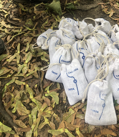
Image Credit:
Maria Thereza Alves, Garrison Creek, 2019.
On display at 259 Lake Shore Blvd E. for the Toronto Biennial of Art
This Night Walk with the Lost Rivers and Rivers Rising initiatives traces hidden histories of the Garrison Creek, which enters Lake Ontario just east of Fort York, the military garrison for the region. Closed since the 1920s, the hidden creek has gained interest as new initiatives have formed to draw attention to the relationships between “lost” creeks, community planning, and urban design by restoring buried bridges and regenerating the Garrison Creek ravine system.
Event Notes: Rain or (moon) shine, participants will meet promptly at 8pm in front of Christie Subway Station on the corner of Christie Street and Bloor Street West.
Accessibility: The Night Walk involves active walking through various paths in a public park with a few stops to rest over the course of the program.
Sunday October 27, 2 PM
WALK THE TREATY BOUNDARY OF THE"TORONTO PURCHASE"
- Lost Rivers Storytelling walk with the Toronto Biennial of Art
https://torontobiennial.org/programs/storytelling-lost-rivers/
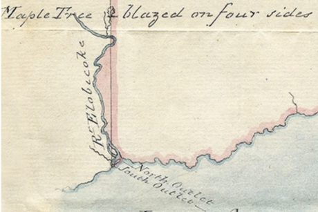
Image Credit:
“The Toronto Purchase Boundary,” 1805, map, source unknown. Courtesy Toronto Public Library.
John Wilson guides a walk entitled Walk the treaty boundary of the “Toronto Purchase” through Marie Curtis Park to the mouth of Etobicoke Creek, on the border between Toronto (Etobicoke) and Mississauga. This river mouth was one of two points along Etobicoke Creek, used to survey the western line of the Toronto Purchase, the treaty between Indigenous Mississaugas of the Credit and the British Crown that permitted European settlement. This line still forms much of the boundary between York and Peel Regions. The walk traces this liminal landscape, following waterways once used as transportation routes by Indigenous peoples, to consider hidden narratives of alienation, accommodation, and resilience.
Meet at: the Small Arms Inspection Building,1352 Lakeshore Road East, Mississauga ON and ends at Marie Curtis Park.
Sunday, November 3 2019, 12:00 PM – 1:30 PM
Storytelling: Lost Rivers and Rivers Rising
- Lost Rivers Storytelling walk with the Toronto Biennial of Art
https://torontobiennial.org/programs/storytelling-lost-rivers-and-rivers-rising
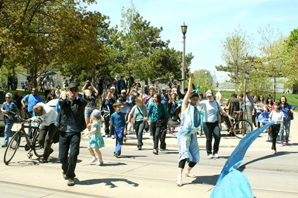
Image Credit:
Human River 2012.
Courtesy of Lost Rivers
Download walk outline and images here.
Be the River. A poetry walk in conjunction with artist Maria Thereza Alves’s project Phantom Pain at Riverdale Park West
Toronto's River Poets, together with Lost Rivers and Rivers Rising knowledge keepers investigate Toronto’s lost rivers, the forgotten network of water that runs beneath our feet.
For this event participants are invited to wear blue for the walk, which will form part of a Human River activity along the lost meander of the Don River.
Rain or shine, the walk will start promptly at 12 pm at the St. Matthews Clubhouse
Meeting point: St. Matthews Clubhouse, 450 Broadview Ave. Riverdale Park East
Accessibility: This event involves active walking through various paths and grassy surfaces in a public park with a few stops to rest over the course of the program. Some steep slopes.
Sunday, October 20, 2019, 2 pm
The Great Migratory Walk.
On this guided walk we’ll look for winged friends who are embarking on their journey and salmon in the Don River who are migrating upstream to spawn.
Join Rivers Rising Ambassador Floyd Ruskin and friends for this exploration.
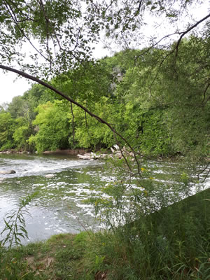 We’ll begin at Evergreen Brick Works at the Watershed Wall and walk along Bayview and the Don Valley multi-use path north from Pottery Road, where we’ll look for salmon swimming upstream and evidence of birds on their way south. Walk returns to wrap up at Evergreen Brick Works. The actual timing of when salmon migrate is largely dependent on weather patterns (including rainfall and temperature). The question of ‘when’ is largely up to the salmon, so cross your fingers and toes that they choose to be active in migration during our walk!
Photo by Floyd Ruskin: the weir north of Pottery Road
September 26th, October 3rd, and October 10th at 6:30 pm
Blue Guerrilla* at the Bentway
Blue Guerrilla is a series of hands-on training and urban exploration walks to understand, reclaim and celebrate nature in our city through water. Join us to decipher the urban landscape and connect with the land by learning about native plants, lost rivers and the stories of Indigenous and newcomer communities.
*Blue Guerrilla is part of The Bentway’s 2019 Community Incubation Program
September 26, 6:30pm
Blue Guerrilla: Building medicine gardens
Facilitated by Alexandra Langford-Pezzo, owner of L.P Design. This training will introduce you to Traditional and Neo-Traditional medicine wheel gardens and their healing properties, starting by plants that you can find at the Bentway.
October 3, 6:30pm
Blue Guerrilla: Lost Rivers and Found Stories
Join us to learn about the multiple creeks that once flowed throughout the Bentway neighbourhoods and the told and untold stories about these creeks and the people who lived near them. A Lost Rivers and Rivers Rising walk.
October 10, 6:30pm
Blue Guerrilla: Building Earth-friendly landscapes
Facilitated by RAINscapeTO. This workshop will present you with easy steps that you can implement at home – whether you live in a house or in a condo- to reconnect with the land, protect the lake, attract pollinators and even grow food.
Sunday September 15, 2019, 2 pm.
Brownfield goes Green: Gerrard Prairie
A walk to explore a threatened cultural prairie on a brownfield site in the Gerrard-Victoria Park area. Meet at the entrance to Victoria Park subway station. Walk returns to the starting point. Nettles on some trails. Great golden digger wasp was seen last time this walk was run. Hairstreak copper butterflies were seen on this prairie in June 2019. Led by Richard Anderson.
Saturday, September 7th 2:00 PM to 4:00 PM
#RiversRising neighbourhood exploration with Jacqueline Scott. Come discover Regent Park! Expect some interesting perspectives - community, nature, urban revitalization and more - from someone who lives there.
Meet at FreshCo, 325 Parliament St - northeast corner of Dundas and Parliament.
Walk Leader: Jacqueline Scott
Sunday, August 18, 2019, 2 pm
Water and Industry on the Don
The story of old mills and forgotten brick yards in the valley of the Don River. This walk takes in Todmorden Mills, the Beechwood Marsh, the Taylor Middle Mill and mill tail race, Cottonwood Flats, Sun Valley, Crothers Woods and Cudmore Creek, Old Pottery Road and a walk along the abandoned Belleville Railspur to end at Evergreen Brick Works.
Walk Leaders: Rivers Rising Ambassador Floyd Ruskin and Friends
Meet at the SW corner of Broadview and Pottery Road (across from the Dairy Queen), finish at Evergreen Brickworks where you can take the free Evergreen shuttle from EBW to Broadview station or the #28 Davisville bus to Yonge subway.
Difficulty: there are elevation changes on this walk - down into the valley along Pottery Road and up through Crothers Woods, some uneven footing. It will take about 1½ to 2 hours.
Sunday, July 21, 2019, 2 pm
Etobicoke Creek: Walk the treaty boundary of the "Toronto Purchase"
A walk to make visible a forgotten place where indigenous history met colonialism on Etobicoke Creek. Near the Neilson Park Creative Centre there once stood a “Maple Tree blazed on four sides” that marked the west boundary of the 1805 Treaty 13 (“Toronto Purchase”) between the British Crown and the Mississaugas of the Credit River. The tree marked a surveyor’s line, later called “Indian Line” by settlers, which still today forms much of the boundary between Peel and York Regions. On the grounds of the Creative Centre we will explore this liminal landscape, where Elmcrest Creek flows into Etobicoke Creek in a wooded setting, to foreground a story of alienation, accommodation and resilience.
Walk Leader: John Wilson
Meet in front of the Neilson Park Creative Centre at 56 Neilson Drive, Etobicoke. TTC access by 112 West Mall bus from Kipling station, to the Dundas-and-West Mall Crescent bus stop; cross Dundas at the lights and walk north and west 500 meters on Neilson Drive.
Difficulty: Moderate. This is a circular walk on park paths and some uneven ground.
25 attended
Sunday, June 16, 2 PM to 4 PM, East End Rain Garden Tour with Rain Gardens United and RAINScapeTO
Come discover the magic of rain garden landscaping in the East End. The gardens planted by Rain Gardens United are heavenly havens for pollinators, and are just the beginning of possibilities and transformations for gardens.
Water really is at the centre and rain gardens are a new way to bring beauty to gardens while helping the lake and the rivers. Walk Leaders: Helen Mills with RAINscapeTO and Rain Gardens United. Met at the southeast corner
of Mortimer and Coxwell in the Michael Garron Hospital Park. Difficulty: an easy walk on city streets, about 2 hours.
19 attended, including Rain Garden hosts.
Sunday, June 2, 10 AM - Quiet Walk along the Lower Don Valley
Please join Lost Rivers and Rivers Rising Ambassadors as we walk north listening to......quiet! June 2 this year is the only opportunity to walk the Don without the ever-present noise of cars, trucks or construction vehicles.
It truly is a magical time. Before we cross the footbridge, a brief stop at the Tannenbaum Sculpture Garden to view the joyful work of Canadian artist Bill Lieshman. Any other day of the year the garden is incredibly noisy with the
sound of the DVP intruding on the space. On past quiet walks with Floyd there have been sightings of fox, deer, muskrat, beaver, turtles, frogs, snakes and all manner of birds and other waterfowl.
Walk Leader: Floyd Ruskin
Meet at Hubbard Park (southside of Bridgepoint Health) and walk north to Evergreen Brick Works.
Difficulty: There is one set of stairs to navigate; No washrooms until Evergreen Brick Works and not good for strollers or people that are mobility challenged. Walk is approximately 1 to 1.5 hours long.
27 attended.
May 19, 2019, 2 pm
The Magic of Spring on Spring Creek in High Park
Come explore the oak savannah and forests of Spring Creek. Hopefully we will be in for wonderful spring flowers and more.
Walk Leaders: Helen Mills and Friends
Meet at the southwest corner of Bloor St W and Keele St
Difficulty: some woodland trails and steep slopes
Sunday, April 21, 2019, 2 pm – Urban Forest on the Lake Iroquois Shore Cliff.
Identify and explore the budding street trees in the Summerhill area for Easter. This linear walk starts at the Summerhill subway entrance, Shaftesbury and Yonge St., and travels city streets with some steep sections to Davenport and Dupont. The route traces part of the escarpment of prehistoric Lake Iroquois along the Core Circle, the natural boundary of central Toronto. Comfort facilities at the start.
John Wilson leads with urban forester, Steve Smith.
Meet at the Summerhill subway entrance
Sunday, March 17, 2019, 2 pm -
Seedy Storytelling Walk with the Rivers Rising Ambassadors
Come early to meet the Rivers Rising Ambassadors at Seedy Saturday at Evergreen Brickworks then join us for a walk exploring nature in early spring. There will be interesting connections and stories about the history of food, seeds, gardens and water at the mouth of Mud Creek.
Walk Leaders: Helen Mills and Reno King
Meet at the Watershed Consciousness Wall, Evergreen Brickworks.
Sunday, February 17, 2019, 2:00 pm – Davenport Road and the Tollkeeper’s Cottage.
Part of a series of walks on the Core Circle, a blue-green liminal zone around the city’s downtown Core. This linear walk begins at Dupont and Davenport and ends with a warm welcome at the Tollkeeper’s Cottage, the restored heritage building from the 1830s at Bathurst and Davenport. The walk traces the shoreline of glacial Lake Iroquois below Casa Loma for about 2 km on level pavement.
Led by Helen Mills and John Wilson.
Sunday, January 20, 2019, 2018, 2:00 pm – Midwinter in Rosedale Ravine.
Part of a series of walks on the Core Circle, a blue-green liminal zone around the city’s downtown Core. This is a circular walk of about 2 km, meeting and ending at Toronto Reference Library, Yonge and Asquith. We will explore the ravine lands of Castle Frank Brook along Rosedale Valley Road and the network of park paths. We will adjust our route for the midwinter conditions and end with a warm drink at the Reference Library. Walk for about 2 km.
Led by Helen Mills and John Wilson.
Sunday, December 16, 2018, 2 pm - Solstice Storytelling Walk with the Rivers Rising Ambassadors, First Story and Evergreen
Join the Rivers Rising Ambassadors and Jon Johnson of First Story for an special Solstice walk and exploration of Mud Creek Evergreen, the most beautiful restoration site in Toronto. Come early or stay late to enjoy the festive village.
Walk Leaders: Jon Johnson, Reno King, Darlene King, Sarena Johnson, Ambika Tenneti.
Meet atthe Watershed Consciousness Wall, Evergreen Brickworks.
Sunday, November 18, 2018, 2:00 pm - Wonscotonach walk
The Lower Don River is always changing: As the Queen St. bridge translates Heraclitus, “The river I step in is not the river I stand in.” We will explore the changes, hydrological, biotic, mechanical and artistic, shaping this well-traveled part of downtown’s liminal Core Circle and examine opportunities to expand Wonscotonach Parklands, a name for the Don that settlers assumed from the Mississaugas. This linear 2.5 km walk includes some uneven ground.
John Wilson leads with friends.
Meet at the corner of Mill St. and Bayview Avenue, a short distance east of the Distillery District streetcar loop.
Sunday, October 21, 2018 2:00 pm - Pass the Glass Water Walk on Garrison Creek
Come Walk with the Rivers Rising Ambassadors!
Explore Lost Garrison Creek, a lost lakeshore, the Bentway, and new futures for the mouth of the Garrison. Bring your water bottle, and wear blue as we embody the watercycle and carry water along the course of Garrison Creek to the lake. Stops along the way include the blood sewer, the smelter, the Bentway, the mouth of the creek, most polluted quay at the lake, and the fish habitat restoration project at Spadina Quay. We've left extra time for the exploration of the Bentway with Ilana Altman as there is so much to see there. This walk continues our series of walks around the Core Circle, a blue-green liminal zone around the city's downtown Core as defined by Toronto City Planning.
Walk leaders: Darlene King, Reno King, Helen Mills, Leah Lem and Ilana Altman.
Meet at the northwest corner of Walnut Avenue and Wellington Street West. Walk is approx 2.4 km and ends at Spadina Quay. Mostly on city streets with a few stairs and uneven surfaces.
Sunday September 30, 2018
We’ll be leading a rerun of our incredible nature walk along Highland Creek as part of the Salmon Fest at Morningside Park.
Saturday September 29, 2018
We’ll be in Parkdale with Greenest City for the Harvest Festival.
Sunday, September 16, 2018, 2:00 pm - Blue-Green Infrastructure at University of Toronto Scarborough U of T SCARBOROUGH COLLEGE - Lost Rivers Urban Walk Leader: Prof Carl Mitchell. Meet at the U of T Scarborough bus loop (95E from York Mills subway station) to explore urban water at UTSC including bioswales that capture rainwater and then visit the valley of Highland Creek. Lost Rivers has not previously visited this part of Highland Creek. The trails to the valley of Highland Creek are closed this month, so we will be using vans to get to the valley.
13 attended. A number of salmon attended.
Saturday September 15, 2018 2 pm Corktown Common Exploration
Take a walk on the land where Crookshank Creek and Sumac Creek once flowed into the Don River Delta. Along the way learn about the connection between the potato famine, Corktown and the Choctaw Nation; visit the site of the Blackburn’s home and hear a riveting tale of escape from slavery; discover how activists have worked for 20 years to Bring Back the Don; discover art and people in the new Corktown Neighbourhood, and find out why Corktown Common Park is much more than just a park. There will be food stories, plant stories and water stories that will surprise you and connect you with the Greenbelt that is right here - not just out in the 905. 15 attended.
Walk Leaders: Rivers Rising Ambassadors Darlene King, Sarena Johnson, Leah Lem, and Rhonda Teitel-Payne of Toronto Urban Growers.
Meet at St. Paul’s Basilica at the southeast corner of Queen Street and Power Street for a 2-2.5 km walk on a mostly paved route to the Don River via Corktown Common.
Suggested Donation $10 or PWYC
Sunday, August 19, 2018, 2:00 pm - Port Lands: New Mouth of the Don River. Part of a series of walks on the Core Circle, a blue-green liminal zone around the city’s downtown Core as defined by Toronto City Planning. Meet at the Cherry Beach TTC stop, foot of Cherry Street for a walk to see the exciting progress creating a new Don River mouth, past future Villiers Island to Corktown Common. See the excavation for the new river course and landfilling for future Promontory Park. Walk for 3 km on level pavement with comfort facilities at start and end points, led by John Wilson and friends. Walk was well atetnded 55+ attended. Not everyone made it to the very end, hot day.
Sunday, July 15, 2018, 2:00 pm – Eastern Waterfront: Sugar Beech to Corktown Common. Part of a series of walks on the Core Circle, a blue-green liminal zone around the city’s downtown Core as defined by Toronto City Planning. Meet on the south side of Queen’s Quay, just east of Lower Jarvis, for a walk through Sugar Beech, Sherbourne Common, the First Parliament site, West Don Lands and Corktown Common, all crown jewels of our Waterfront Revitalization initiative. Walk for 2 km on level pavement with plenty of comfort facilities, led by Helen Mills and John Wilson. 20 walkers, hot weather. Representatives of Sidewalks and St lawrence neighbourhood.
Sunday June 17, 2018, 2:00 pm – Waterfront: Spadina Quay to Sugar Beech. Part of a series of walks on the Core Circle, a blue-green liminal zone around the city’s downtown Core as defined by Toronto City Planning. Connecting from the April walk on Garrison Creek south, we continue east along the lake for 2 km. Fish tales at Spadina Quay, the Deep Lake Cooling Project, the wave decks and what lies below them, early maps and images that show the details of the shoreline 200 years ago, the story of sugar. Meet at Spadina Quay (Queen’s Quay West at the bottom of Spadina. Walk Leaders, Helen Mills and Friends. hot weather, 12 walkers.
Sunday, May 20, 2018, 2:00 pm – Garrison Creek from St Clair Ave to Christie and Bloor – the western boundary of the Core Circle. Part of a series of walks on the Core Circle, a blue-green liminal zone around the city’s downtown Core as defined by Toronto City Planning. This 2.6 km walk begins outside the boundaries of the Core Circle with a trip down the Lake Iroquois Shorecliff, the northern boundary of the Circle. Some familiar and some new stories along this less travelled part of the creek south to Bloor. Meet at 213 Winona Dr (one block north of St Clair). Walk Leaders, Helen Mills and Friends. 41 walkers including TGC Board Chair Shari Doxtator. Fundraising pitch delivered $100.
Sunday, April 15, 2018, 2 pm - Garrison Creek Water Walk (Queen to the Lake) Join the Rivers Rising Ambassadors as we celebrate water and Lost Garrison Creek a week before the day - Earth Day 2018. The Earth Day 2018 theme is “Plastic Pollution” so bring your water bottle, and wear blue as we embody the watercycle and carry water along the course of Lost Garrison Creek to the lake. Stops along the way include the Wall of Oblivion, the smelter, the blood sewer, the most polluted quay at the lake, and the fish habitat restoration project at Spadina Quay. And of course lots of plastic stories! Walk leaders, Darlene King, Helen Mills Meet at the northwest corner of Gore Vale Ave and Queen St West. Walk is approx 2.5 km and ends at Spadina Quay. Mostly on city streets with a few stairs and uneven surfaces. Terrible weather day, so walk was cancelled.
Sunday, March 18, 2018, 2 pm - Garrison Creek (Christie to Queen) This walk will follow the section of Garrison Creek from Christie Pits to Queen St. Walk begins at NW corner of Christie & Bloor, close to the Christie TTC station, and terminates at Trinity Bellwoods Park. Led by Richard Anderson and others. Around 35-40 attended on a fine bright but cool spring day.
Sunday, February 18, 2018, 2 pm - Mid-Winter Walk in Riverdale: Holly Brook aka Heward Brook aka Mill Brook. Starting at Carlaw and Gerrard, southwest corner, a walk through 2,500 years of Riverdale’s history linked by the lost course of Holly Brook also known as Mill Brook and Heward Creek. This creek has backdropped Riverdale’s changing face from forested settlement to farmers’ fields to (sub)urban kaleidoscope. Linear route of about 2 km. on sidewalks through Withrow Park to Carrot Common on the Danforth subway line led by John Wilson and Joanne Doucette. Comfort facilities in businesses at end point. Cool late winter day, 48 walkers.
Sunday, January 21, 2018, 2 pm - PATHology and Geology: Redux. We’ll revisit a popular mid-winter walk route: the PATH system beneath the towers of the downtown core, where we find proxies for nature in a manufactured landscape. Ed Freeman and John Wilson will lead a circular tour to discover memorable stone hewn from the ground in far-flung quarries, fashioned into cladding and sculptures throughout the PATH system. About 2 km. walk, on indoor walkways and street sidewalks with some stairs. A few public washrooms are open on Sunday. Meet at the southeast corner of Yonge and Adelaide. 33 Attended.
Sunday, December 17, 2017, 2 pm - Solstice Storytelling Walk with the Rivers Rising Ambassadors Join us on lost Mud Creek for a magic walk at Evergreen, the most beautiful restoration site in Toronto. Come early or stay late to enjoy the festive village. Walk Leaders. Helen Mills and the Rivers Rising Ambassadors. Meet at the Watershed Consciousness Wall, at the Evergreen Brickworks. Check our site for updates closer to the day. The attendance was 29 or so.
Sunday, November 26, 2017, 1:30 pm – Peter Hare Memorial Walk, Mt. Sullivan, Baymouth Bar. Ian Wheal to lead, starting at Gerrard and Main, NE corner. 8 people attended.
Sunday, November 19, 2017, 1 pm – Autumn Duck Walk Through Crothers Woods. Join Lost Rivers, Toronto Field Naturalists, Thorncliffe Park Women’s Committee and Evergreen on an autumn adventure through Crothers Woods. We’ll wind our way through the forested trails in the Don Valley to the beautiful Beechwood/Cottonwood Flats area, where we’ll tour the natural features of this riverside wonderland and look for the ducks who winter in this area. This is a linear walk of about 2 hours led by John Wilson. At the end of the walk, you may board a bus in the valley, courtesy Evergreen, that will return to the starting point, or take public transit. The walk covers about 2 km. There are uneven woodland trails and a long staircase. No washroom facilities. Please dress for the weather conditions, as November can be chilly. Meet at Leaside Park, Millwood and Overlea, at the north end of the Leaside Bridge. There were 17 walkers.
Sunday, October 15, 2017, 1 PM Black Creek - Lavender Creek - Past, Present and Future. Come discover the history and hear the dreams to restore nature, create trails, reduce flooding problems and bring beauty to this forgotten corner of our neighborhood. Along the way we will discover remnants of Lavender Creek. There will be: Music Snacks Kids Scavenger hunt Prizes Comfortable walking shoes recommended. Joint walk with Black Creek Alliance. Leaders: Reno King, Darlene King, Helen Mills, Tanya Connors and Friends Meet at the corner of Cliff Street and Alliance by the TTC bus stop. [68 people attended].
Sunday, October 15, 2017, 10 AM-11:30 AM - The Great Migratory Walk. On this guided walk we’ll look for winged friends who are embarking on their journey and salmon in the Don River who are migrating upstream to spawn. Join Lost Rivers, Evergreen, TRCA and Bird Studies Canada on a guided walk through the Don Valley. We’ll begin at Evergreen Brick Works at the Watershed Wall and walk along Bayview and the Don Valley multi-use path north from Pottery Road, where we’ll look for salmon swimming upstream and evidence of birds on their way south. Walk returns to wrap up at Evergreen Brick Works. The actual timing of when salmon migrate is largely dependent on weather patterns (including rainfall and temperature). The question of ‘when’ is largely up to the salmon, so cross your fingers and toes that they choose to be active in migration during our walk! [65 walkers attended from Evergreen to the Lower Don. Christine Tu of TRCA spoke on salmon migration. The salmon, unfortunatelly dod not turn up].
Sunday October 1, 2017, all day - THE SALMON FESTIVAL. the Rivers Rising Ambassadors and Jon Johnson of First Story will be leading a walk for up to 30 people - details will be announced shortly. The festival will be on all day: WHERE: Morningside Park, 390 Morningside Ave, Scarborough, ON M1E, Canada. [138 people attended the Lost Rivers/Ambassadors portion of the event, about 2000 overall].
Sunday, September 17, 2 PM-4 PM - Digging the Don: Food and Water Forever. The Don River and the people who have lived and worked on it have been key to Toronto’s food and water systems for thousands of years. This tour focuses on the community gardens, immigrant communities, and Indigenous peoples that have shaped and been shaped by the Don Watershed. Hear about the current efforts to restore and protect the Lower Don lands through inclusion in Ontario’s Greenbelt and celebrate Toronto’s first Urban Agriculture Day. Come for the Pop-Up at Regent Park CRC (40 Oak Street) from 1:00 pm to 2:00 pm to chat about the Greenbelt, share your priorities for the Don River, and get a little surprise from our friends at the Greenbelt Foundation. Walking tour starts at 40 Oak Street at 2 PM. Walk Leaders, Rhonda Teitel-Payne, Reno King, Sarena Johnston (Toronto Green Community Rivers Rising.) [65 people].
Sunday, September 17, 2 PM-4:30 PM - Trees, Urban Ecology, Lost Castle Frank Brook. Join Evergreen’s Don River Valley Park Team, the Rivers Rising Ambassadors and friends on a journey from the concrete jungle into the world of nearby trees in St Jame’s Cemetery and the ravine of lost Castle Frank Brook. At the end, we’ll take a secret pathway along lost Lamb’s Creek and return to Parliament Street. Some ravine pathways and steep stairs. No washrooms till the end of the walk. Approx 2.75 km long Walk Leaders: Helen Mills, Ambika Tenneti, Reno King and friends Meet at the northwest corner of Parliament and Wellesley Streets. Circular walk [30-35 walkers attended].
Sunday, August 20, 2017, 2 pm – Betty Sutherland Trail: Lowlands, Uplands and Mysteries. Walk with John Wilson, Lost Rivers, and Jason Ramsay-Brown, author of Toronto’s Ravines and Urban Forests, along a remarkable trail that displays the resilience of nature on the East Don River as it skirts Highway 401. Discover and learn about ruined mills, energy sources from an era not far removed from our carbon-challenged present. A linear walk of 2.5 km. starting on the southeast corner of Sheppard and Leslie, across from the subway station, ending at a TTC bus stop on Don Mills near York Mills. Washrooms at the start and within walking distance of the end. Expect some steep slopes and uneven trails. 30 people attended, warm day.
Sunday, July 16, 2017, 2 pm – Warden Woods: Landscape, Watercourses and the Urban Forest. Join John Wilson, Lost Rivers, and Jason Ramsay-Brown, author of Toronto’s Ravines and Urban Forests, for a walk through one of the Toronto’s most spectacular ravines. Thousands see it from the subway, but few experience it close-hand with expert commentary. Circular walk of 3.5 km. starting at the southwest corner of Warden and St. Clair, across from the subway station. Washrooms available at the start/end location in subway station. Expect some steep slopes and uneven trails. 29 attended, a little rain. Butternuts attended.
Sunday June 18, 2017, 2 PM - Lost Neighbourhoods, Lost Ecosystems - unearthing stories of land and people in St James Town Join the Rivers Rising Ambassadors for a fascinating journey into the past, present, and possible future of St James Town. How forests became a neighbourhood, and how that neighbourhood got re-developed to become the densest most diverse part of Toronto - the world in a few city blocks. Heritage, water, trees, gardens, food security, climate change, and of course the story of nearby lost rivers - Castle Frank Brook, Crookshank Creek and Sumac Creek. Linear walk mainly on city streets. Walk Leaders: Helen Mills and the St Jamestown Rivers Rising Ambassadors Meet outside Sherbourne Subway. About 35 people attended.
Saturday Jun 17, 2017, 12 noon - Waterlution – Pass the Glass Walk To spread the message that the water we use in our homes, schools and workplaces, comes from our Great Lakes, specifically Lake Ontario. By the same token, our wastewater is treated, recovered and returned to our lake. It’s a cycle that most people are unaware of, which leads to the dumping of certain toxic/polluting materials into toilets and sinks that then unfortunately may end up in the lake. Leah, Reno, Darleneand Helen Mills led this one, about 15 people.
Monday Jun 12, 2017 6:15-8:15 PM - Our Fragile Planet, Flowing Water, Flooding and Gardens for Rain: The Lost Rivers of Ward 13 and RAINScapeTO In this workshop you will discover your personal Lost River, find out what happens when rain falls on your house, where it flows, and why it sometimes floods. Learn about rain garden landscaping - a new way of gardening that can help prevent flooding, restore a more natural water cycle, and enhance quality of life. Helen Mills, founder of Toronto Green Community’s Lost Rivers program, will present the program with partners from RAINscapeTO. RAINscapeTO is a new program to bring RAIN garden landscaping to Toronto. Meet at Jane-Dundas library 620 Jane St. Co-sponsored by Our Fragile Planet, Jane/Dundas Library, Green 13 and Toronto Green Community. http://www.green13toronto.org/event/ About 40 attended.
Friday May 26, 2017, 6:45 PM - Sleepy Valley Transient Camp: 1931 CN Rail Ian Wheal leads a walk to a district which once held a transient Camp, watered by local springs. Meeting point is at Warden Ave and Danforth Rd. Heading south on Warden toward the Bluffs. 6 attended.
Wednesday May 24, 2017, 2:30 pm Lost Ponds in Parkdale A walk and talk with UoFT Theological students, Helen Mills and Rivers Rising. 10-12 attended.
Sunday May 21, 2017, 2 pm Unearthing Stories of (almost) Lost Spring Creek - Blue Green City Part II Starting at SW corner of Dundas St W and Indian Grove, we follow the ravine systems of Spring Creek from its edges at Dundas down to its re-emergence as a dayling watercourse in High Park. Led by Richard Anderson and friends. Washroom facilities in commercial venues en route. A linear walk of about 3 km. on city streets and park paths. TTC access on # 40 Junction bus from Dundas West station. Keele St. is one block west of starting point. Walk ends near High Park streetcar loop, within walking distance of Keele station. 23 attended, during showery weather.
Saturday May 6, 2017, 10 AM - Lakefront Ambassadors Walk Led by the Ambassadors/Waterlution, along Queen’s Quay. Around 20 attended, went well.
Saturday Apr 29, 2017 11 AM - Taddle Creek Rivers Rising/Lost Rivers/Reconciliation walk for Holy Trinity Church, an exploration of Taddle Creek. Led By Helen Mills. 15-20 attended.
Saturday Apr 22, 2017, 2 PM Unearthing Stories of Lost Wendigo Creek - Blue Green City for Earth Day Green 13 (http://www.green13toronto.org/) and Toronto Green Community celebrate Earth Day with a walk along the path of lost Wendigo Creek. Along the way we will discover what happened to Wendigo Creek, where the water is now, and learn about the idea of a Blue Green City - how people are getting together to help re-make a more natural water cycle one garden and one park at a time. Walk is mostly on paved trails and city streets - some pathways and steep slopes in High Park. Dress for the weather and wear sturdy shoes. Washrooms available at High Park Meet at Malta Park, Dundas St West and St John’s Road. Walk Leaders: Gib Goodfellow, member of the West Toronto Junction Historical Society and lifetime resident; Helen Mills of Toronto Green Community’s RAINscapeTO and Lost Rivers. Thirty nine walkers attended, decent weather. David Miller was sighted.
Sunday Apr 16, 2017, 2 PM Spring Frolic in Taylor Creek Ravine With Spring in the air and in our step, we’ll walk and talk about water features, lost and restored, and living things, resident and transient, in Taylor Creek ravine. Join us at the Victoria Park subway for a meandering linear walk through the Goulding Estate and ending at Stan Wadlow Park, Cosburn and Woodbine. Washrooms at the beginning and end of the route. Leaders: John Wilson and Helen Mills. Seventeen walkers in showery weather. Guest appearance by Geoffrey Chaucer.
Sunday March 19 2017, 2 PM Celebrate World Water Day on Castle Frank Brook. This year the theme for World Water Day is “There is no such thing as waste water; only water wasted”. On this walk we explore secret pathways into the Castle Frank Ravine and a tiny tributary that once was a channel for waste water from Lamb’s Glue Factory. Along the way we will talk about the water cycle in the city - and emerging circular design approaches and economies. Some steps and possible icy conditions. Meet at Winchester and Sumach Streets Riverdale Park West Walk Leader, Helen Mills and Friends. 34 walkers attended.
Sunday, Feb 19, 2017, 2 pm – Black History Celebration Walk: Hubbards, Blackburns & more. Lost River Walks joins with the Ontario Black History Society, West Don Lands Committee and Toronto Field Naturalists to remember the accomplishments of African-Canadian community-builders by walking along the lower Don River in honour of Black History Month. We will meet at Hubbard Park (Gerrard Street just west of Broadview), named for William Peyton (W.P.) Hubbard. We will proceed along city streets to the Lucie and Thornton Blackburn Conference Centre at Cherry and Eastern in the new West Don Lands. There a representative of OBHS will recount the story of the Blackburns. Walk follows a linear route with washrooms available at beginning and end. For more Black History Month events see http://www.blackhistorysociety.ca/ Speakers included John Wilson, Diana Mavanduse, Adonis Huggins and Pamala Houson. At least 40 walkers attended.
Sunday 15 Jan 2017, 2 pm Parkdale in the Winter Come discover Parkdale stories of people, gardens, lost ponds and rivers. Learn about the amazing work of Greenest City and others in the neighbourhood. Meet the Rivers Rising Ambassadors and share your local stories. Circular walk ending at a warm site across the road from Masaryk Park Meet at Masaryk Park, 220 Cowan Avenue south of Queen Street. Walk Leaders: Helen Mills with members of Greenest City (Kalsang Dolama, Ayal Dinner). 19 Attended
Sunday 18 Dec 2016 1 pm - 4 pm (Walk starts at 2 pm) Rivers Rising Solstice Celebration Walk Making Indigenous Connections in the Lower Don Valley with First Story, Evergreen, Toronto Green Community, Lost Rivers, Toronto Field Naturalists, Toronto Community Garden Network and friends. Location: Evergreen Brickworks. Description: Celebration, stories, and exploration of the beautiful landscape of Don River Valley. Discover Mud Creek by exploring the deep roots of the area, and learn about what is happening now with a view towards reconciling our relations with each other and Mother Earth. Celebration begins at 1 pm in the BMO Atrium with hot chocolate, conversation and an opening ceremony. Hear about Rivers Rising, RAINscapeTO, the Mud Creek Community Canoe Project, and plans for Don River Valley Park. At 2 pm we head outdoors for a walk to continue with stories and explorations of Indigenous Connections with Jon Johnson, Brian MacLean, Vivian Recollet and friends. Kids welcome. Walk ends at 4.45 pm at the Watershed Consciousness Wall and a short closing ceremony. What better way to celebrate the arrival of winter! Walk Leaders: Members of First Story, Toronto Green Community, Lost Rivers, and friends.
[60 people attended, a good amount of snow on the ground, pretty cold].
Sunday, November 20. 2016, 2 pm – Autumn of the Lower Don. A linear walk starting at Riverdale Farm (Winchester and Sumach), ending at Daniels Spectrum (Dundas and Sumach), reviewing the evolution along the way. The Bring Back the Don movement wrought significant, transformational change to the landscape and ecology of the Don, Toronto’s central urban river. Intensification of the urban core promises more, in conjunction with global climate change. What is the state on the ground in Autumn 2016? John Wilson, West Don Lands Committee co-chair, leads the walk with friends. Inclement weather, 20 attended.
Sunday, October 16, 2016, 2 pm – Gerrard Prairie: Still Intact, but How Long? Three years ago we toured this remnant prairie on the Birch Cliff Quarry lands, scheduled for redevelopment over years of community objection. We’ll see what’s left of wild nature and learn what’s threatened. We’ll learn how this uncommon ecosystem formed and how it has survived cycles of use and neglect. Richard Anderson and John Wilson co-lead. Meet in front of Victoria Park station for a circular walk that includes some uneven, rough ground. Washrooms only available in businesses enroute. Fine weather, 14 attended. http://www.beachmetro.com/2016/01/12/quarry-lands-plan-opposed/
Daylighting Walks Thursday October 13, Saturday October 15 6:30 pm, Sunday October 16 4 pm, Starting from Geary Lane, Walk with me. We are at the western edge of the watershed of a lost river, Garrison Creek. I will tell you something, then we will stroll through the neighbourhood for half an hour in silence. Perhaps we will hear water beneath our feet, on the surface of the concrete, in our bodies or the air. You can tell your thoughts to the microphone. (Audio files generated in the walks may be used in the performance,Daylighting.) Please bring only water in re-fillable bottles to these walks.
Daylighting Friday October 21 7:30 pm Shining light on the street surface and conjuring an image of the buried creek to the east, we will provide relief to what lives in the cracks. We will listen to one another thinking about water in the city. We will walk a straight line like the city’s grid, but you can choose to meander like water, which knows what to do.
Interdisciplinarity has been at the core of Elizabeth Chitty’s artistic practice for 41 years. Site, corporeality, temporality and attention to process thread through her work,
Sunday, September 18, 2016, 2 pm – Taylor’s Todmorden Mills at the Don River Fall Line. This walk will search for lost manufactured watercourses – the mill races of the Lower (Todmorden) Mills and Middle Mill, along with other hidden remains of the industrial heritage that shaped the Don River Valley. Meet at Todmorden Mills Museum (67 Pottery Road, just west of Broadview) for a linear walk ending at Beechwood Drive and Broadview. John Wilson, Don River advocate, will lead with help from friends. Public washrooms available at the starting location only. TTC access on Broadview. Paved trails with some uneven ground Walk and talk with artist Elizabeth Chitty who collaborated with Lost Rivers to create Daylighting Walks and Daylighting
Sunday August 28, 2016, 2 PM - Food, Water and the Evolution of Dinner. Explore the evolving past, present and possible future relationship between water and food in the area of the headwaters of Lost Garrison Creek. Rediscover the fundamental role of water in food production, learn something about the water footprint of the food we eat, and make some surprising connections with local lost rivers. Along the way we will be walking through a neighbourhood that was once a giant orchard, and discovering that many fruit trees still grow here now. A linear walk, approximately 2.5 km, mostly along city streets, ending near St Clair and Winona. Minimal difficulty, with few slopes or paths. Washroom access at Wychwood Barns. Meet at the Christie Street entrance to the Wychwood Artscape Barns, 601 Christie Street. Leaders: Helen Mills and Paul Overy. [15 people].
Sunday, August 21, 2016, 2 pm – A Late Summer Tour of the Rouge Park. Parks Canada staff will join Lost Rivers walk leaders to hike Little Rouge Creek, a river whose course from the headwaters on Oak Ridges Moraine is the least developed of GTA rivers. A circular 4.5 km hike on unpaved park trails starting and ending at Twyn Rivers parking lot, located on Twyn Rivers Dr. 1.5 km. east of Sheppard (after the second bridge). Carpooling is recommended, as the parking lot gets full, and the nearest bus stop is at the Sheppard-Twyn Rivers intersection. Rest rooms available at the walk’s mid-point at the Rouge Park Welcome Centre. [12 attended]
Saturday August 6, 2016, 1-3 pm - High Park Poetry Walk Meet at High Park Nature Centre @ the Forest School, 375 Colborne Lodge Drive, Rain or shine, Free. Join Jon Hayes, Program Supervisor, High Park Nature Centre, Helen Mills of Lost Rivers, John Wilson, former chair of the Task Force to Bring back the Don, and poets Maureen Scott Harris, Maureen Hynes, Dilys Leman and Nicholas Power for a poetry walk! Hear poems inspired by the Park’s black oak savannah, the serpentine wanderings of buried creeks and the dramatic 2003 discovery of the aquifer whose source was buried 10,000 years ago, as well as the plants, birds, snakes and insects that make their home in the Park. And – the poets promise to feature treasures from the Nature Centre’s “word of the week!” (http://www.highparknaturecentre.com/2016/01/nature-word-of-the-week/) Moderate difficulty; some slopes and mud paths; please wear appropriate footwear. Washroom access in High Park. www.highparknaturecentre.com [48 attended].
Sunday, July 17, 2016, 2 pm – What’s in a Name? Historic Meadow Creek. Meet at Lawrence Ave. W. and Duval Dr. (east of Keele at the north side TTC stop) for a linear walk along a live tributary to Black Creek ending at Rustic Drive, east of Keele. The stream’s ravine holds secrets of the urban wild and wears the many names this relatively unknown creek has been assigned over the years. Paved park trails with washrooms at the rallying point. Leaders: Ian Wheal, Helen Mills, John Wilson. [22 attended].
Sunday June 19, 2016, 2 PM - The Laurentian Channel: A Long Lost River. We will explore the origin, course and significance of one of the remaining ancient rivers in southern Ontario, which continues to flow today. Deep underground, it links Georgian Bay to Lake Ontario, passing under High Park. Its waters were unexpectedly brought to the surface by city workers in 2003, and tell the story of its source and significance. A linear walk, approximately 2 km, along some city streets, but mostly on paths within High Park, ending near Spring Creek on the east side of the park, within an easy walk of the Howard Park streetcar loop. Moderate difficulty; some slopes and mud paths; please wear appropriate footwear. Washroom access in High Park. Meet at the southwest corner of Bloor Street W. and Indian Road (2 blocks east of Keele St.). Leaders: Helen Mills, Bill Clarke and Paul Overy. [35 attended].
Thursday June 2, 2016, 6 pm to 8 pm – SAVE THE DATE – Toronto Green Annual General Meeting and the launch of RAIN Groundbreakers. Meet the Rivers Rising Ambassadors and the New Board of Directors. Presentation by Erin Schulz of Toronto Region Conservation on Greening your Grounds. Around 35 attended this event.
Sunday May 29, 2016, 2 pm - SAVE THE DATE – Rivers Rising Jane’s Walk on Lost Lavender Creek.
** Sunday, May 8, 2016, 1.30 pm – Aggies’ Wildflowers [This is not a Lost Rivers Walk, but it is TFN sponsored]** Explore the woods and river flats of Lambton Mills through the eyes of the 19th century. The area was a favourite spot of artist Agnes Dunbar Moodie, daughter of pioneer writer Susanna Moodie. Perhaps Agnes used the flowers here as models for her paintings, published in an 1867 book called Canadian Wild Flowers. Hear stories of ‘Aggie’ and the history of this area while we look for the wildflowers that inspired her. Meet at: Lambton House, 4066 Old Dundas St. East side of Humber River just South of Dundas St W Walk Leader, Madeleine McDowell. Ends at the Lambton House where tea will be available.
Sunday, May 15, 2016, 2 pm – Wetlands and Wildflowers behind Ontario Science Centre. Meet at the corner of Don Mills Road and Gateway Blvd. opposite the Science Centre for a circular walk exploring the secluded natural areas of the West Don River in E.T. Seton Park. Some bushwhacking. Washrooms only available at the rallying point. Leader: Helen Mills and friends. Around 26 attended.
Sunday May 8, 2016 2 pm – SAVE THE DATE – Rivers Rising Jane’s Walk on Mud Creek. Around 35 people attended.
Sunday, Apr 17 2016, 2 pm – Spring Frolic in Ravines of Charles Sauriol Reserve. A walk to see the seasons change along two largely lost tributaries of the East Don River in Wigmore and Anewen ravines. Entering this ancient forested valley, carved into prehistoric Lake Iroquois’ shoreline, is a reminder, tantalizing of the ravine system we wish to preserve and cautionary of the urban stresses we wish to neutralize. A circular walk on forest pathways with stairs and uneven footing – no washrooms. Meet in front of Sloane Public School, Sloane Ave. near Elvaston, 750 m. north of Eglinton. John Wilson and Helen Mills lead. 46 people attended.
Sunday March 20, 2016 2 PM Discover the Rountree in Rountree Lavender Creek! Meet at Rogers Road and Caledonia. Famously a local farmer on Lavender Creek is said to advertised “fresh trout, spring water year round” or was it the other way around? We will explore the Rountree tributary of Lavender Creek, named for a local landowner. Today it is an industrial and post industrial landscape and a neighbourhood of modest houses many of them built by the original owners using bricks from local clays and brickyards that dotted the landscape. We will be walking mostly on the bed of the ancient Humber River lagoon that was part of Lake Iroquois 12,500 years ago. In memory of Dick Watts who explored and mapped Lavender Creek around 2000. We end the walk where Lavender Creek comes up from under in a tiny ravine fragment. Close to a coffee shop. This is a linear walk approximately 2 K. Walk Leaders, Helen Mills and friends. 29 people attended in sunny weather.
Helen Mills and John Wilson will lead the ecology walk [Mar 27] in the following series Walk the Line: History, Culture, and Ecology on the Green Line March 19 - April 02 City of Toronto Archives, 255 Spadina Rd, Toronto Park People, Friends of the Green Line & City of Toronto Archives Park People and Friends of the Green Line host Walk the Line, a series of free history, culture, and nature walks along the Green Line. Walk the Line weaves community planning, art, and ecology to explore the Green Line’s rich history, including a special interactive exhibit at the Toronto Archives.
EXHIBITION: MARCH 19 - APRIL 2 MONDAY - FRIDAY: 9AM - 4:30PM SATURDAY: 10AM - 4:30PM City of Toronto Archives, 255 Spadina Rd. Toronto
OPENING RECEPTION: MARCH 19, 2016 2:00PM - 3:30PM City of Toronto Archives, 255 Spadina Rd. Toronto
WALKING TOURS: MARCH 25, 2016 - 1:00PM - 2:30PM HISTORY (meet at southside Earlscourt Park at Davenport Rd.)
MARCH 26, 2016 - 1:00PM - 2:30PM CULTURE (meet at Davenport Village Park)
MARCH 27, 2016 - 1:00PM - 2:30PM ECOLOGY (meet at Garrison Creek Park by Ossington Ave.) 39 people attended this section which Lost Rivers helped to run.
Sunday, February 21, 2016, 2 pm – Gardens and Parks, Food and Shelter, Crookshank and Sumach Creeks. A linear walk from Allan Gardens to Daniels Spectrum on a food and shelter theme. Regent Park Community Food Centre and themes for Black History Month will be featured along the way. Rest facilities at either end of the walk. Helen Mills and John Wilson will lead with a little help from friends. 30 people present.
Saturday February 13, 2016, 1:30 pm - When a large part of High Park was part of Lake Ontario Meets at Windermere and Queesnway NE corner, via High Park and ends in Roncesvalles village, length about 8 km. Led by Ian Wheal. 7 people attended.
Sunday February 7, 2016, 11 am - Toronto Police on Horseback Trail Meet at Church & King, end at the Distillery District. Led by Ian Wheal. 4 people attended.
Sunday, January 17, 2016, 2 pm – Black Creek then and now. Meet at the northeast corner of Jane & Alliance (843 Jane Street) On a cold January day we plan a short walk along Black Creek to a warm greenhouse where Solomon Boye, supervisor for community gardens at Toronto Parks will tell us about the greenhouse, a community urban farm outside, and the 2013 floods on the site. Then we will venture out to hear stories of the river and neighbourhood over the last 11,000 years, visiting the Carrying Place Trail in Conn Smythe Park along the way. Walk Leaders: Helen Mills, Solomon Boye, First Story members and the Rivers Rising Ambassadors.53 people attended
Sunday, December 20, 2015, 2 pm – Winter on Lost Mud Creek. Lost Rivers, Rivers Rising. Leaders: Helen Mills for Lost Rivers; Ed Sackaney, Catherine Tammaro, Brian MacLean for First Story. Meet at the southwest corner of St Clements Ave and Avenue Rd for a 2-hr linear walk on mostly paved surfaces. Joint outing and inaugural Rivers Rising walk with First Story. A winter-themed walk originating at the site of the Wendat village that used to be located at Allenby School, exploring Mud Creek and the possible extent of the Wendat corn fields. Rivers Rising Ambassadors will be participating. We will talk about traditions that recognize the longest night of the year. Possible slippery conditions. We hope to have a craft activity and/or a meal at the end of the walk.149 people attended, which exceeded the 20 people for which we had catered. These numbers probably conncted to the use of Twitter.
Sunday, November 15, 2015, 2 pm – The Green Line, Westerly Connection. The Green Line is an underutilized open space and natural linkage that follows hydro and rail corridors, parklands and allotment garden spaces between Don, Central and Humber watersheds. This walk explores the interfluve between Garrison and Lavender creeks. Walk starts on Davenport at Caledonia Park Rd. (near Lansdowne) and ends near St. Clair West and Old Weston Rd. with Richard Anderson leading. [42 people attended]
Saturday, October 24, 2015 1:30 pm - Streams and Wetlands of the North Annex Tributaries of Taddle Creek. Walk from St George TTC station [Bedford Rd entrance] to Bathurst & Dupont. IAn Wheal to lead [5 people].
Sunday, October 18, 2015, 1-4 pm – See the Salmon Run in Highland Creek. A collaboration of Lost Rivers (Toronto Green Community), Highland Green Team (Toronto & Region Conservation), Park People and Toronto Water. An annual walk to find the spawning migration of Coho salmon returning in Morningside Park, Scarborough. This event explores the persistence of nature’s wonders in the urbanized watershed of Highland Creek. Walk starts and ends at the second parking lot in Morningside Park, access from Morningside Ave., north of Kingston Rd.
To Love you Deeply I Look to My Mind’s Eye at Nuit Blanche on October 3 with Katie Strang and Christine Dewancker Bickford Park on Lost Garrison Creek
http://toloveyoudeeply2015.tumblr.com/about
The Concept
The physical spaces we inhabit everyday have enormous influence on how we form our conceptions of ourselves, our memories and our interactions with one another. To Love You Deeply I Look To My Mind’s Eye explores and celebrates an invisible geography that has a significant presence within a local community. What are the physical traces that remain with us as our neighbourhood changes? What are the stories we tell ourselves to account for the past and present configuration of the city and the spaces we inhabit? What histories are completely erased to make way for the new city. How do we live within these spaces of simultaneity? To Love You Deeply I Look To My Mind’s Eye takes these questions as a starting point to explore the history of the particular landscape of Bickford Park and the collective memories of the surrounding neighbourhood.

The Project
With To Love You Deeply I Look To My Mind’s Eye we wanted to explore and celebrate an invisible geography that nonetheless has a significant presence in the local community. From the Lost Rivers Project to the Human River walks, the historical path of Garrison Creek has been reinforced again and again by the people who live over and around it.  This event creates an opportunity to visualize a layer of the neighbourhood for people who may not be aware of it, and celebrate it for those that are. The story of Toronto’s urban geography is fascinating, and during Nuit Blanche we can light it up. The project will consist of over 1400 feet of LED lights strung along Bickford Park. The lights will illuminate hundreds of glassware pieces as a reconstruction of the historic creek.
Sunday, September 20, 2015, 2 pm – Edible Trees, Weeds and Wildflowers of the Cedarvale Ravine and Castle Frank Brook. Late summer walk along lost Castle Frank Brook with a visit to a community orchard and a stroll among the flowers, birds and pollinators of the Cedarvale Ravine. The walk leaders will share stories about the trees in the orchard and how it got started, about heritage cultivated plants and the way that fruit trees got to Canada, about stewardship and caring for the ravines, and about some wild edible relatives of the plants we eat every day. Where: Meet at Ben Nobleman Park, across the road from Eglinton West station. Walk ends at the Heath Street entrance to the St Clair West Station. Walk Leaders: Helen Mills of Lost Rivers Susan Aaron, researcher, writer, lecturer, and Jane’s walk leader in the Castle Frank Brook watershed, where she is also a more than 15 year steward with the city’s natural environment projects. Susan Poizner, coordinator of the Ben Nobleman Park Community Orchard and Director of Fruit Tree Care Education Company www.OrchardPeople.com Michael Wheeler, Ranger for the David Suzuki Foundation’s Homegrown National Park, Volunteer with Friends of Eglinton, Cofounder, First Chairperson and current Board Member at Large for the Oakwood Village Community Association.
Sunday, August 16, 2015, 2 pm - Healthy Walk Exploring the Foxwell allotment gardens, the “Toronto Carrying Place” (an Indigenous trade route for millennia), a remnant of Oak Savannah, and the wetland restorations and waterbirds of Smythe Park. Meet at Jane and Woolner; finish at Jane and Alliance. Walk leaders: Helen Mills and friends.
DON WAS HERE WALKING TOURS Saturday, July 25th, 11:30am - 1:00pm Saturday, August 22nd, 11:30am - 1:00pm Meet at Todmorden Mills, end at Riverdale Park Don Was Here is a meandering public installation that retraces the original “lost pathway” of the Don River and leads passersby on an experiential journey to Todmorden Mills – Toronto’s first industrial community. Marked along the Lower Don Trail in locations where the original river route crosses the existing pathway, Don Was Here encourages pedestrians to stop, reflect and consider the historical significance of the Don River. John Wilson will lead two tours that explore the changing face of Toronto’s Don River Valley and the relationship between the river, the valley, and the city that developed alongside and around it. More information about Don was Here: http://www.donwashere.com/ Pre-Registration: Walking tours are limited to 20 participants maximum. Pre-registration is not required, but to ensure a spot on the tour we encourage you to email in advance to info@labspacestudio.com.
Sunday, July 19, 2015, 2 pm – The Wreck of the Alexandria: 100th Anniversary Commemoration. On August 3, 1915, the paddle steamer Alexandria, carrying 300 tons of goods, ran into a “dirty southeasterly blow” and sank off Scarborough Bluffs. Walk with John Wilson to Fool’s Paradise (artist Doris McCarthy’s Heritage home) to see the ship’s still-visible wreckage at the foot of the cliff. Hear stories of daring rescue from M. Jane Fairburn, author of Along the Shore. Visit secret glades and hidden streams where you can see why the 19th century McCowan family settlers called the area “Springbank”. Walk begins and ends at Bellamy and Kingston Road, southwest corner.
Saturday, July 4, 2015, 11 am – Pan Am Path Poetry Walk. The kick-off of a day marking the opening of the Pan-Am Games and the legacy Pan Am Path project. We will meet at St Matthew’s Lawn Bowling Club, Broadview and Langley (four blocks north of Gerrard). Lost Rivers’ poetic exploration of the lower Don River will lead into a day of celebration with nature hikes (led by Evergreen), heritage walks (led by Todmorden Mills), and multi-faceted creativity (with Urbanvessel, Native Earth and friends).
Sunday, June 21, 2015, 2 pm - Blue-Green in Don Mills Explore the Dallington Pollinator Garden, Lost Somer Creek and the East Don River. Meet at Shaughnessy Blvd and Leith Hill Road, near Don Mills and Sheppard. Walk Leaders: Helen Mills, Wendy Colman and friends.
Sunday, Jun 14, 2015 - Black Creek Walk with Ian Wheal details to follow.
Saturday, May 23, 2015, 1:30 pm - Fortifications and Defences of the Union Stockyards in the First World War Meet at Keele & St Clair. Ian Wheal leads this investigation of the efforts made to protect Toronto’s Stockyards from the imaginary threat of German invasion during World War One.
Friday, May 22, 2015, 7 pm - Irish Immigrant Trail from Slattery’s Corners to Hogsback Mountain With Ian Wheal. This is a 12 km walk. Starts at Dundas West subway station and goes up to Eglinton & Claedonia.
Sunday, May 17, 2015, 2 pm - The Garrison Creek/Spring Creek Interfluve. The watershed boundary between the Garrison Creek system and the Spring Creek System was used as a routeway for C19th roads (Dundas St) and railways (The Great Western). Now there is a pleasant walking trail, the West Toronto Railpath, to follow over this route. We will be able to see the ecological restoration along the path of a disused rail corridor, repurposed as a linear park. Meet at the NW corner of Dundas St W and Sterling Rd. Led by Richard Anderson.
Saturday, May 16, 2015, 1:30 pm - Job Creation in Liberty Village 100 years ago Meet at Strachan & King. Ian Wheal leads this ramble which introduces some of the entrepreneurial kingpins who created the first Liberty Village in the later C19th. Asylum Creek and sections of the Garrison Creek watershed provide a Lost Rivers angle.
Saturday, May 16, 2015, 1 pm – Humber River Poetry Walk. Join poets Sue Chenette, Maureen Hynes, Anita Lahey, Dilys Leman, Nicholas Power, Maureen Scott Harris and friends on an adventure in nature and poetry along the lower Humber River. Starting and ending point, Old Mill subway station.
Saturday, May 16, 2015, 1 pm – Words on Water, the Humber River Poetry Walk. Join poets Sue Chenette, Maureen Hynes, Anita Lahey, Dilys Leman, Nicholas Power, Maureen Scott Harris and friends on an adventure in nature and poetry along the lower Humber River. There will be birds, butterflies dragonflies, wildflowers, and a new (to us) lost river”. Starting and ending point, Old Mill subway station.
Saturday, May 9, 2015, 1.30 pm – Aggies’ Wildflowers Explore the woods and river flats of Lambton Mills through the eyes of the 19th century. The area was a favourite spot of artist Agnes Dunbar Moodie, daughter of pioneer writer Susanna Moodie. Perhaps Agnes used the flowers here as models for her paintings, published in an 1867 book called Canadian Wild Flowers. Hear stories of ‘Aggie’ and the history of this area while we look for the wildflowers that inspired her. Meet at: Lambton House, 4066 Old Dundas St. East side of Humber River just South of Dundas St W Walk Leader, Madeleine McDowell
Saturday, May 9, 2015, 1:30 pm - Survivors of the Lusitania: Marine Heritage of the Portlands Meet at Carlaw & Queen. Ian Wheal leads, and takes the opportunity of the anniversary of the sinking of the Lusitania in 1915 to point out some Toronto portands connections.
Sunday, May 3, 2015, 1:30 pm - The Crows Came Back [A Jane’s Walk] Meet outside the Tollkeeper’s Cottage at NW corner of Bathurst & Davenport for this ramble through Hillcrest-Wychwood led by Ian Wheal.Sunday, March 15, 2015, 2 pm – Unearthing Garrison Creek: Creating a Blue-Green Future. This walk looks at the whys and wherefores of burying Garrison Creek 130 years ago, and at the ways and means used by today’s champions of water in the city, who are bringing Garrison Creek back to life. We will visit Community Canoe Gardens, rain gardens and green laneways, all designed to keep our city waters clean and blue, and our city landscapes green and vibrant – the “Blue-Green” city. We will hear from the advocates of the Homegrown National Park, who are bringing the Blue-Green city to life. Meet Helen Mills and friends at College and Crawford streets, northwest corner.
Saturday, May 2, 2015, 3:15 pm - Part 3 of the Castle Frank Immersion Series, Nordheimer to Ramsden Park. Poetry, Transformation, the Blue Green City, Laneways and Parks Follow Castle Frank Brook out of the Nordheimer Ravine into the city grid - past the High Level Pumping Station and the site of the Lily Pond; through the laneway where the creek is buried and onto the ancient trail that is Davenport Road; then back to the the buried creek in Ramsden Park, once a brick yard and source of bricks for many houses around you. Discover creative possibilities for the laneways along the way, how they can be part of building amenity and connection to lost rivers in the blue green city. Get immersed in a conversation about the future shape of the neighbourhood, the park and the watershed - the fragments of green that link the paths of lost rivers. Poetry will happen along the way. (This is a continuation of Castle Frank Immersion 1 with Susan Aaron) Meet at the entrance to Roycroft Park on Boulton Dr. Walk Leaders: Helen Mills, Susan Aaron and friends
Sunday, April 19, 2015, 2 pm – Ashbridge’s Bay: Past, Present, Future. Get a leg up on Earth Week with a Spring Walk at Ashbridge’s Bay. John Wilson, Lost Rivers, and Bob Kortright, Toronto Field Naturalists, will lead a walk through Ashbridge’s Bay Park to find what has become of the lost marsh that once dominated Toronto’s eastern waterfront. We’ll look for returning wildlife, particularly early signs of Spring. We’ll look at future plans for the bay and for urban water treatment nearby, and discuss their implications for our blue-green future. The walk begins and ends at the south end of Coxwell Ave. at Lake Shore Blvd.
Saturday, Apr 18, 2015, 2 pm - A walk with “Born to Walk” author Dan Rubinstein. This is a Walk Toronto event. At a personal and professional crossroads, writer, editor, and obsessive walker Dan Rubinstein travelled throughout the U.S., U.K., and Canada to walk with people who saw the act not only as a form of transportation and recreation, but also as a path to a better world. There are no magic-bullet solutions to modern epidemics like obesity, anxiety, alienation, and climate change. But what if there is a simple way to take a step in the right direction? Combining fascinating reportage, eye-opening research, and Rubinstein’s own discoveries, Born to Walk explores how far this ancient habit can take us, how much repair is within range, and guarantees that you’ll never again take walking for granted. Dan will lead us through his childhood neighbourhood of Ledbury Park, talking about its transformation since his childhood, about walking as a child and an adult, and exploring some of the themes of his book. Meet at Ledbury Park.
Sunday, February 15, 2015, 2 pm -Mid-Winter Walk in Riverdale: Heward /Holly/Mill Brook. From Leslieville to Playter Estates, we’ll tour the first major lost creek east of the Don. Long buried, this stream with several names once scored the landscape, creating the contours of Withrow Park. And it inflected our narratives of the East End, from brick-works and needle trades to coffee shops and dog parks. John Wilson and Joanne Doucette (author of Pigs, Flowers and Bricks: A History of Leslieville to 1920) invite you to share neighbourhood scenes and stories. Meet at Queen and Pape; end at Carrot Common near Chester subway station.
Sunday, January 18, 2015, 2 pm – PATHology and Geology. For the third year, the Lost Rivers mid-winter walk will explore the proxies for the natural world that are found in the manufactured landscape of Toronto’s underground PATH system. This year part of our journey will focus on the stones that are used in cladding the public spaces along the PATH. The walk will be led by John Wilson and friends, including Ed Freeman to discuss the species and native habitat of the stones that we will encounter. Meet at the southeast corner of Adelaide and Yonge streets.
Sunday, December 21, 2014, 2 pm – A Winter Walk for Food and Water. On the Solstice join the Lost Rivers family to seek food, water, love and joy in Old Town Toronto, along the original Lake Ontario shoreline. St. Lawrence Market neighbourhood reminds us of the food producers who fed early Toronto, and still do. The lake and the lost streams flowing to it recall the brewing and distilling industries and our complicated relationship with clean water. We end at the Distillery District Christmas Market for seasonal good cheer. Meet at Berczy Park, on Front St., one block east of Yonge. A collaborative walk led by Helen Mills and friends.
Sunday, November 16th, 2 PM - Deer Park: old oaks, other trees & local history.
Join Janet Langdon to celebrate the fine trees we have in the Deer Park neighbourhood and hear some natural & built history along the way. Easy walk along city streets. Not a circular route. Meet at the SE corner Avoca and St. Clair (one block east of St Clair Subway Station).
Sunday, November 2, 2014, 10AM - 12PM — Rain Gardens of Riverdale: A Guided Walk. A rain garden is a landscaped feature that replaces an area of your lawn in order to collect the stormwater (rain and melted snow) that runsoff your grass, roof and driveway. This shallow depression has loose, deep soil that absorbs and naturally filters the runoff, preventing it from entering the storm drain system and, eventually, our waterways.
The Rain Gardens of Riverdale walk will take you on a 2km guided tour of five unique and beautiful rain gardens located within the Riverdale community of Toronto!
On this free tour you will: Learn how rain gardens are constructed and what they look like Learn why you should build a rain garden Gain a new appreciation for environmental action in Riverdale
Start/End point: the Green Roof at the Carrot Common, 348 Danforth Avenue
Sunday October 26, 2 PM - La rivière Garrison: sur les traces d’une rivière disparue Societe d’Histoire de Toronto leads a tour of Garrison Creek “en Français”. Meet at NW corner Christie and Bloor.
- Départ: Au coin nord-ouest de Christie et Bloor ouest – Métro Christie
- Arrivée: au coin de Queen ouest et Gore Vale. Les guides vous dirigeront vers les transports publics qui vous conviendront.
- Guides: Xavier Lambert et Rolande Smith

Qu’est-il donc arrivé à la rivière Garrison? Elle dévalait autrefois des hauteurs de la ville pour se jeter dans le lac Ontario. À l’instar de bien d’autres rivières à Toronto et à travers le monde, elle fut enterrée à tout jamais au début du siècle dernier. Aujourd’hui on devine parfois son cours en sillonnant les rues et les parcs de l’ouest de la ville. Xavier et Rolande vous invitent à suivre les traces de cette rivière disparue mais pas oubliée.
Historitours 2014 - Pas nécessaire de réserver - Visite guidée gratuite. La Société d’histoire de Toronto passe le chapeau à la fin
Sunday, October 19, 2014, 2 pm – Bellamy Ravine / Gates Gully / Doris McCarthy Trail. An autumn walk on a forest trail in a secluded cut through the Scarborough Bluffs. The gully guards its mysteries well – stories of shipwrecks and smugglers, marauding soldiers and buried treasure – but also reveals a landscape and lakefront that inspires artists in several media. The trail is named for renowned landscape painter Doris McCarthy, who lived nearby.
The two-hour walk will begin and end at Kingston Rd. and Bellamy Rd. (south side at Ravine Dr). It will be led by John Wilson and friends along trails that are maintained, but steep and somewhat uneven due to erosion.
Around 40 people attended. raptors kettled overhead.
Sunday, 5 October 2014, 10 AM to 5 PM Join David Suzuki and dozens of Toronto’s best chefs, performers and musical acts at the 2nd annual Homegrown Park Crawl. We’ll be sampling tasty treats while parading through four city parks along the former Garrison Creek, in celebration of the second year of the Homegrown National Park Project. Find out more, and get your food tickets in advance here.
More than 1000 people attended.
Sunday, 28 September 2014, 1 PM to 4 PM. See the Salmon Run, Celebrate the Annual Salmon Run in Highland Creek Join the guided walk to see the salmon run. Meet fish and nature experts. Enjoy community event booths and food vendors in the park. This is a joint walk with Highland Creek Green Team , City of Toronto Water, Park People, Toronto and Region Conservation, and the Highland Creek Watershed Meeting Place: the second parking lot in Morningside Park, Scarborough
Directions: The park entrance is on the west side of Morningside Avenue south of Ellesmere Road and north of Kingston Road. TTC access: Via Morningside bus #116 from Kennedy station. Please allow 40 minutes to travel from the subway to the park.
For more information, visit www.parkpeople.ca or contact Cass at 416.661.6600 x5941
Around 675 people and two salmon attended.
Sunday, 28 September 2014, 10am-11:30am - Rain Gardens of Riverdale: A Guided Walk Rain gardens are a beautiful and planet-friendly way to conserve water and nature in your garden. Join the Don Watershed Regeneration Council and Toronto and Region Conservation for a tour of seven fabulous rain gardens in Riverdale. Sign up here

Sunday September 21, 2014 - 11am (Note earlier than usual start time) - Reading the Don, Lost River’s Fourth Blockbuster Poetry Walk
The riverbank is neither book nor text
but I can read it.
—Maureen Scott Harris, “3 Views of the Don”
Join poets Maureen Scott Harris, Maureen Hynes, Anita Lahey, Nick Power and Dilys Leman for a walk along the Lower Don, as they read its history, what it has become and what lies in store for it.
Meeting Place: Entrance to Riverdale Park at St Matthews Clubhouse, south end of Riverdale Park, west side of Broadview Avenue, across from Langley Avenue, 3 blocks north of Gerrard St.
20 attended plus 6 leaders.
Sunday, September 7th, 2014 - 2pm - Lost Orchards of Garrison Creek Meet at Northeast corner of Dufferin St and Sylvan Ave, Dufferin Grove Park. In the 1800’s large orchards dotted the landscape of Garrison Creek, providing an important part of the daily diet and the daily drink. Join Lost Rivers and Not FarFrom The Tree to discover the story of how orchards came to Ontario, explore the sites of lost orchards and farms, and find out what’s still growing in the city.
Saturday, September 13, 2014 - 11:30am - 1:00pm Don Was Here Part 2 Meeting Place: Todmorden Mills, Main Building. Led by Helen Mills. For more information visit the Don Was Here website.
Walking tours are limited to 20 participants maximum. Pre-registration is not required, but to ensure a spot on the tour please email in advance to info@labspacestudio.com 17 attended.
Saturday, August 30 2014, 2pm - Nature and Lost Rivers in Earl Bales Park Meet at Raoul Wallenberger Drive and Bathurst Street. Earl Bales Park, one of the largest green spaces in the lower West Don watershed, is known for owls, bluebirds, warblers, dragonflies, butterflies and patches of forest that are quite wonderful despite the many impacts of people. Richard Aaron will share his broad knowledge of flora and fauna, and Helen will talk about rivers lost and not so lost in the park, as well as the new storm pond in the valley. We will explore the incredible woodlot on the hill above the pond, and if there is time venture into the valley to take a closer look at the storm pond.
Walk Leaders Richard Aaron, naturalist & educator, and Helen Mills
9 attended.
Sunday, August 17, 2014, 2 pm - Sky and Water, a Lost Rivers Walk. The story of an astronomical observatory and the man who built it on a height of land between the Don and Black Creek watersheds. Join Helen Mills and Lynn Kirk for an exploration of the Beltline Trail and the topography of this industrial and post industrial neighbourhood. Lynn will tell the remarkable story of Bert Topham, an ordinary working man and WW1 veteran who got interested in the stars while in the trenches. Bert taught himself astronomy and built an observatory on a hill northwest of Dufferin and Castlefield. He became a renowned amateur astronomer with an international reputation, and hosted thousands of visitors at the observatory. Besides this we will be thinking about the origins of water in the universe, the presence of water as an indicator of a habitable planets, and the planetary history of this one spot in Toronto, as far as we are able to decipher it. Along the way we will cross the path of two lost rivers that rose in this hilly landscape, and hear a bit about the story of the neighbourhood before and after the observatory. Meet at Castlefield and Dufferin.
29-33 people attended.
Sunday, July 20, 2014, 2 pm - Small Green Gems along Small’s Creek. The string of ravines that link almost-forgotten Small’s Creek are hidden treasures of Ward 32. Join the Friends of Small’s Creek Ravines with John Wilson when they show off the improvements being implemented to preserve these unusual islands of biodiversity in east Toronto. Special guest Ruthanne Henry, landscape ecologist, park planner and ravine champion, will help us identify rare and special trees and shrubs in the environmentally significant Williamson ravines. Meet at SW corner of East Lynn Ave. and Danforth Ave., two blocks west of Woodbine. Along the route there are some stairs and uneven ground, so please wear good footwear and expect a two-hour adventure ending near Coxwell and Gerrard.
Saturday, July 5, 4-6pm - Lost Rivers Walk (A Toronto Green Community Collaboration) Meet at Section 37 Gallery (180 Sudbury St.). This walk is an extension of the Nature in the City talk and will be a photo walk tracing a route of buried and dead/filled watercourses in Toronto. Along the walk there will be stops at select ecological features, examples of Nature adapting in the city, as well as discussions of the routes of Watercourses.
Saturday, July 5, 2:30-4pm - Nature in the City Talk – Les Luxemburger Meet at Section 37 Gallery (180 Sudbury St.). This talk takes you on a photographic journey of ways that Nature in the city and human-animal interactions have both inspired/influenced urban land use planning and green design. We explore, critically evaluate, and discuss the roles of photographer and artist in documenting impacts of urban development upon Nature and subsequent human-on-human interactions and Nature’s ability to adapt to the urban fabric.
Sunday, June 15, 2014, 2 pm - Poetry Walk The third Lost Rivers poetry walk features a surprise contingent of poets/poetry readers walking along Lost Garrison Creek where a river of canoes and butterfly plants is beginning to sprout, all part of the Homegrown National Park. Meet at Dundas and Crawford. Leaders, Helen Mills and poetic friends.
Saturday May 31, 2 pm - Unpaving Paradise - Field Guide to a Blue Green City: The Parks, Gardens, Parking Lots, Laneways and Roads of the Garrison Creek Watershed. Explore laneways in the Garrison Creek watershed. You will hear all about a waterharvesting project that is planned for the laneway beside the Fred Hamilton Park, discover some amazing laneway art, visit a laneway butterfly garden that is part of the butterfly corridor being created by the Homegrown National Park, and enjoy gardens and trees along the way.
Meet at the corner of Crawford and College Sts. Walk Partners: Helen Mills of Lost Rivers, Graeme Parry of Toronto Laneway Tours, David Suzuki Homegrown National Park, and Friends of Roxton Road Parks. 16 People attended.
Monday, May 19, 2014, 2 pm - In Defence of Learning. University of Toronto, military water sites, 1066 to today. Leaders: Ian Wheal and Ed Freeman. Meet at St. George subway station, Bedford Rd entrance. 30 people attended.
Sunday, May 18, 2014, 2 pm - Lavender and Black Creeks. Meet NW corner of Weston Road and Gunns Road. Led by Richard Anderson and friends. 25 People attended, weather showery at the end of the walk.
Saturday May 17, 2014, 1 pm - Jewish Summer Camp - Military Training Camp, Long Branch Camp. Leader Ian Wheal. Meet at Long Branch TTC loop. 14 km walk on Saul’s Creek. 4 People attended.
Wednesday, May 14, 2014, 6:45 pm - Grog Lane to Whiskey Alley. Leader Ian Wheal. Meets at NE corner of Queen St W and John St, 7 km walk in Russell Creek and Taddle Creek areas. 5 People attended.
Sunday, May 11, 2014, 1:30 pm - Aggie’s Wildflowers. Madeleine McDowell, chair of the Humber Heritage Alliance, will again lead us to find Spring wildflowers among those that Agnes Moodie FitzGibbon painted and lithographed in her often-reprinted 1868 classic, Canadian Wild Flowers. FitzGibbon lived in the Humber and illustrated from her surroundings, with detailed descriptions penned by Catherine Parr Traill. This annual walk since 2001 is co-sponsored by Toronto Field Naturalists, Humber Heritage Alliance and Toronto Green Community. The walk is on city streets and park paths. Meet at Lambton House, 4066 Old Dundas St.
Saturday May 10, 2014, 2pm - 4pm, in Fred Hamilton Park
Photograph of Vancouver laneway taken from National Post article linked below
There are 2,433 laneways in Toronto just looking for some love! Come to a free workshop and make a beautiful water wise container garden in the lane. Discover how to un-pave paradise, harvest rainwater and reduce flood risk in your neighbourhood.
To see a great story on laneway greening elsewhere, check out this article in the National Post. 19 people attended.
Wednesday, May 7, 2014, 6:45 pm - Pomona fruit tree orchards in Little Italy. Leader: Ian Wheal. Meet at the northwest corner of College St and Grace St. 5 km. walk in the Garrison Creek area. 4 people attended.
Saturday, May 3, 2014, 10 am - Jane’s Walk. Come PLAI With Us in the New Port Lands. Toronto’s Port Lands may have stagnated for generations, but the Port Lands Acceleration Initiative (PLAI) is breaking the gridlock. A new reality is emerging in the Lower Don Lands, South of Eastern and Film District precincts that you must see. Today neighbourhood community and business leaders invite you to walk, explore, share and contribute with us and our partners from Waterfront Toronto, City Planning and Toronto & Region Conservation. Walk facilitators include Councillor Paula Fletcher, Alfredo Romano, David Stonehouse, Mark Wilson and John Wilson. Start at Carlaw and Lake Shore Blvd. End at Cherry and Commissioners. 85 people attended.
Sunday, April 27, 2014, 2 pm - The Don Valley of Sandford Fleming. Fleming surveyed the Don in the mid-1800s. He and his wife, Annie (Hall) Fleming lived nine years by the Don. Start at Castle Frank subway station; led by Ian Wheal. 23 attended.
Friday, April 25, 2014, 6:30 pm - Garrison Common: Water & Wetlands. Meet at King and Strachan, Ian Wheal to lead. 5 people attended.
Sunday, April 20, 2014, 2 pm - Corktown Common. Meet at the corner of Queen and River to tour the award-winning Corktown Common Park. The plantings and wetlands should be just “springing” to life. Walk leader John Wilson has been active in community input for this park continuously since the West Don Lands design charrette of 1999. Joining him are Friends of Corktown Common, to show off naturalization, accessibility, flood protection, public art, ongoing maintenance plans, and nearby Pan Am Athletes’ Village construction. 50 people attended.
Sunday, March 30 2014 2 pm - Physiography of Bathurst Street.
Ian Wheal led a walk starting at Bathurst & Eglinton on the Physiography of Bathurst Street.
Ed Freeman kindly spoke at the start of the walk. Conditions were cool at -7 degrees C, but 16 attended.
Saturday, March 15, 2014 2 pm - Wetlands, Streams, Riots and Circuses in Corktown. Starting at Power and Queen and ending at the Distillery District. Led by Ian Wheal. 21 attended.
Sunday, March 16, 2014 2 pm - Water Week: Lost Woodlands, Orchards and Farms of Garrison Creek The fascinating tale of food and water in the Garrison Creek watershed. We will explore the sites of lost woodlots,orchards and farms along two tributaries of Garrison Creek, and hear about some interesting new urban food and fruit projects. Meet outside Ossington Station Walk Leaders: Helen Mills, Richard Anderson, John Wilson. 38 attendended.
The following is not a Lost Rivers event, but it is related, we are participating and we said we would help in publicising it:
Water Week: Water & Energy: Urban Infrastructure Explored
Thursday, March-20-14 6:00 PM - 9:00 PM (Eastern Time)
CSI Annex (416) 979-3939 720 Bathurst Street
Toronto, Ontario M5S 2R4 Canada
The panel will include Bryan Karney from the University of Toronto, Pat Coleman from Black and Veatch, Paul Norris from the Ontario Waterpower Association, Helen Mills from Lost Rivers
Sunday, February 16, 2014. 2 pm PATHology 2.0 Manufactured Nature. For the second year in frigid February our walk will explore the 17 km PATH system that runs beneath the towers of Toronto’s central core. We’ll search a new part of the PATH for proxies for the lost natural landscape, and we’ll seek out examples of evolution in building design that brings living systems and sustainable water use into the built environment. This year’s extra challenge - to find vertical rivers. Meet at Metro Hall, King and John streets, southeast corner. Led by John Wilson, Lacey Williams, Helen Mills and friends. 35 attended.
Sunday, January 19, 2014, 2pm - On the Waterfront, Western Edition Meet at Bathurst & Front, explore the west-central waterfront with the Lost Rivers team, including Richard, Helen, Ian and John. 10 walkers attended.
Sunday, December 15, 2013, 2 pm - Migration - Flows of Water and People in the Russell Creek Watershed. Russell Creek once “meandered most recklessly through the field” near Simcoe and King Streets, but today is one of the ‘most lost’ lost creeks in Toronto. On this walk hear some incredible stories of human migration and political change in the Russell Creek watershed, and the way they changed the flow of water. We will be walking through Kensington Market, Chinatown west, the Grange, past the former “Grog Lane” near Queen and John, and perhaps a bit further. Start at Harbord & Bathurst SE corner; Led by Helen Mills and friends. Cold day, 15 walkers.
Sunday, December 7, 2013 2 pm An Eiffel Tower at the Don Pinnacle? Meet at the entrance to Broadview TTC station, led by Ian Wheal. 5 attended, cold and windy.
Sunday, November 17, 2013, 2 pm - Nordheimer Ravine. Meet Helen Mills and friends at St. Clair Ave. West and Wells Hill Ave., two blocks east of Bathurst. 27 walkers attended.
Sunday, November 3, 2013, 11 am Henry Scadding Bicentenary: Memorial Walk on the Don. Meet at River St & Queen St E. Ends at Riverdale farm around 12:30 pm. led by Ian Wheal. 8 people attended.
Sunday, October 27, 2013, 2 pm, From Sherbourne Common to the new Corktown Common Park. Explore the idea of water as a commons with Paul Baines of the Great Lakes Commons Map project greatlakescommonsmap.org. Along the way, discover the lost shoreline of Lake Ontario, the mouth of Taddle Creek, the Don delta, Crookshank and Sumach Creeks, and get introduced to other kinds of commons that are hiding in plain sight. Meet at Sherbourne Common (Queens Quay East and Dockside Drive). Walk leaders: Helen Mills, John Wilson, Paul Baines. 28 walkers attended.
Sunday, October 20, 2013, 2 pm Walk the Green Line Meet at Caledonia and Davenport. The beach of glacial Lake Iroquois, the ancient trail that followed the shore of the lake, the headwaters of Garrison and Taddle Creek; explore the remaking of a Hydro Corridor and plans for the Green Line, a linear park coming soon to an ancient landscape turned industrial, turning post industrial. See greenlinetoronto.ca. Led by Lacey Williams and friends. Lacey was indisposed as it turned out. John and Helen ran the walk instead. 24 attended and kettle of 100 turkey vultures.
Saturday, October 12, 2013, 2 pm, Lavender Creek - Meet at Eglinton & Dufferin SE corner, walk from Fairbank Park to Jane and Alliance. Ian Wheal to lead. 14 attended
Saturday, October 5, 2013, 2 pm - Riverdale Park Saved by CP Railway (1888) - An Environmental Success Story. Meet at Winchester and Parliament, northeast corner to visit Riverdale Farm and the Don River “Big Bend” with walk leaders Ian Wheal and Ed Freeman. 27 attended.
Sunday, September 29, 2013, 1 pm - Take a Walk to See the Salmon Run! A two-hour walk in Morningside Park to see the annual return of the salmon to carborough’s Highland Creek. In association with TRCA and Park People, with commentary by Bill Snodgrass, Toronto Water, and Christine Tu, TRCA. Entrance is on Morningside Ave. west side between Kingston and Ellesmere. Follow the signs to the second parking lot. TTC access via Morningside bus #116 from Kennedy station. Please allow 40 minutes to travel from the subway to the park. Walk registration at https://salmonwalk.eventbrite.com. 275 people showed up but only a dozen fish.
Sunday, September 29, 2010 11 am to 4 pm Garrison Creek Homegrown Park Crawl. Join 16 homegrown food vendors, 16 neighbourhood groups, 4 local musical acts and the David Suzuki Foundation’s Neighbourhood Park Rangers and Toronto Green Community migration guides in celebration of the first year of the Homegrown National Park Project.
Park Crawl schedule
- 11:00am – Join us in Christie Pits Park to kick off the crawl
- 1:00pm – Crawl to Bickford Park
- 2:00pm – Parade to Fred Hamilton Park
- 3:00pm – Final parade to Trinity Bellwoods Park
Each of the four parks will host food booths, entertainment and eco- activities. Participants will be led from one park to the next by parade marshals and musical acts. http://tinyurl.com/m8c8ajp
Canoe got planted, sewer pinata. 1000 people on the crawl
Saturday, Sept. 21, 2013, 9:30 am First Day of Gov. Simcoe’s 1793 Journey Up the Toronto Carrying Place. Commentary by Madeleine McDowell, in period dress, for the Humber Heritage Committee. Assemble on South Kingsway north of Queensway - Petro Canada station, 8 South Kingsway. A re-enactment of John Graves Simcoe’s expedition in the form of a parade, permitting people to join and leave along the route. Ending before 2:00 pm at the guv’ner’s 1793 campsite at the Humber River and Eglinton. Early drop off at Etienne Brule Park (Bloor St). 10 walkers in heavy rain. Ony 3 less than Simcoe had.
Sunday Sep 15, 2013 2 pm Gerrard Prairie (while it lasts). Meet at Victoria Park Subway station. Walking from there to a portion of the Taylor Creek watershed, in the Gerrard Prairie. A former quarry site, this area has some fine regenerated meadow ecology and stands of oak trees. It is likely to be destroyed for housing by next spring, so it is a ‘last chance to see’ deal. Walk led by Richard Anderson and John Wilson. 22 walkers in cloudy, windy weather. Highlights included meadow, wetland and prairie habitat, with a Great Golden Digger Wasp observed and videoed.
Saturday, September 7, 2 pm Moat Fortress Geology (War of 1812). Meet at the southwest corner of Roncesvalles/King and Queen/Queensway intersection, by the Polish War Memorial. A walk in Parkdale, Exhibition and Liberty Village to discover the landscape and water features the U.S. soldiers encountered during their assault on Fort York. Ian Wheal leads. Six attended, rainy.
Sunday, August 25, 2013, 4 pm Garrison Creek Street-Painting and Poetry Event. This event combines visual art with poetry to raise awareness about Garrison Creek, the largest buried river in Toronto, encased in a sewer in 1885 in the struggle to prevent the spread of epidemics of typhoid and cholera. Join us to help revive the river for a day! What’s Included:
-
Public Poetry - Katherine Leyton, founder of HowPedestrian, will be filming members of the community reading poems about rivers, resilience, and restoration which will then be posted on her website - howpedestrian.ca.
-
Street Painting - Lacey Williams, a volunteer with Lost Rivers, will be leading the street painting event which will involve painting our favourite poem about buried rivers on Crawford Street with water-based durable acrylic street paint.
-
Surprise Guests - We can’t give these guests away just yet, but we may have some very well-known local celebrities attending in the evening.
-
Fundraising - Patagonia is donating a prize pack to help with the fundraising portion of the event, which will be promoted in-store on August 11th and will be at the event on August 25th. By donating and signing up to become a member of Toronto Green Community, each person will have their name put in the draw to win the Patagonia Prize Pack. Meet us in Trinity Bellwoods Park near the southeast corner of Crawford and Dundas, on the path leading to the dog bowl.
Sunday Aug 18, 2013, 2 pm The Meeting of the Waters: Poetry Walk on the Vale of Avoca. Meet on St Clair south side east of Yonge outside the subway. Helen Mills and friends.
There is not in the wide world a valley so sweet,
As the vale in whose bosom the bright waters meet;
Oh, the last rays of feeling and life must depart,
Ere the bloom of that valley shall fade from my heart
Thomas Moore (1779-1852).
Poetry was read by Fergal Nolan and Annabelle Sabloff. 40-plus attended.
Sunday July 28, 2013 2 pm Water in the Junction. 21 walkers (17 finished) in warm weather. Discussion of droughts, artesian wells, and the history of the Junction.
Sunday, July 21, 2013, 2 pm Geology and Natural History. 31 walkers observed aftermath of major flooding on July 8. Washed out trails forced route changes.
Sunday, June 23, 2013 2 pm Lost Creeks of the Beach. Walk went along the boardwalk and up to the top of Kew Creek at Isleworth Ave. 40 attended.
Tuesday, June 18, 2013 6:30 pm Boston Corners to Sullivan Mountain. Six walkers participated.
Sunday, June 16, 2013, 2 pm The Garden District. Led by John Wilson with Sophie Lewis Knowles, Garden District Residents Association. About 20 walkers.
Tuesday June 11, 2013 6:30 pm Scott’s Heritage on the Don River. Visited the site of Ardmore’s Crossing ghost town. Led by Ian Wheal. Nine attended. The Don River was in flood state.
Sunday, June 9, 2013, 2 pm - Leslie-Withrow Woodgreen Women’s Military Gardens. World War One heritage. Meet at Chester Subway station, ending at Logan and Queen. Led by Ian Wheal. 16 people attended and two more came later. Fine weather. Merry tales about the Badgerow Avenue rat infestations.
Tuesday, May 28, 2013, 6:45 pm. Wartime Community Gardens of Dovercourt. Starting at Dovercourt YMCA, Dovercourt and College. Led by Ian Wheal. Two attended.
Sunday, May 26, 2013, 2 pm, Birds Bees and Butterflies Coming Soon to Dallington Public School. Somer Creek at Leslie and Sheppard. Find out about plans for the Dallington Pollinator Garden, and learn about lost Somer Creek in Dallington Park, where kids once crossed the Hobbit Bridge. We will discover the East Don Parkland Trail, and find a part of Somer Creek that is still above ground. Walk Leaders, Helen Mills and Wendy Colman. Meet at Dallington Public School, 18 Dallington Drive (Closest Subway is Don Mills). About 15-16 people attended, weather was good, children enjoyed the activities. Seemed like a good launch event for the school’s community garden.
Monday May 20, 2013, 1:30 pm - Langstaff EcoPark. Meet at Dufferin & Steeles NW corner. Led by Ian Wheal. A long walk 12-18 km. Visited Koffler Marsh. Four energetic walkers attended, took about 5 hours. Langstaff Eco-park well worth a visit.
Sunday May 19, 2013, 2 pm Jewish Heritage on Long Branch. Judah Creek and Saul’s Creek, meeting at Long Branch TTC loop. Led by Ian Wheal. 12 people attended, and some saw the walk to its completion.
Sunday, May 19, 2013, 2 pm - Daylighting Wilson Creek? An Investigation of Lost Watersheds and Water Infrastructure. Explore a lost watershed with Helen Mills, Michael Cook of vanishingpoint.ca, and Zora Ignjatovic of the Toronto Community Garden Network and vanishingpoint.ca. Consider why this creek had to be buried. Along the way Zora and Helen will point out some interesting green infrastructure and urban agriculture projects tucked into the present day landscape of cars, small industrial buildings and powerlines. Meet at the northwest corner of Victoria Park and Jonesville Crescent (one block north of Eglinton). We will be walking on uneven hummocky terrain. Hiking boots advised. 15 Attended, good walk.
Sunday, May 12, 2013, 2 pm- Ames Ponds Ramble. Class A wetlands on the Toronto-Pickering border. Meet at Pearse House. Led by Ian Wheal. Three ponds on the Toronto side of town line; three more in Durham. White swans, egrets, GB herons, etc. 12 assembled but only 3 proceeded upon learning the length of the walk. Petticoat Creek watershed.
**Sunday, May 12, 2013, 1:30 pm Aggie’s Wildflowers, led by Humber Heritage Committee chair Madeleine McDowell. **Rediscover the world of Agnes Dunbar Moodie Fitzgibbon, daughter of Susanna Moodie and illustrator of Canadian Wildflowers (published in 1867). All of Aggie’s specimens were from the Baby Point and Humber valley area. Many of these flowers still survive in the Magwood Sanctuary on the north side of Baby Point. Lasting approximately two hours, starting in the historic Lambton House, 4066 Old Dundas Street, at 1:30 p.m. with a talk about Agnes and returning there for tea. 17 attended with snow pellets.
Sunday May 5th, 4:30 pm, Feet and Ears to the Ground on Lost Garrison Creek Meeting Place: Queen St East and Gorevale Ave (SE corner of Trinity Bellwoods Park) Feet and ears to the ground along lost Garrison Creek: join the new Neighbourhood Park Rangers in an exploration of possibilities for David Suzuki’s “Homegrown National Park” on Lost Garrison Creek. Inspired by an idea from authors Richard Louv and Douglas Tallamy, the David Suzuki Foundation is launching a project to create Canada’s first crowd-sourced “Homegrown National Park.” This new green urban corridor is growing in downtown Toronto along the former path of Garrison Creek, one of the city’s most notable “Lost Rivers.” Find out how you can be part of transforming an urban watershed, wherever you are. Together we can bring nature home, one act at a time to yards, balconies, roofs, alleyways, parks and green spaces, making this urban corridor one of the greenest in the country. David Suzuki Homegrown National Park initiative 50+ walkers. Jane’s Walk of Garrison Creek with Helen and led by David Suzuki Foundation Homegrown Park Rangers.
Sunday May 5th, 1 pm, Tap to Toilet 2013 Feel the lake-breeze on eastern Toronto’s waterfront. Walk from the RC Harris “Palace of Purification” (sorry, no tour inside the waterworks) to the Ashbridge’s Bay Sewage Treatment Plant, learning about Toronto’s complicated relationship with its lake and visiting several Blue Flag Beaches for an existential moment with the water that sustains, hydrates, cleanses and atones us. Meeting Place, Nursewood and Queen St. (#501 streetcar Neville Park loop). Walk Leaders: Councillor Mary-Margaret McMahon (Ward 32), Helen Mills (Toronto Green Community Lost Rivers) and John Wilson (CodeBlueTO, Bring Back the Don), and some surprise guests. Return to Thirsty City walk as a Jane’s Walk with John, Helen and a cast of thousands - Councillor Mary-Margaret McMahon, Brett Tryon (Blue Flag Beach program of Environmental Defence), Bill Snodgrass, James Yacoumides, Gord Mitchell, and Colin Marshall (Toronto Water) and Nicole Swerhun. 40 walkers.
April 25-28, 2013, Gladstone Grow Op 2013: Play the Walk, Helen is featured in a self-guided neighbourhood exploration (including flower bombs and a corner of Asylum Creek), part of a four-day curated celebration of landscape and place. $10 admission at Gladstone Hotel. Info at: Gladstone Grow Op Follow links to Play the Walk. Around 42 walkers. Good result. Co-led by architect David Oleson of Oleson Worland Architects.
Sunday, April 21, 2013, 2 pm - Spring Frolic in L’Amoreaux Woods. Explored the renaturalized upper reaches of Bendale Branch, Highland Creek, Enbridge Line 9 pipeline in the Finch Hydro Corridor, and the extraordinary forest interior of L’Amoreaux Woods. Start northeast corner, Birchmount and Finch; end at Kennedy and McNicoll. Leader: John Wilson. 35 attended. Carol MacDonald, Mike Del Grande’s assistant, provided local commentary, as did resident Denis Lanoue.
Saturday, April 20, 2013, 2 pm A Walk on H2O and Joules: Exploring the Connection in Toronto’s Landscape with Helen Mills and Waterlution. An Earthweek event to physically explore the secret life of water in the city and its intersection with energy. Starting on southwest corner of Richmond and Yonge. Register here 35 attended on a cold day. Mariko Uda helped with the technical energy matters.
Sunday March 31, 2013: 1 pm - Exploring Nature along Mud Creek. Start at the Evergreen Brickworks in front of the watershed wall installation. Led by Kate Monaghan and the Lost Rivers team. Approx. 20 walkers and a good feedback plan organized by Kate. She integrated relevant wildlife videos and binocular training.
Sunday March 17, 2013: 2 pm - Crookshank Creek Walk for World Water Day. Start at Sherbourne and Dundas, southeast corner. In this International Year of Water Cooperation, we will follow the course of lost Crookshank Creek towards the new Pan-Am Games Athletes’ Village near the Don River. Along the way we will tour sites of conflict, comity and cooperation, ending at the Distillery District with walk leader John Wilson.
Sunday March 10, 2013 2 pm - Lost Rivers Walking Tour: ‘Homegrown National Park’ coming to Toronto’s Garrison Creek . Join the Toronto Green Community, Human River and David Suzuki Foundation to learn about an exciting new project for greening Toronto’s former Garrison Creek watershed. Through the Homegrown National Park Project, a new green urban corridor will be created following the path of Garrison Creek, one of the city’s most notable “Lost Rivers.” (More at http://www.davidsuzuki.org/issues/wildlife-habitat/projects/the-homegrown-national-park/) Come join the walk to learn about the history of Garrison Creek and find out more about how you can help bring nature home to the city. There is a Facebook Event page for this walk The walk proceeded in sunny spring weather, about 125 people attended.
There is to be a screening of a new documentary film about Lost Rivers at the Bloor Hot Docs movie theatre: On March 1-2-3. For details please visit this site.
Sunday February 17, 2013, 2 pm - PATHology Toronto’s central core is perhaps the most manufactured landscape in Canada. The 17 km PATH system beneath the towers of Yonge, Bay and University offers us a challenging and unusual goal - to discover proxies in the city’s core for the natural landscape that has been lost. Meet in the Eaton Centre, inside the Queen St. entrance just west of Yonge Street, under the best-known proxy, the Canada Geese installation (“Flight Stop” by Michael Snow). Led by John Wilson, Lacey Williams and friends.
Sunday February 3, 2013 11 am, Baldwin-Grossman Village. Starts at SW corner of Queens Park TTC sta, College & University. Originally to be led by Ian Wheal, but actually led by Richard Anderson. Five people attended, cold and bright.
Tuesday January 22, 2013 1:30 pm Vaughan Road Interfluvial. Meet at SE corner of Dufferin & Eglinton. Will walk the interfluve (the height of land dividing watersheds from each other) of Lavender, Garrison and Castle Frank Brooks. Led by Sandy Cappell. Six people went on the walk.
Sunday January 20, 2013 2 pm Lost Ponds of the University Neighbourhood. Meet at Harbord & Bathurst. Led by Helen Mills and Ian Wheal. Around 12 people, Ian was indisposed.
Monday December 31, 2012 1 pm Toronto Islands. Meet at the ferry docks to take the 1:30 pm ferry to Ward’s Island. Led by Ian Wheal. Blow away the cobwebs and walk off the turkey. Six attended. Crows and assorted ducks.
Sunday December 16, 2012 2 pm Tracing the old Toronto Waterfront. Meet at Spadina & Front, SW corner. Led by Richard Anderson. Helen Mills, and Ian Wheal. 17 attended. Saw a juvenile Cooper’s Hawk in the Toronto Music Garden. Pigeons were nervous.
Sunday December 9, 2012 2 pm Origins of Forest Hill. Meet Bathurst & Eglinton, runs in a loop and returns. Led by Ian Wheal. 12 people and a dog attended.
Sunday December 2, 2012 11 am York Springs Water Pipe Line to Severn Brewery. Meet at Montgomery & Yonge at the old post office building. Led by Ian Wheal. Retraces the water line which supplied the Severn brewery near Davenport Rd. 5 Attended.
Sunday November 25, 2012 2 pm Cliffs, Quarries & Wetlands of Birchcliff. Meet at Victoria Park Subway Station, south entrance. Led by Ian Wheal. This explores an area known to TFN as the Gerrard Prairie. slated to disappear soon in development. 12 attended.
Walks by other groups:
Lower Don Greenway Walks in the Valley
Be part of the conversations for Evergreen’s new Lower Don Greenway project, and discover how we can transform the Lower Don Valley into an innovative green space like no other–showcasing Toronto’s distinctive ravine system through arresting gateways, new and improved access points and amenities and enhanced pedestrian trails and bridges.
Share with us your favourite stories and places in the Lower Don and we’ll share with you why we love it too.
Remember, wear good walking shoes and dress for the weather!
Sunday, November 18, 2012, 1-3pm Green Walk
Join Evergreen on a walking tour from Riverdale Park to Evergreen Brick Works as we weave together your stories of the Don Valley. A representative of Bridgepoint Health Foundation will join us to share the story of the redevelopment of the hospital.
Meeting place: Northwest corner of Broadview Ave and Gerrard St, in front of the library
Destination: Evergreen Brick Works via the Lower Don Trail. (There you can board the shuttle bus to Broadview station.)
Length: Approximately 2 hours
Distance: Approximately 5km
Terrain: Stairs, paved pathways and city sidewalks
John Wilson says that 35 people attended.
Sunday, November 25, 2012, 1-3pm Blue Walk
Help Evergreen envision our Don Valley as an ongoing story that we tell each other at the water’s edge. The Blue Walk takes you from Riverdale Park to the Distillery Historic District co-hosted by Evergreen and Waterfront Toronto.
Meeting place: Northwest corner of Broadview Ave and Gerrard St, in front of the library
Destination: Distillery District, via the Lower Don Trail
Length: Approximately 2 hours
Distance: Approximately 5km
Terrain: Stairs, paved park pathways and city sidewalks
Fifty people attended.
Tuesday November 20, 2012 2 pm Ashbridges Creek. Meet at Queen St East/Woodfield Ave. The creek flowed past Duke of Connaught school (celebrating 100th anniversary this year). Led by Ian Wheal. Two people attended, intended as a pilot pre-walk for a walk next year.
**Sunday November 18, 2012 2 pm Russell Creek. **Meet at Harbord & Bathurst. Led by Helen Mills and Ian Wheal. This walk traces the line of Russell Creek from its headwaters towards its mouth downtown. Twenty six people attended. Jewish community history was explored. Russell Creek still flows through the City-TV sub-basement apparently.
Saturday November 17, 2012 2 pm Lost Ponds & Wetlands of East York: Met at Broadview TTC station entrance, led by Ian Wheal. Ten attended.
Sunday November 11, 2012 2 pm On Sacred Ground: Military Memorial Walk to War-Horses and Toronto Community Garden Site, Horse Corral. Meet at 2 pm Dundas St W and Runnymede Rd. Ends at Symes Rd & St Clair. Led by Ian Wheal. Nine attended.
Sunday October 21, 2012 2 pm Resurfacing Stormwater at the New Sherbourne Common. Meet on the south side of Queens’ Quay E at lower Sherbourne St. Led by Lacey Williams and friends. Come and see the interesting things happening to urban surface waters down near Sugar Beach. Thirty six attended.
Sunday October 14, 2012 1 pm Salmon Run on Highland Creek. Meet at the East Scarborough Storefront 4040 Lawrence Ave E., You won’t want to miss the salmoin as they swim upstream on the Highland. Join TRCA, the Toronto Green Community, Lost Rivers and Toronto Water to see the fishes’ annual migration and the fall colours. Led by Bill Snodgrass and friends. TRCA estimates fifty plus attended. Some saw several salmon and several said they saw some salmon.
Thanksgiving Monday October 8, 2012 1:30 pm Ames Ponds: Rouge Valley. Meet at Pearse House east of Meadowvale & Zoo Road. The 86 and the rare 85 bus goes there, but you must get off before it gets to the zoo. Led by Ian Wheal and Orville White. This is a long hike, approximately 12 km, but it is a Class A wetland, so it is well worth it. Great Blue Herons, swans, ducks, the works. Nine attended, but saw some of the ponds. Black and white swans, pelicans, and gray and blue herons. Turkey vultures too, and spoor of coyoyte aand fox. A long 14 km hike.
Sunday September 30, 2012 2 pm Muster Point No. 1 (Oakwood) Children’s Playgrounds, Gardens and Trails, Women’s Land Army. Meet at 2 pm at Oakwood and St Clair. Led by Ian Wheal. Three attended.
Saturday September 22, 2012 9:30 am The First Day of the Governor’s Journey up the Toronto Carrying Place. Meet beside the Petrocanada Station (8 South Kingsway) at the entrance to the trail and monument in Swansea. Expedition will take the form of a parade and will end at the 1793 campsite at Eglinton & the Humber River. Led by Madeleine McDowell.
Sunday, September 16, 2010 2 pm. Farewell to Dufferin Creek. Meet outside the York University Student Centre at the bus stops for the 196 TTC bus from Downsview. Keele and Finch is a mess at the moment for driving, and parking on campus is expensive, We suggest you come by TTC bus, take the 196A or 196B from the Downsview TTC station, and enjoy that $38 million dollar busway. Dufferin Creek is the westernmost tributary to the Don in this part of Toronto, and used to flow across the York University campus. The surface watercourse gone, but a string of ponds, wetlands and woodlots remain. Subway construction, and the University’s development plans will destroy the creek wetlands on the south eastern parts of Campus. There will be a chance to visit Carolinian woodlots and woodlot ponds, and what is probably your last chance to see the elm-ash successional field on the campus. Led by Richard Anderson. 25 attended, 27 degrees C warm and sunny.
Sunday, September 9, 2012 2 pm. Henry Scadding’s Don Mount Vegetable Gardens.Meet at NE corner of Queen & Broadview. Ian Wheal leads the walk. Scadding was a Victorian clergyman, diarist and antiquarian who chronicled the city’s nineteenth-century history extensively. He was also a keen observer of nature. Two attended.
**Sunday, September 2, 2012 2 pm. Newspaper Community Gardens. **Meet at the NW corner of Queen St W and Brock Ave. During the First World War several of the city’s newspapers sponsored community and victory gardens. These continued for a number of years afterwards. Ian Wheal leads the walk which will also explores the sites of some of lost rivers and ponds of Parkdale, once known as the Flowery Suburb. Ian hosted twelve people on this walk.
**Sunday, August 19, 2012 2 pm. Whats in a name? Uncovering layers of history, meaning and culture along Burke’s Brook. **Meet at the SW corner of Yonge St. and Cranbrooke Ave. (north of Lawrence). Walk Leaders, poet and essayist, Maureen Scott-Harris and Helen Mills. The walk happened, but without the intended poet. Poetry still happened though. 35 poetry lovers attended.
Sunday, July 15, 2012 2 pm Waddling the Wendigo. This walk explores the lost Wendigo Creek which drained into Grenadier Pond from north of Bloor. Hear the stories of Mrs. Brown’s cows and the lost feminist golf course. Meet at the Runnymede Rd exit of the Runnymede TTC subway station. Led by Richard Anderson and friends. Please dress appropriately for this summer walk and bring your own drinking water., ideally in a reusable container. 15-20 people attended, while the heavens opened.
Tuesday June 26, 2012, 6:30 pm. Upper Mimico Creek Ramble. Meet at the entrance to Islington Subway Station. Leader: Ian Wheal. Five people attended.
**Sunday, June 17, 2012 2 pm - Milliken Park and Highland Creek: Headwaters and Heritage. **We will complete the walk that was interrupted by thunderstorms last August. Start at Milliken Park Community Recreation Centre, 4325 McCowan Rd., just south of Steeles. We will trace headwaters features, walk the Finch hydro corridor, and see heritage homes in Agincourt. Ends at Brimley Woods, Brimley and Finch. Leader: John Wilson. Ten attended.
**Tuesday June 5, 20126:30 pm Drainage and Floods in Old Regent Park and Corktown. **Meet at Gerrard St E and River St. Ian Wheal leads this walk, where flash floods have occurred from Victorian times onwards, down to the storms which disrupted Walkerton’s water supplies in May 2000. Three attended.
Sunday. May 27, 2012 6:45 pm Grenadier Heights: Rennie Gardens, Ponds & Seeds. Meet at entrance to High Park (Bloor St W and High Park Ave). Led by Ian Wheal.
Tuesday, May 22, 2012 6:30 pm Lower Mimico Creek Ramble. Meet at NW corner of Lake Shore Blvd W and Parklawn (TFN says ‘Parkside Dr’, this is an error). Led by Ian Wheal. Two people attended.
Sunday, May 20, 2012 2 pm Wildscapes of the West Don Meet at the corner of Thorncliffe Park Dr east & Overlea Blvd. Led by Helen Mills and friends. Hidden jewels tucked away behind high-rise Thorncliffe Park. Helen says that 48 attended, much to her surprise, with a group from York University.
Sunday, May 13, 2012 1 pm (Mother’s Day) Aggie’s Wildflowers A two-hour tour of wildflowers in the Magwood Sanctuary. There were trilliums in bloom on last year’s walk. Start at Historic Lambton House 4066 Old Dundas Street with a talk about Agnes, and return there for tea. Led by Madeleine McDowell, chair of Humber Heritage Committee. This second walk will be slightly different from the first one. Come to both if you like.
Saturday, May 12, 2012 1 pm Aggie’s Wildflowers A two-hour tour of wildflowers in the Magwood Sanctuary. There were trilliums in bloom on last year’s walk. Start at Historic Lambton House 4066 Old Dundas Street with a talk about Agnes, and return there for tea. Led by Madeleine McDowell, chair of Humber Heritage Committee. In association with Heritage Toronto.
Wednesday May 9, 2012 5 p.m. Historical Landscapes and Hauntings:
Connecting place to the history and social studies curriculum. Meet at the
outside C5 entrance of the ROM. A spring walk around the University of Toronto
campus. Talks by Helen Mills from Lost Rivers, Richard Fiennes-Clinton from
Muddy York Walking Tours, and University of Toronto instructor Rose Fine-
Meyer. ApproachingThePast-Toronto.com. RSVP now
here Walk was
cut short due to rain. 20 or so attended.
Sunday, May 6 2012, 1 pm Jane’s Walk: Garrison Creek spring rising. Parade and story-telling walk on lost Garrison Creek. Wear something blue. We will become a human river and bring the Garrison back to life. Meeting: 1 pm on SE corner of Dundas and Crawford. A joint venture of Human River & Lost Rivers. We may be filmed for the HotDoc “Under the City”. Community artists and volunteers are needed to help run the walk. Please contact helen.lostrivers@gmail.com if you’d like to volunteer. Helen says that it was hard work to organize. Attendance was around 90. Film crew was there, a raging granny, a river goddess, drummers.
Saturday, May 5, 2012 Jane’s Walk: Tap to Toilet, 2 pm Meet at Queen St E and Nursewood Ave In 2011 Toronto celebrated a century of safe water supply. It is 100 years since the last major outbreak of waterborne disease due to the shortcomings of the Toronto’s tapwater. Prior to 1910 it wasn’t safe to drink. Major investments in the decade 1905-1915 brought huge improvements in the quality of the city’s drinking water, and some progress in the treatment of its sewage. But it took the appointment of R C Harris as Works Commissioner to truly transform the city’s sanitation measures. He presided over massive expansions of sewage and water treatment. He forced both the public and politicians to find the necessary funds. On this walk we will be exploring the remarkable urban life support system created by R C Harris from the R C Harris Water Filtration Plant - Toronto’s “Palace of Purification” to the Ashbridges Bay Sewage Treatment Plant. We will be finding out a bit more about efforts to bring sustainable sanitation to the 2.6 billion people worldwide who are still vulnerable to waterborne disease, learning more about water protection in Ontario from the new source protection legislation, to improvements at the Ashbridge’s Bay Sewage Treatment Plant, and hearing from local experts about some exciting new ideas for eco-engineering the future of sanitation and toilets. Led by John Wilson, Helen Mills, Councillor Mary-Margaret McMahon. 38 attended, despite some confusion on the Jane’s Walk website directing people to meet at the end point of the walk.
Sunday, April 29, 2012 12:30-2:30pm Reading the Ravines Join John Wilson of Lost Rivers and author Maggie Helwig for a guided tour of the ravines from Castle Frank Station to Evergreen Brick Works. Learn about the history of Toronto’s Don Valley Ravine surrounding the great Don River. On this tour you will follow Milkman’s Lane, where dairy trucks once delivered milk to the mansions of Rosedale. Discover the ravines of “lost” Yellow Creek and Mud Creek, and see how they are being restored with tree plantings and wetlands. Walk along the Beltline, Toronto’s first commuter rail line. The tour will meet on the Danforth across from Castle Frank Station, and move through the Beltline trail, finishing at Evergreen Brick Works. Author Maggie Helwig will read excerpts from her book and talk about the inspiration behind her character, Derek, who lives in the ravines in her book, Girls Fall Down. Once at Evergreen Brick Works, join a tour of the site and learn about how it has been transformed into the environmental community centre it is today. Meeting Place: The North East corner of Castle Frank Road and Bloor Street East, across from Castle Frank Station. 150 or so attended, a consequence perhaps of the connections with the Library on this walk. The readings seemed to work, despite the large numbers. Many had not been to the Evergreen Brickworks before.
Sunday April 15, 2012 2 PM Water and Energy Version Two. Meet at SW corner of Richmond and Yonge. Explore the Market Creeks and Russell Creek in Downtown Toronto, and find out about the connections between water and energy in Toronto’s urban ecosystem. This walk incorporates parts of the Thirsty City Water and Energy walk but adds a few interesting new sites. Helen Mills and Friends. Twenty three attended.
Friday April 13 2012 Central Tech Garrison Creek walk led by Helen Mills. Met at Christie Pits, walking south to Queen St. Both these walks combined had about 52 in attendance.
Wednesday April 11 2012 Central Tech Garrison Creek walk led by Helen Mills. Met at Christie Pits, walking south to Queen St.
Sunday Mar 18, 2012 2 pm Lower Castle Frank Brook
Meet at Rosedale TTC subway station. With leadership and contributions from
Helen Mills, Richard Anderson, and Ian Wheal. A varied walk in which we
explore some lost creeks and encounter the ghost of glue factories past. There
will be an opportunity to hear the stories of Commissioner Harris and the
sealion, of streetcars and heffalumps; and of budget cuts, the CPR and the
Siberian camel. Ties in with World Water Day. Sixty-five attended.
Saturday Mar 17, 2012 2 pm Colonel Walter O’Hara’s Parkdale. Meet at Queen & Roncesvalles. Led by Ian Wheal. Sixteen people attended on an overcast March day.
Sunday Feb 19, 2012 2 pm Earth, Air, Fire and Water. A tale of smokes, fires, explosions, floods. Starts at Queen & Logan. Led by Ian Wheal, John Wilson. 43 people attended.
Saturday Feb 18, 2012 2 pm Don Marshes. Start Queen & Sumach, looks at the mouth of the Don and ends at the Distillery. Ian Wheal to lead. 23 people attended.
Sunday Feb 5, 2012 11 am Baldwin-Grossman Village Redux Start at Queens Park TTC station SW corner. Bowling greens, creeks to markets. Ian Wheal to lead. 24 people attended.
Saturday Jan 21, 2012 2 pm: Forest Hill: Poplar Plains; Geology, Landforms, Watersheds. Meet at Yonge & St Clair, led by Ian Wheal (416-593-2656). 7 people attended.
Sunday Jan 15, 2012 2 pm Toddle Down more of the Taddle. Start at the Labyrinth outside Holy Trinity Church near the Eaton Centre. Led by Helen Mills and Richard Anderson. Finishes at the Distillery District. There were 30 participants on this cold, crisp, sunny January afternoon.
Saturday Dec 31 20111 Ian Wheal’s year-end Toronto Island Walk, started at ferry docks foot of Bay, finish at Lighthouse. Ian’s end-of-the-year walk on Toronto islands, 5 people. 2pm.
Monday Dec 26, 2011 2 pm Helen and Deborah’s Boxing Day Taddle Ramble. Start in front of St Matthew’s United Church at Rushton & St Clair Ave W. Six stalwarts went on the walk, which was good considering the event was organized at short notice and not widely advertised.
Tuesday Dec 20, 2011 2pm Garrison Creek South from Christie subway, Ian led. 8 people and a dog attended.
Sunday Dec 18, 2011 2 pm Toddle down the Taddle. Start at the Bedford exit of the St George Subway station, ending at the Eaton Centre. Helen Mills and Richard Anderson. Around 25 people attended, cold and windy.
Tuesday Dec 6 2011 Helen led two geography fieldwalks for Central Tech, involved two classes and went successfully. Close to 60 attended the two events. A loudspeaker was required.
Sunday Dec 4, 2011 11 am Baldwin-Grossman Village: bowling greens, creeks to markets. Meet at 11 am on the SE corner of College & McCaul. Led by Ian Wheal. Ian had six walkers
Sunday Nov 27, 2011 2 pm Dovercourt Swamp. Start at College & Dovercourt YMCA. Led by Ian Wheal. Covers portions of the western tributaries of Garrison Creek. Four attended in driving rain.
Sunday Nov 20, 2011 2 pm Tap to Toilet Event. Helen Mills is co-ordinating this, Walk begins at 2 pm at Queen and Nursewood (the end of the Queen Car Line). Designed to co-incide with World Toilet Day, Nov 19, for which there is a nifty website.
In 2011 Toronto celebrates a century of safe water supply. It is 100 years since the last major outbreak of waterborne disease due to the shortcomings of the Toronto’s tapwater. Prior to 1910 it wasn’t safe to drink. Major investments in the decade 1905-1915 brought huge improvements in the quality of the city’s drinking water, and some progress in the treatment of its sewage. But it took the appointment of R C Harris as Works Commissioner to truly transform the city’s sanitation measures. He presided over massive expansions of sewage and water treatment. He forced both the public and politicians to find the necessary funds. On this walk we will be exploring the remarkable urban life support system created by R C Harris from the R C Harris Water Filtration Plant - Toronto’s “Palace of Purification” to the Ashbridges Bay Sewage Treatment Plant. We will be finding out a bit more about efforts to bring sustainable sanitation to the 2.6 billion people worldwide who are still vulnerable to waterborne disease, learning more about water protection in Ontario from the new source protection legislation, to improvements at the Ashbridge’s Bay Sewage Treatment Plant, and hearing from local experts about some exciting new ideas for eco-engineering the future of sanitation and toilets. Around 23 attended, pleasant warm November weather.
Sunday Oct 16, 2011 1 pm (note new start time) Highland Creek, Morningside Park. You won’t want to miss the Coho salmon running up Highland Creek. Walk is hosted by John Wilson, joined by Bill Snodgrass, Toronto Water, and Keri McMahon, Toronto and Region Conservation. You will see creek and fish habitat restoration work, and hear of new stewardship programs to help green the Highland. Similar to last year’s popular event, when many salmon graced us with their presence, we will take a pleasant Fall walk along a new route on the West Highland, starting and ending at a more convenient location - East Scarborough Storefront, 4040 Lawrence Ave. East (Lawrence Ave at Overture Rd, near Galloway). Parking is available. 70 people attended.
Saturday, Oct. 15, 2011 2 pm Williamson Ravine and CN Rail Springs with Ian Wheal and Helen Mills to start at the Woodbine subway ending near Coxwell and Gerrard. 21 attended.
Monday Oct 10, 2011 2 pm (Thanksgiving Day) Trail of the Whippoorwill. An urban ecology walk to rediscover Jessie Montana’s Whippoorwill Estate. Meet outside Dovercourt YMCA (Dovercourt & College, SE corner.) Led by Ian Wheal. Fifteen attended.
Friday Sep 30, 2011 6:15 pm Cowgirls of Toronto. An urban ecology walk led by Ian Wheal. Meet at Keele & St Clair. Four people attended.
A message from our friends:
LIEUTENANT GOVERNOR JOHN GRAVES SIMCOE
& THE HUMBER HERITAGE COMMITTEE
INVITE YOU TO JOIN THEM IN REENACTING
THE FIRST DAY OF THE GOV’S 1793 JOURNEY UP THE TORONTO CARRYING PLACE ON SATURDAY, SEPTEMBER 24TH 2011
ASSEMBLING AT THE QUEEN STREET RIGHT OF WAY AND THE SOUTH KINGSWAY TO DEPART NORTHWARDS FROM THE ROUSSEAUX SITE AT 9:30 A.M. THE EXPEDITION WILL TAKE THE FORM OF A PARADE, PERMITTING PEOPLE TO JOIN AND LEAVE ALONG THE ROUTE AND WILL END BEFORE 2;00 P.M. AT THE 1793 CAMPSITE AT EGLINTON AND THE HUMBER RIVER
Early drop off at Etienne Brule Park
THERE WILL BE AN HISTORICAL COMENTARY BY GUIDE MADELEINE McDOWELL
Info: 416-767-7633
This year marks the two hundred and eighteenth anniversary of the expedition.
Sunday Sep 18, 2011 2 pm Lavender Creek. Explore the lower course of Rowntree-Lavender Creek, an urban watercourse whose restoration potential is as obvious as the abuse it has suffered. This is a creek which badly needs more friends. Led by Cameron Groves and Richard Anderson. Starts at the NW corner of Gunns Road and Weston Road. Twenty people attended, sunny and warm.
Saturday Sep 17, 2011 2pm Hastings Creek. Explore the Jones Avenue Pocket and Hastings Creek with Helen Mills and Liz Hood. Starts at Donlands TTC station. 48 people attended.
Monday Sep 5, 2011 2pm (Labour Day) Centernary of Canadian Northern Railway Children’s Gardens and Playground. Sorry, Cancelled.
Sunday Aug 21, 2011 2 pm Milliken Park and Highland Creek, Headwaters and Heritage. Start at Milliken Park Community Recreation Centre, 4325 McCowan Rd in Scarborough. Near Steeles & McCowan. Ends at Brimley Woods, Brimley & Finch. John Wilson to lead. “Abbreviated walk due to severe thunderstorms. We toured Milliken Pond and Milliken Forest after the storm, sharing stories of the neighbourhood when it was farmland only a few decades ago. Attended by 15 dedicated walkers.”
Friday Aug 12, 2011 11 am in the Castle frank Brook ravine there was an edible weeds walk with the Stop, community food organization. Foraged snacks were served, 48 attended.
Sunday Jul 17, 2011 2 pm The Five Creeks. This picks up a walk started years ago by Dick Watts. We’ll walk along the route he devised, to some extent. Starting outside the York Civic Centre where Bicknell Ave intersects with Eglinton Ave W. The walk takes us along Black Creek and into the tributaries (the Five Creeks) which flow (or flowed) into it. We will probably walk as far as Amesbury Park, at Keele & Lawrence, and end there. Led by Richard Anderson. Since the weather may be hot, please dress for the weather and bring some water. The TFN has a helpful checklist for what to wear and bring on a walk. 30 people attended in 35 degree heat.
Sunday Jun 26, 2011 6:30 pm Scott’s Fisher Girl, Grace MacDonald and others. A walk to commemorate some of the inhabitants of Fishermen’s Island, the only female fishers of the place. Led by ian Wheal. 11 attended. Hot.
Sunday June 26, 2011 4 pm Nature Walk in the Valley: Don River. A special walk organized for Thorncliffe Park women’s group and led by Helen Mills. With a kids scavenger hunt.
Sunday Jun 19, 2011 2 pm Mud Creek “Walk the Don (Subwatersheds) Walk” in conjunction with the Don Regeneration Council. Led by Annie MacLeod. Starting and ending at the Evergreen Brick Works. _Since the weather may be hot, please dress for the weather and bring some water. The TFN has a helpful checklist for what to wear and bring on a walk. _At least 45 attended.
Thursday Jun 16, 2011 6:30 pm Milliken Neighbourhood Water Walk. Start at 4325 McCowan Rd, Scarborough (Milliken Park community recreation centre). In conjunction with Toronto Region Conservation Authority (TRCA) and Toronto Chinese for Ecological Living. Led by John Wilson. There is a website at http://tcel.ca. A pleasant evening, 20 degrees C or so, under clear skies. An enthusiastic dozen attended.
Tuesday Jun 14, 2011 6:30 pm Impact of Walkerton Rainstorm on a Toronto watershed (Russell Creek) Met at Osgoode Subway, walked west to the site of the John St collapse. Led by Ian Wheal. Several attended, a crowd gathered at some points.
Sunday May 22, 2011 2 pm Rediscovering Brooks Bush. Start at Chester Subway Station. Covers the district where the notorious Brooks Bush gang did their thing. A tale of local desperadoes, Victorian naughtiness and old topography. Led by John Wilson and Richard Anderson. 58 attended in showery weather. Alice Hall (from Thames21) was a special guest.
Sunday May 15, 2011 11 am An exploration of Viner Creek. A special walk organized with Temple Emanuel and led by Helen Mills. Successful.
Sunday, May 8, 2011, 1 pm. (Mother’s day) Aggie’s Wildflowers. A two-hour tour of wildflowers in the Magwood Sanctuary. There were trilliums in bloom on last year’s walk. Start at Historic Lambton House 4066 Old Dundas Street with a talk about Agnes, and return there for tea. Led by Madeleine McDowell, chair of Humber Heritage Committee.
Sunday May 8 2011 2 pm. Lower Don Lands (a Jane’s walk) in conjunction with the lower Donlands Committee and Waterfront Toronto. Led by John Wilson and Brenda Webster. Explored the furture of the natualised and flood protected mouth of the Don. 100 plus in attendance.
Saturday May 7, 2011, 2 pm. Fire and Water. A walk to commemorate the Triangle Shirtwaist fire in New York City, and to explore its implications for the urban ecosystem of Toronto. Led by Ian Wheal and Helen Mills. 12 attendees.
Sunday April 17, 2011 2 pm Earth Day on Mud Creek. Starts at Wilson and Wilson Heights Blvd. Wilson TTC station will be very handy if you are coming by TTC. Led by Helen Mills. Six attended, the weather was challenging, and the walk remarkably successful under the circumstances.
April is Nature Month at the Royal Ontario Museum and Lost Rivers is participating in a series of lectures. Please follow this link for details. Lectures are supposed to be free with admission to the ROM.
Sunday March 20 2011 2 pm MUD CREEK WALK CELEBRATES CANADA WATER WEEK AND WORLD WATER DAY Start at Barbara Frum Library (20 Covington Road, north of Lawrence west of Bathurst) Toronto Join Youth for Water and Helen Mills of Lost River Walks to discover and celebrate the secret life of Mud Creek in your neighbourhood. Mud Creek originally rose between the runways at Downsview Airport and flowed south-east to reach the Don River at Evergreen Brick Works.
The walk explores fragments of the Mud Creek ecosystem in backyard ravines and linked green spaces. Along the way find out about ways to reconnect and enhance the ecosystem, create beautiful gardens that attract songbirds and butterflies, and restore a healthier watercycle.
The Mud Creek walk is about 3.4 kilometers through parks and city streets. End at the Eglinton Park Heritage Community Garden with light refreshments.
Heather says this was a great walk, and interesting to have Youth For Water participating. Artistic experiences kept breaking out en route. Some 42 people attended.
Tuesday February 22 2011 at 1 pm Fort Rouille: Moat Fortress, waterlogged resources of the western CNE. Meet at King & Dufferin SE corner. Leader Ian Wheal. Cold and raw, attendance was thin. Not suprising really.
Sunday February 20 2011 at 1 pm West Toronto Railpath. This walk was popular last year, and will be run again under the leadership of Scott Torrance and John Wilson. Scott is a landscape architect who designed the railpath. The route will reverse last year’s walk, starting at Dundas West and Dupont (parkette, east side of Dundas) and ending at College and Lansdowne. John says that James Brown kindly stood in for Scott Torrance at short notice. James is well known to us for his work on Garrison Creek. Sunny, cool, windy day with 45 people attending.
Sunday February 6 2011 at 11 am Water Wells of Old Toronto. This walk, led by Ian Wheal starts at Church & Queen, and visits the sites of some of the notable historic wells of the downtown east, and their related topography, ending up at York & Front Streets. Cold, six attended.
Sunday January 16 2011 at 2 pm Taddle Creek and the Market Creeks Meet at the mosaic labyrinth outside Holy Trinity Church. Come and meet Goodwin Creek. Details developing. Led by Ian Wheal and Helen Mills. Cold weather 30 people.
Saturday January 15 2011 at 1 pm. University of Toronto Topography Explored. Meet at Wellesley subway station, walking westwards from there to end at Spadina & College 1.5-2 hours later. led by Ian Wheal. Seven people attended, wintery.
Sunday December 19 2010 at 2 pm Forgotten tributaries of Garrison Creek. Meet at SW corner of Bloor & Dufferin. Walks of the Garrison Creek system frequently focus on the Fort York-Christie section, or even the headwaters section north of the Davenport Hill. This walk aims to explore the tributaries on the western branches of the creek. To be led by Richard Anderson. Attendance roughly of 25, cold and wintery.
Tuesday December 14 2010 1:30 pm Creeks, Ponds and Sinkholes. Meeting at Woodbine & Queen NE corner. A walk through matters geological and hydrological. Led by Ian Wheal. Six people attended.
Saturday December 11 2010 1:30 pm Amos Ponds Meet outside Pease House (1749 Meadowvale Avenue, one stop before the Toronto Zoo). Led by Ian Wheal. This is a long walk, be prepared for winter conditions, but you get to see Class A wetlands. In the event, proved to be too icy to get very far.
Saturday 4 December 2010 Homeless Children Sheltered by the CPR. Meet at King & Strachan 2 pm. The CPR sheltered 5,000 children here over a decade. Led by Ian Wheal. Just think of all the runny noses. Weather: frosty -4 degrees C, windy, bright. About 10 attended.
Sunday 28 Nov 2010 at 1:30 pm, Urban Rivers Lost & Found: Natural Heritage at Evergreen Brickworks. Meeting in the welcome court at the Evergreen Brickworks at 1:30 pm. Led by John Wilson. Intention is to return to the brickworks at the end of the walk. 20 attendees, including someone from the master’s programme at Ryerson who was keen to talk. Cold and sunny.
Sunday November 21 2010 at 10:30 a.m. - Fall Colour in Lavender, Black and Scarlett Meet at Weston Road and Gunn’s Road (1 block north of St Clair). We will follow Lavender Creek west to Black Creek and thence west along Black Creek across Jane Street through the old Smythe Gravel pits to Scarlett and back to Jane Street (and a hot drink at Tim Horton’s before the bus) about three miles in total. Leader: Madeleine McDowell, recipient of a 2010 Heritage Toronto Special Achievement Award (yay!). Attended by about 25 people, light snow, sun and cloud, 5 degrees C. Heron, beaver lodge. Long and newsy report turned into TFN.
Sunday 14 November, 2010 2 p.m. Old Trethewey Had a farm (and an airfield). Meet at Keele & Eglinton at SE corner. Centenary of the first heavier-than-air flight in Toronto. Quickly followed by the centenary of the first plane crash in Toronto. Led by Ian Wheal. Three people attended.
Tuesday 9 Nov 2010 St Germain Creek: tributary of Garrison Creek. Meet at Shaw & Queen at 2 pm. Explore this sub-watershed’s French-speaking settlement history Led by Ian Wheal. Eight attended.
Sunday 7 November 2010 11 am Ballad of the Belle Sheridan. Meet at Front & Church at 11 am. A tragic tale of Lake Ontario shipwreck. Commemorates a three-masted schooner that sank off Prince Edward County. Led by Ian Wheal. Nautical dress optional. Opportunity to sing the ballad. 2 hour walk approximately. Twelve attended.
Saturday Oct 30 2010 11 am Riverdale Creeks meet at Withrow Farmers Market in Withrow Park at 11 am. Details to follow, led by Helen Mills. About 10 people attended, all adults, but they enjoyed the activities intended for the children.
Sunday Oct 17, 2010 1 - 3 p.m. Salmon Run on Highland Creek. Start: Morningside Park, first parking lot west of Morningside. Access road is about halfway between Kingston Rd. and Ellesmere. This is a joint walk with the Toronto & Region Conservation Authority. The walk will deposit you either at the start location (if you come by car) or at Tim Horton’s at Morningside and Kingston (with TTC bus access). See the city’s efforts to reintroduce fish habitat in the Highland, and learn of the stewardship programs and workshops being developed by TRCA with funding from Trillium. Leaders: Bill Snodgrass and Keri McMahon. 60 people and a quantity of coho salmon attended.
Sunday, Sep 19, 2010 1:30 p.m. - Toronto’s Landscape at the Equinox. Start: Bathurst and Eglinton northeast corner. End Spadina and Dupont TTC subway station. We will see a drumlin, a watershed, the valley of Castle Frank Creek, the Lake Iroquois Shore, and public art that celebrates the location and the Earth’s relationship to the Sun. Walk is on sidewalks and down the Baldwin stairs. Estimated duration: 2-2.5 hours. Leader: Ed Freeman. 37 people attended.
Sunday Aug 15, 20102 p.m. Lost Sandbars, Fisherman’s Island, Future of the Portlands. Meet at the south end of Cherry Street at the bus circle. Walk covers Fisherman’s Island and First Nations Fisheries, Ashbridges Bay Marsh, the life and death of the delta that once lay at the mouth of the Don, and plans for the a more sustainable future for the Portlands. Walk ends at the Distillery. Walk Leaders: Helen Mills and Friends. 30 people attended.
Sunday July 18, 2010 2 p.m, Spring Creek and Wild Fires in High Park. The sordid tale of landfilling and pollution of the creek which once meandered through eastern High Park. Find out why Indian Road wiggles, why Dundas Street bends, why the local porches are cracked and why your Spring Creek backyard may go up in smoke. Shake your head at the latest misdeeds of rapacious developers, who can’t see a landfilled ravine for all of the weed trees. Gaze in awe at the mighty trickle of the pre-historic Laurentian Stream. Start at Keele & Dundas SW corner at 2 p.m. Led by Richard Anderson and local community members. LEAF is a sponsor too.
Sunday, June 20, 2010, 2 p.m. - East Toronto: Gateway to the World. Starting at the Main Street Public Library, 137 Main St., south of Gerrard, be prepared to hike to Norway by way of Boston. Find a wonderland of cultural and natural heritage, as you trace the course of lost Tomlin Creek to the Serpentine. If you get drunk you may be thrown from Lake Iroquois Baymouth Bar. Streets, paved paths and stairs. Approx. 2.5 hours. Leader: John Wilson.
Sunday May 16, 2010 2 p.m. - Highland Creek: Hidden Ravines, Heritage Highway and High Places. Meet at the northwest corner of Orton Park and Lawrence prepared for Scarborough surprises - the Highland watershed’s forgotten creeks of Woburn and Bendale, Asa Danforth’s 210-year old road and Toronto’s oldest heritage construction. Streets and park paths with optional final off-trail portion, be prepared to bushwhack the most overlooked ESA (Environmentally significant area) in the Toronto region. Approx. 3 hours total. Ends at McCowan & Lawrence. Leader: John Wilson.
Saturday, May 15, 2010, 10 am - Garrison Creek Geography Walk Join Toronto Green Community - Lost Rivers Project, the U of T Association of Geography Alumni, and the Senior College (U of T) on a walk of lost Garrison Creek from Christie Pits to Fort York. Meet on the west side of Christie St., across from the subway station. Helen Mills of Lost Rivers and Dr. Joe Whitney, President of UTAGA, will be your hosts. Bring a lunch. At Fort York there will be a talk about historic Fort York and its relation to the Garrison Creek at about 2 pm. A donation of $10.00 to one of the organizing groups is suggested.
Sunday, May 9, 2010, 1 pm. (Mother’s day) Aggie’s Wildflowers. A two-hour tour of wildflowers in the Magwood Sanctuary. There were trilliums in bloom on last year’s walk. Start at Historic Lambton House 4066 Old Dundas Street with a talk about Agnes, and return there for tea. Led by Madeleine McDowell, chair of Humber Heritage Committee.
Sunday, May 2, 2010 2 p.m. - Pedal the Don: Second Annual Bike Hike. Visit www.pedalthedon.ca for updates. Start at SE corner of Lawrence & Yonge, outside the public library. Ends at Lakeshore Blvd E & Don Roadway. John Wilson is one of the guiding intelligences behind this.
Sunday, April 18, 2010, 2 p.m. - Toilet to Tap. Meet at the southwest corner of Coxwell and Lake Shore Boulevard. To mark Earth Day #40, Lost Rivers and Riversides, in conjunction with Toronto Field Naturalists, present the a Thirsty City Walk from www.thirstycitywalks.ca. “Toilet to Tap” takes place in the Beach neighourbood of Toronto and takes one on foot from Ashbridge’s Bay Sewage Treatment Plant to the R.C Harris Drinking Water Filtration Plant. It explores the history of drinking water and sanitation systems in Toronto by using the development of the Beach neighbourhood as an example.
Easter Sunday Apr 4, 2010 6:30 pm Oakwood: Gardens By and For Women’s Land Army. Led by ian Wheal. Meet at Oakwood CI SW corner of Oakwood & St Clair. 19 attended, 21 degrees C warm and dry.
Saturday Apr 3, 2010 2 p.m. Parson’s Creek and area. Leader Ian Wheal. Meet at the northwest corner of Caledonia Rd. and Eglinton Ave. W. 18 attended, 27 degrees C, dry and humid.
Sunday, March 21, 2010, 2 p.m. - Water and Energy: Exploring the connection in Toronto’s landscape. Meet at the northeast corner of Queen and University. For World Water Day (March 22) Lost Rivers and Riversides, in conjunction with the Toronto Field Naturalists, will lead the Water and Energy walk from www.thirstycitywalks.ca . We will discover the close relationship between water consumption and energy use as it has developed in the urban ecosystem of downtown Toronto. 34 attended.
Saturday March 20, 2010 at 2 p.m. - Asylum Creek runs hot and cold. Meet at south side of Queen St W at Gladstone, opposite the Gladstone Hotel. Led by Ian Wheal. + 2 degrees C windy, snow flurries, 24 attended.
Saturday March 6 2010 at 2 p.m. Historic Community Gardens in Toronto (in honour of International Women’s Day). Meet at Lansdowne & College southwest corner. Led by Helen Mills and Ian Wheal. A good walk, with quite a good turnout (in the 30s).
Sunday Feb 21, 2010 at 2 pm - West Toronto Railpath. Meet at the southwest corner of Lansdowne and College. Join Landscape Architect Scott Torrance, the path’s designer, and the Lost Rivers committee to walk the acclaimed, new Railpath from Dundas to Cariboo. Among other topics, we will learn of native seed collection and propagation during construction of the path and of future plans for the rail corridor. Attended by 65 people or so.
Sunday Feb 14, 2010 2 pm Allenby of Jerusalem: Horse Trails, Jewish Water, Heritage of Riverdale. led by ian Wheal. Started at Greenwood Subway. 28 attended -1 degrees C snow flurries.
Sunday, January 17, 2010, 2 pm - Yellow Creek, Mud Creek and the Brick Works. Meet at the Glen Road exit from the Sherbourne subway station. Follow Milkmen’s Lane to Park Drive Reservation, Moore Park ravine and the Don Valley Brick Works for warm drinks, winter tales and rambles through Brick Works Park. The walk concludes at the Brickworks. Led by Annie MacLeod, Evergreen, and John Wilson, Bring Back the Don. 56 Attended, gray overcast 3 degrees celcius.
Sunday Dec 20, 2009 at 2 pm Forgotten tributaries of Garrison Creek. Meet at SW corner of Bloor & Dufferin. Walks of the Garrison Creek system frequently focus on the Fort York-Christie section, or even the headwaters section north of the Davenport Hill. This walk aims to explore the tributaries on the western branches of the creek. Details to follow, to be led by Richard Anderson. 35 attended under cloudy skies, finishing at St Anne’s Church for the carol service.
Thursday Dec 10, 2009 Lost Ponds of Parkdale (there were 10 or 12). Meet at Gladstone & Queen, opposite the Gladstone Hotel. led by Ian Wheal.
Tuesday Dec 8, 2009 at 130 pm Lavender Creek. Meet at Dufferin & Key West Ave (south of Eglinton on Dufferin on the east side of the street). To be led by Ian Wheal.
Saturday Nov 21, 2009, 1 pm Tap to Toilet in Toronto for World Toilet Day. Walk, workshop and bus tour with Riversides and Lost Rivers. Start at Jonathan Ashbridge Park, SW corner of Woodward and Queen. Tour takes us from Ashbridges Bay Sewage Treatment Plant to Toronto’s “Palace of Purification” - the R.C. Harris Water Treatment Plant. The Workshop will feature various speakers who will discuss the City’s water consumption and handling of sewage, impacts on the lake’s health, and innovations in water and sewage treatment. The bus tour is made available on a pay-what-you-can basis, suggested donation $10 to help cover costs. Free refreshments at the end. 52 people attended
Sunday Nov 15 2009 2 pm The Dead Contractor: Ashbridges Creek Lost Rivers/TFN walk. Starts at Greenwood subway station, will proceed to Ashbridges Estate where a representative will join us to show us around. Led by John Wilson, Richard Anderson. 35 participants under gray overcast skies, mild weather for mid November.
Sunday November 1, 1 pm Beyond the Water’s Edge, Looking Upstream and Downstream from the Mouth of the Don River. Walk and Workshop with Riversides & Lost Rivers launching the Alphabet City Festival 2009: Water, and their new book “Water”. Meet at Villiers St & Don Roadway in the Portlands. The natural and social history of the lower Don, transboundary and jurisdictional issues, the waterfront, water, fish and First Nations. The workshop will take place at the Dancemakers Studio at the Distillery District with guest speaker Garry Sault. (15-20 overall)
THE 5th ANNUAL HUMAN RIVER EVENT: SUNDAY, OCTOBER 25th, 2009, 1 PM. With everyone wearing blue we will become a human river bringing the Garrison Creek back to life! START AT the Pavillion @ Christie Pits Park, finish at Historic Fort York, Blue Barracks where there is a reception until 5:00pm. FOR MORE INFO OR TO VOLUNTEER GO TO http://humanriver.ca/ Toronto Public Space Committee with partners Lost Rivers, Riversides, LEAF. (57 people and 4 dogs attended)
Sunday Oct 18 2009 2 pm Thirsty City Walk: Suburbs, Springs and Sprawl, the evolution of the water supply system in a thirsty city. Meet at Roselawn west of Avenue Rd, led by Helen Mills and friends. A Lost Rivers/Riversides/TFN walk. (around 30 attended)
Sunday Oct 4 2009 Lost Breweries of the Lower Don and Taddle Creek Lost Rivers/TFN walk led by Wayne Reeves. Meet at 1.00 pm outside Sherbourne Subway Station. The walk covers at least five breweries, including Toronto’s oldest and most intact sites, and ends at the ‘Dominion on Queen’ pub (Queen East / Sumach).
Saturday Sep 26 2009 1 pm Thirsty City Walk: Water and Energy, the climate change connection. Meet NE corner of University & Queen. Walk leader John Wilson.
Sunday Sep 20 2009 1 pm Waterworks Triangle: How past and present water reservoirs and pumping stations relate to Toronto’s lost rivers. Meet outside the Dupont subway station at the NW corner of Dupont & Spadina. A Lost Rivers/TFN walk. Led by Wayne Reeves.
Tuesday Aug 18 2009 2 pm Backwoods Settlements: Irish, Italian, and Scots, builders of a nation. Start at Don Mills Rd & Overlea Blvd. Led by Ian Wheal
Sunday Aug 16 2009 2 pm San Lorenzo community garden and Castle Frank Brook. Meet SW corner of Dufferin & Lawrence outside Villa Colombo at 2 pm. Helen Mills to lead.
Sunday Aug 16 2009 6:45 pm Creeks, Ponds, and Farm in the City. Start at Keele & Sheppard, led by Ian Wheal.
Monday Aug 3 2009 1:30 pm to 5 pm Ames Ponds and Altona Forest Rouge River Meet at Pease House (Pronounced “Peace”). Elihu Pease House is the HQ for the Rouge Park. Take Meadowvale Rd north of Sheppard, and follow the signs to Pease House. Led by Ian Wheal.
Sunday July 19, 2009 2 pm Peanut Garden, Deerfield Butterfly Garden. Helen Mills leads a walk in the vicinity of Somers Creek in the Don Mills & Sheppard area. Start at corner of Deerford Rd and Don Mills Rd East at 2 pm.
Wednesday July 15, 2009 6:45 pm Falling Brook. Start at Victoria Park and Kingston Rd. The walk Ames to follow the watershed of the creek and end at the Filtration Plant.
Tuesday July 14, 2009 6:45 pm Creeks of Riverdale and Leslieville. Meet at Chester Subway Station. Led by Ian Wheal.
Sunday July 12, 2009 6:45 pm Creeks of the Beach. Meet at Kingston & Main. Led by Ian Wheal.
Sunday July 5, 2009 1:30 pm Saul’s Creek. led by Ian Wheal. Meet at Long Branch TTC loop at the end of the Lakeshore streetcar line. Looks at Jewish military heritage.
Wednesday July 1, 2009 2 pm Horsing Around in Toronto. Meet at Queen & River Streets, outside the Toronto Humane Society. Ian Wheal leads.
Tuesday June 30, 2009 1:30 pm Humber Marshes. Led by Ian Wheal. Due to renovations this area will be closed for (contraversial) renovations shortly so this may be you last chance to see the Humber marshes for a bit. Meet at Old Mill subway station outside, front.
Sunday June 21, 2009 Major Gray’s Tree Train. 2 pm Led by Ian Wheal, meet at the Bathurst St entrance to Old Fort York (off the bridge). Will end in Parkdale. For details call Ian’s voice mail at 416-761-1289.
Sunday June 7, 2009 1 pm Walk and Workshop for River to Oceans Week. Meet at Villiers St & Don Roadway in the Portlands. Celebrate Rivers to Oceans week with a walk and workshop brought to you by Riversides & Lost Rivers. Coverage of transboundary water issues, jurisdictional issues in the lower Don, the waterfront, water fish and First Nations. Ends in the general area of the Distillery District for the workshop.
Saturday June 6 2009 2 pm. Histoire Franco-Ontarien: A walk among historic sites with a French heritage theme, led by Ian Wheal and his amis. Meet Spadina & Queen’s Quay NW corner 2 pm. Interpretation in French et en anglais.
Tuesday May 26, 2009 1.30 pm Turtle Viewing Sites Eglinton Flats Ponds and Wetlands: Come out of your shell and meet at Eglinton West and Jane Sts SE corner. Led by Ian Wheal.
Saturday and Sunday May 23rd-24th 10am - 1pm-Mud Creek Quarry Tour at Evergreen Brick Works for Doors Open Toronto. Explore stories of the past in the quarry at the Don Valley Brick Works. Learn about the history and transformation of the quarry, the workers who dug the clay and shale, the dynamite blasts that rocked the valley, the horses that worked the land, and Mud Creek that once emptied into the Don River. Tours will be held on the hour. (LEAF and Lost Rivers).
Sunday, May 17, 1 pm, A Don Valley walk led by John Routh. Meet at Broadview TTC station, walking north from there toward Pottery Rd. Walk along trails from Todmorden Mills to Crothers’ Woods. Investigate forests and water features, human and natural. Last 2-3 hours, moderate exertion required.
Monday May 18, 2009 2 pm. Don Inverted Triangle. Ian Wheal and Ed Freeman lead the walk. Meet at SW corner of Broadview and Mortimer. Geology and ancient trails, springs, creeks but not much about the square of the hypoteneuse etc., (37 attended)
Tuesday 12 May 2009 1:30 pm Creeks of South Etobicoke. Meet at Kipling & Lakeshore Blvd W on south side. These were streams that flowed into the Humber College/Mimico Hospital grounds. Led by Ian Wheal.
Sunday 10 May 2009, 1 pm. Aggie’s Wildflowers. A two-hour tour of wildflowers in the Magwood Sanctuary. There were trilliums in bloom on last year’s walk. Start at Historic Lambton House 4066 Old Dundas Street with a talk about Agnes, and return there for tea. Led by Madeleine McDowell, chair of Humber Heritage Committee.
Sunday 10 May 2009, 6:30 pm. Chaffey’s Creek. Meet at the intersection of St Philips & Dixon Roads in Etobicoke just across the Humber from Weston. This is a Humber tributary. Led by Ian Wheal.
Sunday 3 May 2009 2:30 pm Two Watersheds Walk: a Jane’s Walk. Led by Andrew Schulz. Explore tributaries of the Don River and Highland Creek, railways and a section of Eglinton Avenue East, all in one walk! These small creeks and this street have been neglected and deserve some remediation. Those interested in public transit, urban planning, local retail, housing and green spaces would enjoy this walk. Be prepared for some mud and 2+ hours of walking in a variety of terrain. Expect a few hidden surprises that passersby on Eglinton seldom notice. Towards the end we’ll stop for some refreshments with a local senior’s social club. Please bring a reusable mug to minimize waste. Meeting Place: 2467 Eglinton Avenue East, North side of Don Montgomergy (formerly Mid-Scarborough) Recreation Centre. End Location: 31 Gilder Drive (Refreshments). Public Transit Directions: East side of Kennedy Station (exit via tunnel from fare collector level).
Sunday May 3, 2009 1-3 pm Pedal the Don Cycle the length of the connected trail in the Lower Don River, from Sunnybrook to the Waterfront. John Wilson, chair of the Task Force to Bring Back the Don, assisted by the U of T Mountain Biking Team and friends, will lead a bicycle tour, running parallel to the “Paddle the Don” event organized for the same day by the Toronto & Region Conservation Authority. This gentle bike hike will stop at various locations to view the high-points of Don River restoration efforts, to share stories and to look at how connected and accessible the Don trails are and could become. This event is in conjunction with Lost Rivers and Jane’s Walks. Cycling is primarily off-road on paved trails, with a short section of residential street cycling, at an easy pace.
Starting point - Yonge & Lawrence, southeast corner near library; finish at the Paddle the Don take-out event , Don Roadway & Villiers (near Lake Shore Blvd.). Refreshments are sold by TRCA at the take-out event. For information contact John at 416-432-2544 or pedalthedon.ca
The 17km ride will be leisurely and informative, with 4 rest stops (approx 10 min each) where you can view the valley and learn about this important area. John Wilson, Chairperson of the Task Force to Bring Back the Don, will provide commentary at each rest stop. There are photos of the event on flickr see here
Saturday May 2, 2009 2 pm: Jane’s Walk on Rainbow Creek Lost Rivers walk on Rainbow Creek (Church St tributary of Taddle Creek) on Saturday May 2, meet outside Wellesley Subway at 2 pm. Led by Helen Mills and Ian Wheal. Ear trumpet friendly (7 people).
Sunday, April 19th 1pm to 3pm, The Bain Co-operative in Riverdale. Meet at the Exit to Chester Subway Station. Join Lost Rivers and LEAF arborist Todd Irvine and Annie McLeod of Evergreen through a tour of the Bain Co-operative, a charming enclave of nearly century-old low rise apartments nestled in the heart of Riverdale. Explore the history of the fertile marshlands on which the Bain appartments were built and the streams that ran south down the hill into the marsh. (almost 40 attended)
Saturday April 18, 12:30 pm, Denton Creek, Gerrard Prairie and Rosetta McClain Gardens Meet in front of Victoria Park subway station. Discover a long-lost tributary of Taylor-Massey Creek, ramble through the “Gerrard Prairie” on the Birchcliff Quarry site, see remnant forests on the Lake Iroquois shore cliff, visit the Bluffs Gallery of the Scarborough Arts Council, and release your cares at Rosetta McClain Gardens. Leader: John Wilson. A joint walk with the Taylor-Massey Project. (well attended 50 people plus, perhaps link with LEAF next time?)
Sunday Apr 12, 6:30 pm, Asylum Creek - evening ramble. Leader: Ian Wheal. Meet at the northeast corner of Gladstone Ave. and Queen St. W. A walk of “the creek that runs through the Asylum”, now lost, and buried March 1882. Walk will end in Liberty Village by 8 pm. (15 attended).
Saturday 11 Apr 2009, 2 pm. St Hildegard Patron Saint of Stitchers and Knitters. Starts at Queen & Spadina 2pm. A heritage walk through the garment district. Ian Wheal leads with TFN on the theme of Urban Ecology. (14 people plus 20 on Sunday 12 April).
Saturday March 28, 2 pm. Robert Clarke of Ireland. Bob Clarke was a Galway man, and this is an Irish-themed walk led by Ian Wheal, in the Bathurst-Taddle Creek area. Meet at the Tollkeepers Cottage, northwest corner of Bathurst St and Davenport Rd.
**Saturday March 21, 1 pm, Suburbs, Springs and Sprawl - the evolution of the water supply system in a thirsty city **Walk and Workshop for World Water Day - Joint Walk with Riversides. Meet at the northwest corner of Avenue Road and Roselawn Ave. Walk Leader, Helen Mills. Workshop Leaders tbd
Sunday March 15, 2 pm, Spring Creek - High Park. The sordid tale of landfilling and pollution of the creek which once meandered through eastern High Park. Find out why Indian Road wiggles. Start at Keele & Dundas SW corner at 2 p.m. Led by Richard Anderson.
Saturday March 14, 2pm Swedish Heritage Logging Trail. Starts at Pottery Rd & Broadview NW corner. Thence down into the valley to end eventually in Leaside. Led by Ian Wheal.
Sunday February 15, 2 pm, Mayim Creek in Leslieville. Start at Pape subway station and trace the course of a lost creek that ran past two Jewish cemeteries - hence the name Mayim - Hebrew for “waters”. End at Leslie & Queen. Moderate difficulty (streets and some alleyways - may be cold). Leader John Wilson.
Sunday 8 February 1.30 pm. Dallamore’s Swamp, Don River. Start at Gerrard & Brioadview NW corner at 1:30 pm; in front of the library. Thence up through Riverdale Park and the east side of the Don to end at Todmorden Mills. Led by Ian Wheal.
Monday February 2 An event to mark World Wetlands Day. Lost Rivers in cahoots with Evergreen for this one.
Sunday Dec 28, 2008 1:30 pm, The Finch Meander. This explores parts of the Rouge system and Rouge Park. Led by Ian Wheal. Meet at Old Finch Road (a continuation of Finch) at Sewell’s Road at SE corner. We think that the best public transit route to the starting point involves taking the 131 Nugget bus from Scarborough Town Centre LRT station to Old Finch and Morningview Trail, then walk east, down the hill 500 metres to meeting place. Allow at least 45 min. from Scarborough Centre station.
Sunday Dec 21, 2008 10 a.m. Toddle down the Taddle for winter Solstice. Start in Humewood Park, adjoining Pinewood Ave, north of St Clair Ave W. Led by Helen Mills and Ed Freeman. Bring lunch.
Sunday Dec 7, 2008 10:30 a.m. The Wetlands of University of Toronto. Start at Bedford & Bloor NW corner. Led by Ian Wheal. Taddle Creek used to toddle through the campus, creating the so-called University Pond where people once caught frogs and drowned dogs. There were others too. There will be a chance to glimpse Queen’s Park, once the site of a lunatic asylum.
Sunday Nov 16, 2008 2 pm Celebrate world fisheries day. Start at Todmorden Mills heritage Museum & Arts Centre on Pottery Road. Visit weirs on the Don River and discuss the impact of the environment on fisheries. Leaders Christine Tu (TRCA) and Ed Freeman.
Sunday Nov 16, 2008 Irish Emigrants Trail: Smalls Corners to Sullivan Mountain. 11 am start from Coxwell and Queen. Led by Ian Wheal.
Saturday Nov 15, 2008, 1 pm Celebrate world toilet day. Helen Mills leads the walk from inlet to outlet, from tap to toilet. Walk, workshop and bus tour to celebrate world toilet day. Lost Rivers is working with Riversides on this one. Starting point the SW corner of Coxwell and Eastern Ave at 1 pm. There will be a bus to the workshop at St Aidan’s Anglican Church. Workshop will feature various speakers who will discuss the City’s water consumption and handling of sewage, impacts on the lake’s health, and innovations in water and sewage treatment. Sponsored by the Water Guardians Network. The bus tour is made available on a pay-what-you-can basis but Riversides asks you to phone ahead (416-868-1983) and pre-register for the bus.
Sunday 19 Oct 2008 The Urban Water Cycle. Start time 1 pm For its fourth year Human River brings you Urban Water Cycle, a storytelling bike parade following the path of the buried Garrison Creek. Starting north of St. Clair at the creek’s source we will bike its full length, creating music, experiencing performances and celebrating the creek’s history. With everyone wearing blue, we will become a human river bringing the Garrison Creek back to life! Walk sponsored/organizede by Human River, LEAF and Lost Rivers. Human Rivers website: humanriver.ca
Saturday Oct 25, 2008 2 p. m. Mystery & Geology of Grenadier Pond led by Ian Wheal, but substantially assisted by Ed Freeman. Start Windermere & Queensway NW corner. 2 hours, end at the Grenadier in High Park.
Sunday Oct 26, 2008 Ontario’s largest (and oldest) ‘lost river’. Led by Nick Eyles.
The 2 hour walk from the foot of Brimley Road along the shoreline of Scarborough Bluffs will primarily focus on the geological record of lost rivers during the last 100,000 years. Sediments exposed in the Bluffs cliffs record a major river draining the entire Great Lakes well before the Niagara River became the major outflow for the basin. The Laurentian River drained south from Georgian Bay through a 30 km wide bedrock channel east of the Niagara Escarpment now filled with glacial sediments. Glacial-fed rivers built a very large delta where they entered ancestral Lake Ontario; delataic sediments from the lowermost half of the cliffs at Bluffers Park. It was later blocked by ice sheets creating a huge glacial lake and eventually buried by sediment.
Today, a ‘lost’ river (actually a combined sewer) enters the east side of the Bluffs and we will examine modern technologies used to control contaminated runoff to Lake Ontario. We will also discuss the infilling of local ravines with waste materials and the loss of small creeks during the various ‘garbage crises’ of the 1970’s. Brimley Road was closed in 1991 by a spectacular landslide of garbage and we will review why and where this occurred.
Bring good hiking boots and be prepared for a steep hike up the bluffs.
The walk will commence at 1 pm from the western parking lot of Bluffers Park. Take Brimley Road south from Kingston and keep to the right (west) at the the bottom of the steep hill down the bluffs.
The Waterworks Triangle on Sunday Nov 2 at 2 pm. meet outside Dupont TTC station. A look at the High level Pumping Startion, St Clair Reservoir and Rosehill Reservoir, and their connections to various lost and found cfreeks, fravines and lakeshores (and a lost reservoir). 2-3 hours. led by Wayne Reeves.
Sunday Sep 21, 2008 1 p.m. Equinox & Forests Week. In the spirit of Peter Hare, and on Maple Leaf Day, a walk led by John Routh. Meet at Broadview TTC station, walking north from there toward Pottery Rd into the Don Valley to investigate forests and water features, human and natural. Last 2-3 hours, moderate exertion required.
Wednesday 3 Sep 2008, 6:30 pm Water Taps and Wells in old Toronto. Meet St. James Cathedral corner King and Church. Led by Ian Wheal. Walk on city streets.
Sunday Aug 17, 2008 1 - 3 p.m. Highland Creek Restoration Hike. Joint walk with Highland Creek Community Stewardship Program. Get a first hand look at erosion control and fish habitat restoration work taking place in the Highland Creek. Discover the beauty and diversity of plants and animals that make Morningside Park their home. This will take place in Morningside Park. The park access road is off Morningside Avenue, south of Ellesmere Rd. Start at the third parking lot and walking downstream along the creek, then looping back along a trail that brings us back to the road and parking lot. Washroom facilities between the first and second parking lots. Moderate difficulty. Leaders Bill Snodgrass and others
**Sunday Aug 10, 2008 1 p.m. Source Protection Walk and Workshop **a joint walk with Lost Rivers and Riversides. Led by Helen Mills and friends, details to follow.
Sunday Aug 9, 2008 2 p.m. Italian Vines & Viticulture. Start at Lansdowne & St Clair SW corner. Ian Wheal will lead.
Sunday July 20, 2008 2 p.m. Parc Downsview Park Tree Tour. Start at SE corner of Keele & Sheppard. Led by Helen Mills of Lost Rivers and Todd Irvine of LEAF.
Saturday July 12, 2008 2 p.m. Muskrats of Black Creek. Start at Jane & Alliance, proceeding west through former muskrat habitat. To be led by Helen Mills and Richard Anderson.
Saturday July 5, 2008 1:00 p.m. Brick Works Walking Tour. Start at Don Valley Brickworks. Led by Ed Freeman and Helen Mills. This walk is in cahoots with Evergreen. 40 people attended.
**Sunday June 22, 2008 7:00 p.m. Garrison Creek Evening Ramble. **Led by Ian Wheal. Meet at Christie TTC subway station, entrance on Christie Street. Walk will proceed south, following the course of Garrison Creek to its former mouth at Fort York. Scheduled to last about two hours.
Sunday June 15, 2008 2 p.m. Bain Tree Tour led by Dagmar Baur and Todd Irvine of LEAF. Meet at Chester Subway. Joint walk of Lost Rivers and LEAF.
Tuesday June 10, 2008 7 p.m. In Memory of Peter Hare on Canada Rivers Day. Evening Ramble through three watersheds -one of Peter’s favourite routes. Led by Helen Mills and Ed Freeman. Start at the Heath Street Exit of the St Clair West Subway.
**Sunday June 8, 2008 1 p.m. “The Lower Don River: from First Nations fishing camp to contested waterfront redevelopment” **a walking tour led by Helen Mills of Lost Rivers. Meet at NE corner of Queen & River Streets, 1. p.m. This is the walking tour component of a workshop “At the Water’s Edge: Water Rights in the Lower Don River” a walk & workshop exploring the history of access to water and the waterfront around the mouth of the Don River. The details of the workshop and tour can be found here. This is a Riversides/Lost Rivers joint project. Leaders, Helen Mills, Jennifer Bonnell, Wayne Reeves Workshop-Water Rights, Access, Source Protection. Emily Alfred.
Saturday June 7, 2008 11:00 a.m. to 1:00 p.m. Lost Rivers Bike Hike for Bike Month Celebrate Bike Month with a Lost Rivers Bike Tour along the full length of the Belt Line Trail. The trail starts in the Black Creek Watershed, crosses a few Black Creek tributary streams, then enters the Don Watershed, to pass over two branches and a couple of tributaries to Castle Frank Brook, follow the path of Yellow Creek to Mount Pleasant Cemetery, and finally crosses into the Mud Creek Watershed, following the creek all the way to the Don Valley Brick Works. The ride begins early at 11 a.m. and ends at the Brick Works. Meet at NW corner of Eglinton Ave. W and Croham Rd. (2 blocks west of Caledonia). Leaders: John Wilson and David Stonehouse of Evergreen.
Saturday May 31, 2008 2:00 p.m. Green Railways of Toronto (CNR & CPR). Looks at community gardens. Meet at SE corner of King St W and Strachan Ave. Leader Ian Wheal.
Saturday May 24, 2008 2 p.m. Celebrating the Year of the Potato. Led by Helen Mills a heritage and eco walk celebrating International Biodiversity Day (May 22). The potato is the poster vegetable this year. Joint walk with Seeds of Diversity Canada. Come and get your free potato! Starts at Dundas Square.
Sunday May 18, 2008 2 p.m. Christie Pits, Meet outside the entrance to the Christie subway on the NE corner of Christie & Bloor. This walk will take in the segments of the Garrison Creek ravine which cuts through Christie Pits and the surrounding neighbourhoods. Ends at Ossington subway station. Leader: Richard Anderson.
Sunday May 11, 2008 1:00 p.m. Aggie’s Wildflowers Madeleine MacDowell and the Humber Heritage Committee will again hold this special annual walk starting at the Lambton House, 4066 Old Dundas street West, on the east bank of the Humber River. City streets and park trails. Could be a good time to see spring wild flowers. Oh let there be trilliums!This walk was originally listed with a different date and starting time, but this is the correct one.
Saturday May 10, 2008 2:00 p.m. Canadian Pacific Railway at the Distillery: In the footsteps of William VanHorne. Start at King & Parliament (SW corner). A heritage walk led by Ian Wheal.
Sunday May 4, 2008 2.00 pm. Janes Walk II: Commies & Christians and the Secret History of Spontaneous Invention in the East End. Walking Tour of Riverdale to celebrate the late Jane Jacobs (see www.janeswalk.net): START: 2 pm at the Big Carrot, 348 Danforth just west of the Chester Subway StopLed by Sister Gwen Smith, Dagmar Baur and others. Riverdale has traditionally been a riding where left-wing and Christian organizations played a large role and worked together to improve the environment and life of all east-enders - what Jane Jacobs called a “guardian moral syndrome.” Jacobs believed that power should be exercised by individuals or people in small groups rather than big government and corporations and that most problems, if solvable at all, will not be solved by the elaborate schemes of experts, but by spontaneous invention. We will look at their accomplishments and celebrate moral guardians of long ago and now. We will also note other points of interest in the riding and talk about the flow of time, the lost creeks, the web of people and organizations that shaped our wonderful east end. Join us and contribute to the stories. Ends at the South Riverdale Community Health Center at Carlaw & Queen.
Saturday May 3, 2008 2 p.m. Jane’s Walk I, Beach Neighbourhood Creeks, Ecosystems and Stories. A walking tour to celebrate the late Jane Jacobs (see www.janeswalk.net). Lost Creeks, Oak Savannahs, Historic Ecosystems, and the story of the Beach Neighbourhood, including mention of the Scarborough Expressway that was never built, and other “heroic” engineering projects that were. Find out about a rare ecosystem that once existed here and is preserved only in High Park today. Ideas and advice for gardeners who want to naturalize, and lots of interesting human heritage along the way. Start at Kew Gardens outside the Library. Walk Leaders, Helen Mills and Beach residents.
Sunday April 27, 2008 1:00 p.m. Toronto Islands, 150 Years. Starting point and time to be arranged, details here soon. Ian Wheal, George Hume, and Ed Freeman will lead the walk which coincides with the 150th anniversary of the storm which turned the Toronto peninsula into a group of islands. Meet at 1 p.m. at the ferry docks, foot of Bay St
Sunday, April 27, 2008, 10:00 a.m. - Birding and Natural Heritage Protection in Warden Woods. Mature Forests on steep slopes provide feeding and nesting sites for many bird species in Warden Woods Park, one of the best-kept secrets in Toronto, but which also has many ecological challenges, including eroding banks, poor water quality, and invasive species. The walk will be co-lead by two members of the Taylor Massey Project: experienced birder Christine Greenlaw and founding chair Andrew McCammon. Bird species seen in the past include raptors, scarlet tanagers, northern orioles, and migrating warblers. Meet at the Warden Subway Station. This 90-minute walk will end near Pharmacy Avenue, after which people can continue to the Victoria Park subway station (5 minutes) or walk back to Warden (20 minutes). Joint Walk with Taylor Massey Project. See www.thetmp.org/tours/Tour4.pdf for additional information.
**Saturday, April 26, 2008, 2:00 p.m. Rouge River: Railways and Horse Thieves. **Starts at Pearse House (1749 Meadowvale Road) at the second to last bus stop before the Toronto Zoo, on the 85 bus route. A heritage walk led by Ian Wheal and staff of the Rouge Park.
Friday March 21, 2008 2:00 p.m. (Good Friday) Lost Creeks in Sam Smith Park Start at the SE corner of Kipling & Lakeshore. Some sections of the creeks remain, others have been lost quite recently. The walk will explore them. Leader: Ian Wheal.
Saturday March 22, 2008 2:00 p.m. Irish Heritage in Toronto Start from outside St Paul’s Basilica, Queen & Power. Walk runs from Corktown to the Don pinnacle. The environmental component of this heritage walk includes the lower Don. Led by Ian Wheal.
Sunday March 23, 2008 2:00 p.m. Italian wine trains heritage trail. Start at St Clair & Lansdowne SW corner. A heritage walk led by Ian Wheal, focussing on early Italian winemaking in Toronto. Ends at College & Grace.
Saturday March 29, 2008 11:00 a.m. Natural History of the Don valley. Start at Bayview & Moore, SE corner outside Loblaws. Proceed down Bayview and via Sun Brick Works site, into the Don Valley, ending at the Science Centre. Bring a packed lunch, and eat it at a lunch stop along the way. Toronto Field Naturalists’ walk, led by Ed Freeman.
Saturday March 29, 2008 1:00 p.m. Toronto in the Age of Cholera I, walk and workshop. Start at Queen’s Quay and Bathurst (note the change in starting point, previously Ireland Park), ends at CSL, 215 Spadina. A joint walk with Riversides, Human River, and friends. Leaders include Helen Mills and Ian Wheal.
Sunday April 20, 2008 2:00 p.m. Leslie Spit for Wildlife Week & Earth Day Beaches and the Lakeshore, past present and future - a walk from Cherry Beach to the Leslie St. Spit, and a chance to find out about plans for “Lake Ontario Park”. Walk from 2-4 p.m. Start at the entrance to Cherry Beach, end at the entrance to Tommy Thompson Park. Walk leaders include John Wilson of Lost Rivers and Joanna Kidd (facilitator for community engagement with “Lake Ontario Park”).
Sunday March 16, 2008 1:30 p.m. Humber River for World Water & International Rivers Day. Start: Eglinton and Scarlett Road NE corner at 1:30 pm, End at Weston Road and St. Phillips Road intersection. Ed Freeman will lead the walk for Lost Rivers in partnership with Emily of Riversides. The Humber is nationally designated as a Heritage River.
Tuesday March 11, 2008 1:30 p.m. Don Valley. Start at Mortimer & Broadview, SW corner. Walk will proceed down Pottery Rd to the Don River and along it to Riverdale Farm. Toronto Field Naturalists’ walk, led by Ed Freeman.
Saturday March 1, 2008 2:00 p.m. Muskrat Houses of Leslieville. Meet at NW corner of Jones & Queen. Leader Ian Wheal.
Saturday February 23, 2008 2:00 p.m. Lost Ponds of Dentonia Park. Meet at Main TTC subway station. Leader Ian Wheal.
Sunday February 17, 2008 1:00 p.m. Heritage Day. Note early start time! Explore the Lower Don River and former tributaries as well as “lost” meanders along the river. Along the way we will visit the riverdale Meadow Community Garden and learn about simple ways to extend the season and harvest fresh greens year round. Meet at 1 p.m. outside the Broadview Subway Stn, end Riverdale Farm Meeting House with hot drinks. Walk Leaders: John Wilson, Kyla Dixon-Muir.
Saturday February 16, 2008 1:30 p.m. Black Creek Headwaters. Start at the TRCA (Toronto Region Conservation Authority) headquarters on Shoreham Drive. Transportation will be available from there. This walk led by Ian Wheal of Lost Rivers and the Black Creek Advisory Group.
Saturday January 26, 2008 2:00 p.m. Small’s Creek and Springs. Meet outside the Coxwell Subway Station. Explore Small’s Creek. Find the springs that still flow and the site where the Grand Trunk Railway used water. Then follow its course through the Williamson Ravine, and south to the former site of Small’s Pond, and the spot where the creek once entered Ashbridge’s Bay. Walk Leader, Ian Wheal.
Sunday January 20, 2008, 2 p.m. Market Creeks with Helen Mills
Saturday January 19, 2008 A walk from Davisville to Fairbank with Ed Freeman and the Toronto Field Naturalists
Sunday January 13, 2008 2 p.m. Hastings Creek with Ian Wheal. Starting at Donlands TTC Station
Sunday November 18. 2007, 2 p.m. A Walk to Celebrate World Fisheries Day. Starting at Pottery Road and Broadview Avenue. Visit weirs on the Don River and discuss the impact of the environment on fisheries. Leaders Christine Tu, TRCA and Ed Freeman.
Sunday December 16, 2007, 1 p.m. Toronto Island Toronto Islands 1857-2007 - 150 years of separation. Start at 1 pm; meet at the ferry dock to the Islands. Leader Ian Wheal.
Sunday October 21, 2007, 12:30 to 6 p.m. The Third Annual Human River
Walk. Starts at Christie Pits Park and ends at Fort York. The third annual
Human River celebrates the Garrison Creek’s path with a range of eclectic
events, including: film, education, art and exploration. Join us to celebrate
the water’s past as a creek that carved our city, learn about its presence in
Toronto’s storm sewers, and imagine its potential future. Human River events
culminate with a storytelling walk along the Garrison on October 21. 12:30-1PM
~ Make fish puppets for the walk 1PM ~ Walk Starts at Christie Pits Park
4:30PM ~ Walk Ends at Fort York 4:30-6PM ~ Explore Historic Fort York, visit
Human River Art and enjoy delicious refreshments! With everyone wearing blue,
we will become a human river bringing the Garrison Creek back to life! Leaders
Kathryn McLeod & David Anselmii.
Sunday October 21, 2007, 2 p.m. Celebrate UN day at Downsview. Meet SE corner Keele Street and Sheppard Avenue. On this walk we will catch up on developments at Parc Downsview Park, which is sited on the divide between the Don and Humber Watersheds, and is the historic headwaters for a number of tributaries flowing into the Don and Black Creek. The demise of these creeks was intimately intertwined with the military history of the area, and the settlement of the surrounding neighbourhoods after the end of WW2 by waves of refugees from the war, as well as economic migrants a few years later. United Nations Day marks the formation of the UN at the end of WW2, is on October 24, so it seemed a good occasion to look at the story of the park and surrounding communities. As well as looking at war and peace we will be speaking briefly about the UNEP (United Nations Environment Program) and climate change. Richard Anderson, plans to discuss some interesting historical data about atmosphere and air quality, and the impact of atmospheric pollution on the Great Lakes. Easy walking. Leaders Kathryn McLeod and Richard Anderson.
Saturday October 6, 2007, 2 p.m. Irish Toronto - The Immigrants. Walk Corktown to Don Pinnacle. Start at Queen Street East and Power Street. City streets. Leader Ian Wheal.
Sunday, September 30, 2007, 2 p.m. Woodlands along Castle Frank Brook. Start at the front door of Eglinton West Subway Station. This is a second walk to celebrate National Forests Week. See new wetland meadow in Cedarvale Ravine older forest wetlands in the Nordheimer Ravine and much more. This will be a moderately easy walk. Leaders Susan Aaron and Ian Wheal.
Attendance 20. Sunny light breeze. “We had 20 people, including a handful of children. We started with introductions and handed out brochures from natural environment, urban forestry and on the wetland in Cedarvale. I stopped along the route to the park to situate the creek in relation to us, describe my tracking of it from Dufferin and Lawrence. After the initial discussion at the park entrance with some history from Ian, and myself inputting re more experiential relations to the parks, we started through the ravines stopping along the way to discuss naturalization, plants, when trees would have been planted, subway disturbances etc. We lost a few at the rest stop at Loblaws but quickly finished in the Nordheimer. The hawk made an appearance, and we finished by the storm water sewer at Boulton with a little chant I made up about the water/tree relationship.” Susan
Sunday, September 23, 2007, 2 p.m. Don Valley Woodlands. Start SW corner Pottery Road and Broadview Avenue. A walk to celebrate National Forests Week - Sept. 24 - 30, when we visit Todmorden Wildflower Reserve, Beechwood Wetland, Don Valley Paper Mill site and Crother’s Woods to discuss the past, present and future of the Toronto Forest. Moderate difficulty. Leader John Routh. Attendance 30; sunny light breeze 23C.

Sunday September 16, 2007, 2 p.m. Historic Air Pollution. Start at SW corner Berkeley and Front Streets; city streets. Historic landscapes, air pollution sources and refuges. Leader Richard Anderson.
Sunday, August 19, 2007, 2 p.m. Natural Gardens along Lost Creeks. Start outside 40 Orchard View (Northern District Library), north-west of Yonge & Eglinton. Leaders Helen Mills and friends. Attendance 36.
Thursday August 9, 2007, 2 p.m. Lost Sandbars, Shorelines, Peoples and Ways of Life. A walk to celebrate indigenous Peoples Day. Start SE corner of Parliament and Mill Streets. City streets. 200 years ago Toronto Island was connected to the mainland by a narrow spit of sand, and Ashbridge’s Bay was a rich wetland at the bottom of the Don River, enclosed by a long sandbar that stretched all the way to the Beaches. The sandbar had been a favourite fishing place for time immemorial, and remained so for many years after the founding of Toronto. Storms in the mid 1800’s broke the sandbar, creating a small ‘islet’ known as Fisherman’s Island, as well as turning Toronto Island into an island. This walk traces the shoreline track that once joined Toronto to the island and to the Bay, and tells the story of the changes brought by the Harbour Commission in their efforts to create a port for the City. This track, followed for thousands of years by First Nations, reminds us of an invisible history of 60,000 Mississauga who lived in the area when the Simcoes landed. Leaders Helen Mills, Ian Wheal and friends. Attendance 9.
Monday, August 6, 2007, 2 p.m. Simcoe Day. See early Toronto and Governor Simcoe’s legacy. Start and end on the south side of Front Street opposite John Street in Isabella Valency Crawford Parkette. Easy, on streets with some stairs. Leader Ed Freeman. Attendance 36; Sunny hot and humid,30 C, light brease,
Sunday, July 15, 2007, 1 ‒ 3 p.m. Highland Creek Restoration Hike. Joint walk with Highland Creek Community Stewardship Program. Get a first hand look at erosion control and fish habitat restoration work taking place in the Highland Creek. Discover the beauty and diversity of plants and animals that make Morningside Park their home. This will take place in Morningside Park. The park access road is off Morningside Avenue, south of Ellesmere Rd. Start at the third parking lot and walking downstream along the creek, then looping back along a trail that brings us back to the road and parking lot. Washroom facilities between the first and second parking lots. Moderate difficulty. Leaders Bill Snodgrass, Helen Mills and others. Attendance 46; warm 24 C and sunny light wind. “As always Bill was great.”

Along Highland Creek
Saturday July 14, 2007.1:30 p.m. Class A Wetlands in Scarborough. Meet at Pearse House, 1749 Meadowvale Road. Drive north of Sheppard on Meadowvale. Take TTC bus 85B from Don Mills subways station, or 86A from Kennedy subway station, or 85A from Rouge Hill GO station. Moderate difficulty. Leader Ian Wheal. Attendance 6.
Sunday July 1, 2007, 2 p.m. Green Pathways of the CPR. How the railways started a green program. Start Summerhill Subway Station. Medium difficulty. Leader Ian Wheal. Attendance 28.
Sunday, June 24, 2007, 2 p.m. The “Lost Toronto Islands” Bike Hike. Start the small Kiwanis Parkette at the south end of Leaside Bridge, north of O’Connor on Pape. Please note that this will be exclusively a bicycle event. It will NOT take place on Toronto Islands. Rather, we will discover vestiges of a prehistoric Lake Iroquois Baymouth Bar analogous to today’s Islands. We will be bicycling almost exclusively on city streets, not trails, at moderate speeds. We will stop for observations at a number of locations of geological and cultural interest. The end point will be the Rosetta McClain Gardens at Kingston Road and Glen Everest (east of Birchmount). Duration 2-3 hours; total distance about 14 km. Leader John Wilson.
Some notes provided by John Wilson in response to some questions
Bicycle helmets are required by provincial statute.
There will be a printed itinerary available at the outset. This will help those, who may become separated from the group, to catch up.
There will be a rest stop along the way to give people the opportunity to use public washrooms or purchase refreshments. Several layover spots will be selected to maximize opportunities for resting in shade and to discuss the area traversed.
Whenever possible: streets with cycling lanes or signed bicycle routes will be used and major roads will be crossed at locations with street lights.
While all are welcome to join, this is not a “family” outing. Including very young children would not be appropriate.
Attendance 8
Sunday June 17, 2007, 2 p.m. Iroquois Shore Bluff. Start SE corner St. Clair and Caledonia Park Road end at Bathurst St. Moderate, city streets but some hills. Walk along the shore of a glacial lake and cross a couple of lost streams. Leader Sandy Cappell. Attendance 12.
Sunday June 10, 2007, 2:15 p.m. Etobicoke Creek Walk. Start at Tim Hortons at corner of Sherway Drive and The West Mall in the Sherway Gardens Shopping Centre accessed by #80 TTC bus. End at Marie Curtis Park at mouth of Etobicoke Creek. Walk is on mostly level ground with some dirt paths. Time: about 2 hours. Leaders Ed Freeman and Ian Wheal. Day was bright and sunny; attendance
Saturday June 9, 2007. 2 p.m. Backyard Sustainability for UN International Environment Day. A joint walk with LEAF (Local Enhancement and Appreciation of Forests). Start outside the St Clair Subway Station on the south side of St. Clair (just east of Yonge). Fragments of Lost Rivers still f low in the city, and even when they don’t they leave a pattern in the landscape. In the same way, Toronto has many “Lost Forests”, relict trees that still reflect the particular very local character of the original forests that once covered the land. One of the most remarkable is the line of oak trees that grows all along the top of the old Lake Iroquois shore cliff (the Davenport Hill). On this walk we will be exploring some magnificent oaks in the “Lost Forest” of the Mashquoteh watershed. In honour of International Environment day we will be talking about the “Natural Step”, trees, water and the “naturals steps” you can take in your own backyard. An easy walk along city streets. Walk Leaders: Helen Mills and Todd Irvine of LEAF. Attendance 45; 23C, sunny fair breeze.

Tod Irvine discusses Oaks
Sunday, May 27, 2007. 2 p.m. Albion Creek. History & nature in Toronto’s north west. Start on Islington Avenue south of Albion Rd at the West Humber River. Moderate difficulty. (more than moderate) Leaders Ron Fletcher and Ian Wheal. Attendance 16; 21C; rain started 20 minutes into this walk; it came down in torents with lightning.
Sunday May 20, 2007, 2:00 p.m. Lost Creeks of Earl Bales Park. Start at the southeast corner of Bathurst and Sheppard, end at Bathurst and Wilson. Explore the topography of Earl Bales Park, home to several creeks and former creeks tributary to the West Don. Hopefully we will be in good time for the spring ephemerals still to be found in the park, and for inbound migratory birds. We will also get an update on plans for a storm water retention pond towards the south end of the park. Moderate difficulty - lots of hills and possibly muddy paths. Leader Helen Mills. Attendance 37; hot and sunny.
Sunday May 13, 2007, 1:00 - 3:00 p.m. Agnes Moodie Fitzgibbon Wildflower walk. Madeleine MacDowell and the Humber Heritage Committee will again hold this special annual walk starting at the Lambton House, 4066 Old Dundas street West, on the east bank of the Humber River. City streets and park trails. Could be a good time to see spring wild flowers. Attendance 34; warm and sunny; lots of floweres but trilliums past peak.
Sunday April 29, 2007, 2 p.m. Wilket Creek. Starts and ends at the south-west corner of Lawrence Avenue East and Leslie Street. A chance to see spring in and above the valley. Moderate difficulty. Leader Peter Heinz.
Today’s walk was blessed by wonderful warm weather. Although only 13 people participated, we roamed through the ages. During our two hour walk, we followed a creek that has lost much of its identity when it was buried north of York Mills Road, then it lost its original name of Milne Creek through a clerical error in 1960. The added bonus was climbing the shoreline of a lost lake. We began in Toronto’s new Toronto Botanical Garden with its award- winning design, then walked through an estate of the wealthy known as Edwards Gardens, to the severely storm-damaged ravine through which Wilket Creek flows. Near the south end, we climbed the steep embankment of the former Lake Iroquois, shoreline to the playing fields of Sunnybrook Park, site of Ontario’s first plowing match. The full bloom of trilliums eluded us by about a week. At this time last year, they formed a dazzling carpet of white whereas the delayed bloom this year gave us only unfolding leaves to view. The mayapple leaves were beginning to unravel and a few trout lilies showed colour. Only bloodroot offered a full bloom. The steep decent by steps led us to the West Don River which we crossed into Serena Gundy Park. This looped- walk led us back to Edwards Gardens via Wilket Creek.
Saturday, April 28, 2007, 2 p.m. Erosion on the Don. Start at SE corner Donway and Don Mills (one block south of Lawrence). Observe erosion and nature along the East Don River. Moderate difficulty. Leader Ian Wheal. Attendance 5; cloudy, drizzle, cold 4C
Sunday, April 22, 2007. 2 p.m. Earth Day. Start Summerhill TTC Station 2 p.m., end Summerhill Avenue in North Rosedale. A walk to observe some Earth features with a stress on fossils, earth materials and landforms. Walk difficulty: moderate. Only difficulty is walking uphill from Summerhill to St. Clair. Rest is easy. Should be a couple of hours. Leader Ed Freeman. Attendance 48; sunny warm 25C
Sunday, April 15, 2007, 2 p.m. Eglinton Flats, Celebrating National Wildlife Week.Start in the parking lot near the pond in the SE quadrant (SE of Jane & Eglinton). Moderate difficulty. Hope to see deer and beaver, as well as turtles, birds, pond and stream. Leaders Madeleine McDowell and Dave Watkins. Attendance 24; fair, 6°C, overcast, wind N 28 km/h.
Sunday, March 18, 2007, 2 p.m. International Rivers Day & World Water Day along Taylor Creek. A Joint walk with the Taylor Massey Project, the Birchmount Santa Monica Neighbourhood Association, and the Clairlea Neighbourhood Association to celebrate International Rivers Day (March 14) & World Water Day (March 22). Start at Warden Subway Station, walk through Warden Woods, the Goulding Estate and the east half of Taylor Creek Park and end at Stan Wadlow clubhouse on Cedarvale Avenue. Walk will be easy as it will all be on paved pathway, unless there are still some snowy or icy sections. Please note that this walk will take 90-120 minutes and that there are no washrooms along the way, until we get to Stan Wadlow. Leader Andrew McCammon, Taylor Massey Project.
Attendence: 6 people from the TMP including the leader, 1 from Lost Rivers, and 29 from TFN, for a total of 36. Time of walk: 2:09, plus ten minutes for stragglers, who did not miss any presentations but walked slowly over icy trails in the last section. Flora and Fauna seen: pointed out areas of maple, oak, and, beech, as well as invasive isues relating to Norway maple, dog- stranging vine, and eauropean alder, but no leaves so no “identification”exercises. Many people expected at birds, but we saw nothing today. We also oriented people to local water quantity (erosion) and quality (e-coli) issues.
Saturday, March 17, 2007, 2 p.m. St Patrick’s Day, The Irish in Toronto. Start at SW corner Power and Queen Streets. City streets. Leader Ian Wheal is planning to visit Corktown, & other Irish settlements . Searching for Unsung Irish Heroes in Toronto both military & police . Water and its impact on public health and also Taddle Creek will be discussed.
Note from Ian Wheal:
Toronto’s unsung Irish hero, Sergeant Major Patrick Cummins, exofficer of Coldstream Guards Regiment (British). was Steward of Toronto’s Cholera Detachment in 1851-54 at a time when cholera, Dysentery, typhoid fever and typhus were endemic in Toronto due to lack of safe drinking water and open drains. Waterborne diseases affected the whole population. Creeks and wells were contaminated as was Toronto Bay by rats, arrival 1828. A major Cholera epidemic in July 1854 started at George and Britain Streets on the bank of Taddle Creek and killed 3,000 and sickened 30,00 people. Sgt. Cummins evacuated sick and dead, brought in fresh water and imposed order on civil power; he took effective control of Toronto in the summer of 1854.
Attendance 42; -1C, patches of ice.
Saturday February 24, 2007, 2 p.m. Ben Lamond and Nature and Prehistory. Start at Main Subway Station, in front of entrance. Moderate difficulty. Leader Ian Wheal. Attendanc 21; cold and slippery -3 C.
Sunday, February 18, 2007, 2 p.m. Crookshank and Other Lost Creeks in Old Toronto. Start at Allen Gardens outside the main entrance to the Greenhouses, end at the Distillery District. Start warm with a quick visit to the greenhouses, then leave Allen Gardens to explore parts of Taddle, Crookshank, Sumach and Mandela Creeks, and the former course of the Don River (time and weather permitting). We will find out more about plans for big changes to the lower Don River. End at the Distillery District where we can defrost in a fair trade coffee shop. Moderate difficulty (could be cold, except for the greenhouses). Leader Helen Mills. Attendance good 47; sunny and cold - 14C.

Group sets off across Alan Gardens
Saturday February 10, 2007, 2 p.m. Muskrat House of Leslieville. Start at SW corner Queen and Leslie Streets. Small house built of mud and marsh strawin the form of a cone up to three feet tall. Moderate difficulty. Leader Ian Wheal. Attendance 17; cold.
Sunday, January 21, 2007, 2 p.m. The Don, Riverdale Farm and Cabbagetown. Meet at the Meeting House in Riverdale Farm. Some indoor activities and some short walks to see Riverdale Farm, lost streams in Cabbagetown and the channelled Don River. This is a joint event with Riverdale Farm and the Task Force to Bring Back The Don. Walk difficulty could be light to moderate, but in January we need to be flexible in case of adverse conditions. Leaders Peter Hare, John Wilson & Ian Wheal. Attendance 43; cloudy, light snow fluries, -8C.

Enjoying refreshments after walk.
Wednesday, January 10, 2007, 1:30 p.m. The Beltline. Ed Freeman will be leading a Toronto Field Naturalists walk along tJanuary 10, 2007 walk Davisville to Fairbank along the Belt Line Start 1:30 pm; finish 3:30 pm. Ed Freeman. The Beltline from Davisville Subway Station to Fairbank. Should be easy walking, weather permitting.
Number on walk 35 Weather: partly cloudy, cold -4°C windchill -10°C
Yellow Creek and Castle Frank Creek watersheds. Walked on belt line trail to Alien Expy. Then south to first street and west to Marlee Av.. North on Marlee to Hopewell and west to Martin Saunders Park and back onto belt line. Then west to Dufferin and south to Eglinton and coffee shop. If this walk repeated then walk north on Marlee past Hopewell to Roselawn Av (one block) and then west to an entrance to the Belt Line on south. An easy walk on level ground with examples of changing land use from industrial to residential and recreational.
Sunday, January 7, 2007, 2 p.m. High Park Creeks, Springs & Ponds. Meet at Quebec Ave. entrance to High Park Station. Leader Ian Wheal. Atttendance 27 mild 12C light winds fair
Saturday, January 6, 2007, 2 p.m. Market Streams. Meet at SE corner Queen and Yonge. Easy. Leader Ian Wheal. Attendance 23 mild 10C fair