LAND ACKNOWLEDGEMENT
We show gratitude today to the Mississaugas of the Credit, the Anishnabeg, the Chippewa, the Petun, the Haudenosaunee and the Wendat nations. This walk is taking place on lands covered by the Mississauga Treaty with the Mississaugas of the Credit. We highly recommend this video that says so much more at some time before or after the walk. Land acknowledgements: uncovering an oral history of Tkaronto
Anthropocene Immersion: Unearthing Lost Taddle Creek
This is an audio walk from X University (formerly Ryerson University) to Toronto City Hall. Walking time 45 minutes to an hour. Distance approximately 2 km
This walk was developed by Helen Mills of the Lost Rivers of Toronto Project, and collaborators, as part of the Luminato Festival series: Illuminating Ideas.
Anthropocene Immersion: Unearthing Lost Taddle Creek
Introduction
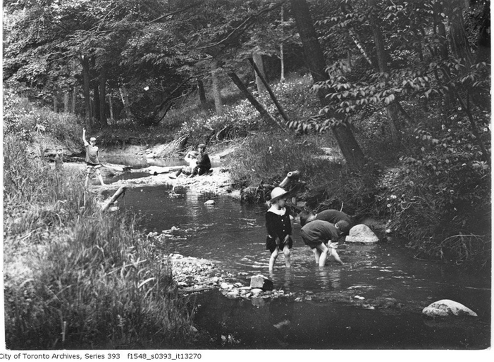
Anthropocene Immersion, Unearthing Lost Taddle Creek is a journey to find the landscape of lost Taddle Creek. These are the stories of the land: the little tributary creeks, a marsh and rivulet, a lost forest, Yonge Street and the Toronto Portages, and the amazing stories of Indigenous peoples, settlers, immigrants in this place called Toronto. Journey through Ryerson, Dundas Square, the Eaton Centre, the old Ward neighbourhood and see the landscape in a whole new light with the imprint of the old paths opening up new possibilities for reconciliation, resilience, and resurgence.
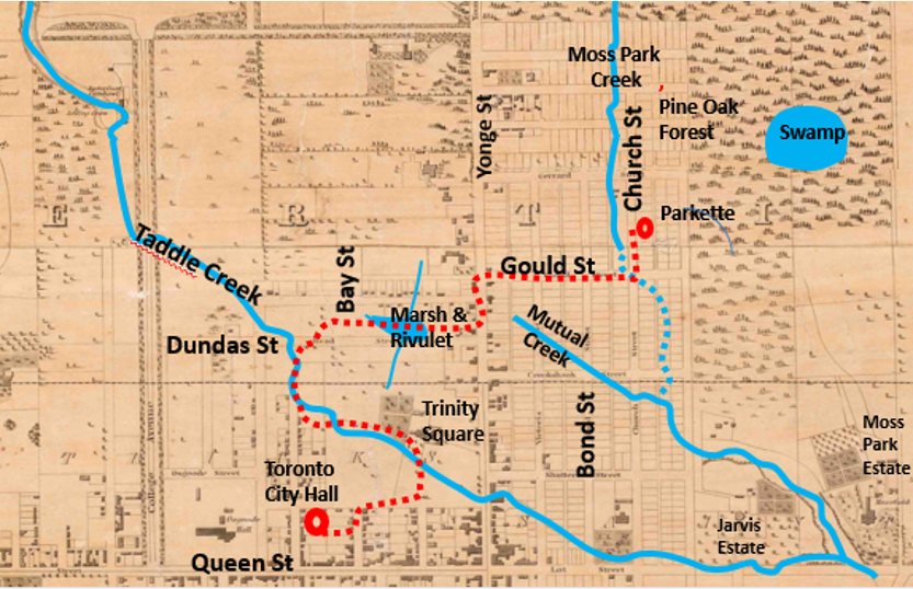
About the map
This web map design was originally developed as a pilot project for Geohistory/Géohistoire, the Canadian Historical GIS Partnership Development Project geohist.ca.on behalf of the Lost Rivers of Toronto Project lostrivers.ca. The current version has been developed in conjunction with the Luminato Festival.
The historical map overlay used here for reference is an excerpt from the 1842 "Topographical Plan of the City and Liberties of Toronto", by James Cane. For details see its full page description on Nathan Ng's website: Historical Maps of Toronto: 1842 Cane
Thanks and Credits
Thank you for coming on this walk and thank you to the collaborators an contributors who helped make it happen:
To the Luminato Festival Toronto team: Alex Rand, Kim Purtell, Wilson Lin, Pip Bradford, Lekan Agunbiade
To Lost Rivers contributors: Rhonda Lucy, John Lorinc, Rita Wong, Sandra Campbell, Zachary Grant, Setayesh Babaei, Byron Moldofsky , Waiyee Chou, Ed Freeman, Elisha MacMillan, Ellen Karp, Dilys Leman, Maureen Scott Harris, Paul Overy, Rene Fan, Ambika Tenneti
and John Wilson, Waiyee Chou, Ed Freeman, Peter Hare, Michael Cook