Other years
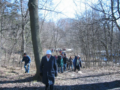
Sunday, January 18, 2:00 p.m. 2004, Lower Don. Start at Broadview and Queen and end at Riverdale Farm for some inside activities. Leaders John Wilson and others, Difficulty: mostly city streets, with some park trails and stairs; could be icy in spots depending on weather. Cold and clear, attendance 30.
Sunday, February 15, 2:00 p.m. 2004, The City and Garrison Tributaries. Start southwest corner of Bloor St. & Havelock (two blocks east of Dufferin). End Dovercourt Community Centre (Dovercourt east side north of Queen). Leader Ian Wheal. Difficulty: mostly city streets, with some park trails if not icy. Attendance 15.
Saturday, March 13, 2004, 1:30 p.m. Lake Iroquois Shoreline walk. Start Summerhill Subway Sta. End at Moore/Bayview Aves. Leader Ed Freeman. Walk difficulty moderate, mostly city sidewalks, but some steep slopes crossing the Vale of Avoca. This is a Toronto Field Naturalists walk. Attendance 57.
Saturday March 20, 2004, 2 p.m. Don Valley walk to mark World Water Day. Includes Don Valley Brick Works and fish weirs on Don. Start at Glen Road and Douglas Dr. Chorley Park bus stop, finish at the Ontario Science Centre. Leader Ed Freeman. Walk difficulty moderate (park trails some steep slopes). Attendance 8.
Sunday, March 28, 2004, 2 p.m. Reconnecting Toronto to its Waterfront. Highlighting the original shore of Lake Ontario, wharves, industries, and public buildings. “The view from ‘the top of the bank’ a look at Toronto Waterfront as it was in 1793. A time when pristine, unspoilt vistas shone forth, when water wells within 100 yards of Front St. yielded clean, unpolluted water, when bubbling shoreline springs were awash in crystal pure water, a time when trout and other fish swam up the small streams to spawn. In scarcely more than half a century, Toronto would lose this vista and replace it with factories, wharves and railways. Landfill was the culprit and with it, development at any price.” from OHS BULLETIN February 2004.
Start southwest corner Simcoe and Front Sts. End Esplanade at Parliament St. Leaders: Ian Wheal, Ed Freeman. City streets. Attendance 33.
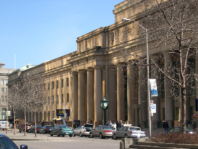
Union Station lit by reflection from RBC Building
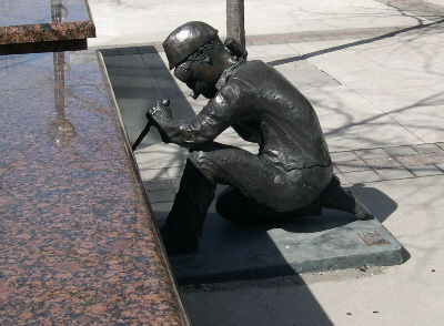
Statue of Worker in Simcoe Park
March 29, 7-9 p.m. - “If Trees Could Speak”, talk by Henry Kock, University of Guelph at the North Toronto Memorial Community Centre 200 Eglinton Avenue West (between Yonge St. and Avenue Rd.) For more information see North Toronto Green Community website.
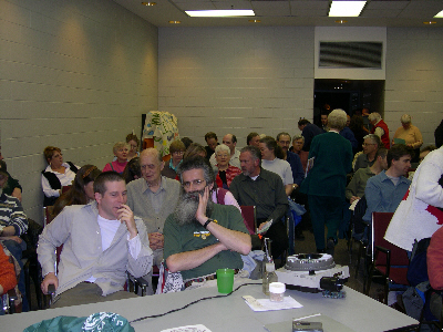
There was a fair crowd March 29.2004.
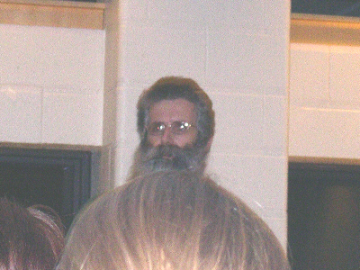
Henry Kock telling what trees tell us.
Saturday, April 3, 2004, 2 p.m. Rockcliffe Creek and vicinity walk. Start Jane St. and Alliance Ave. Walk to end at Weston Rd. and Alliance Ave. Walk difficulty: moderate, dirt trail, possibly muddy.. Leader Ian Wheal. Attendance 4.
Sunday, April 18, 2004, 1 p.m.. Rowntree/Lavender Creek; an exploration of glacial impacts and erosion; Lake Iroquois Shore Bluff; sands and clays of former brickfields; landfills; the Humber Baymouth Gravel Bar; remains of the old Belt Line Railway and the CN Electric RR to Guelph; and stories of early residents. Meet at Bert Robinson Park (Caledonia Rd. South of Eglinton Ave.). Walk leaders: Dick Watts, Rob Colle, Richard Anderson and others. Degree of difficulty: moderate ( mostly on city streets and park trails, but some steep and rough terrain). April 22 - is Canada Earth Day. Attendance 20; intermittent rain.
Saturday, April 24, 2004, 9am-12 noon, Canada Earth Day Clean Up of Burke Brook - Sylvan Valleyway and Avenue Road. Another clean-up on Mud Creek north of Wilson, meet at Champlain Place, 493 Wilson.
Sunday, April 25, 12:00 noon - Official Launch of “1000 Trees in North Toronto” at Fairlawn Heights United Church, Get into spring by joining us at this exciting event to kick off “1000 Trees.” The North Toronto Green Community and partners, Fairlawn Heights United Church and Neighbourhood Centre, LEAF, The Clean Air Foundation, and The City of Toronto, would like your help to plant 1000 Trees and Shrubs in the North Toronto area by 2005. How youcan get involved:
- Decide to plant a tree or shrub in either your front or backyard.
- Attend one of the information events mentioned in this brochure.
- Call the North Toronto Green Community at 416-781-7663 for more information.
- Help us spread the word, tell all your friends and/or become a volunteer!
Sunday May 9. 2004, 6:45 p.m. Central Toronto Landscape, an Ian Wheal ““Heritage in the Landscape” Walk. Meet at SW corner of University and Dundas, end Sherbourne and Richmond. Approximately one and a half hours on city streets. Attendance 11.
Saturday, May 15, 2004, 2:00 p.m. Terraview Willowfield on Taylor Massey Creek. Explore the ponds and plantings of this award-winning regeneration site, then walk along the trapezoidal concrete section below it, still to be reclaimed, with local champion Nancy Penny. Meet in the parking lot, east side of Pharmacy, just south of the 401. We’ll walk to Ellesmere and back. Joint walk with FODE, and the local Terraview Willowfield committee. Walk difficulty: walk in the park. Cloudy dull odd sprinkle 16 people.
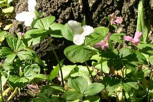
Sunday, May 16 , 2004, 2:00 p.m. Agnes Moody Fitzgibbon Wildflower walk by the Humber, starting at the Lambton House, 4066 Old Dundas St., on the East bank of the River. Aprox. 2 hours. Leader Madeleine McDowell and friends. Walk difficulty, walk in the park. Pleasant sunny day, attendance 25. Picture below- Trilliums seen on this walk.
Sunday, May 23, 2004, 2 p.m. Mud Creek and Spring Wildflowers. Meet at Wilson Subway Station (Wilson entrance). Leader Helen Millls. Moderate difficulty Two hours. Attendance 25; fine day.
Saturday, May 29, 2004, 2:00 p.m., Wilket Creek (Part 1) and Windfield Farm. Meet York Mills Rd. and Bayview Avenue SE corner; end Edwards Gardens. Moderate difficulty. Leader Peter Heinz.
This was the first of a two-part walk tracing the former Milne Creek from where it emerges at York Mills to where it empties into the West Don River. We discussed of the history of Milne Creek, erroneously labelled Wilket Creek in 1960. (The original Wilket, now called Newtonbrook Creek, flows further north into the East Don River.) The St. Andrews Reach, Hwy 401 south to York Mills, is now a well cut parkland, site of the former St. Andrews Golf Course. We followed the Banbury Reach south, visiting E.P. Taylor’s Windfield Farm enroute. The former IBM Golf Course outline is evident in the very large manicured, hilly open area before the path enters the old growth forest approaching Post Road. Only 6 people participated, even though the weather was warm and sunny.(See Aug 1 for Part 2)
Sunday, May 30, 2004, 2:00 p.m. Deerlick Creek and the Brookbanks Ravine System. Meet at SW corner of York Mills Rd. and Fenside Dr. Moderate difficulty. Leader Helen Mills. Attendance 32; fine day.
Sunday, June 6, 2004, 2 p.m. Mount Pleasant Cemetery, Wildflowers, Peonies and Sculpture. Meet at The main gate on Yonge St. Leaders Helen Mills & friends. Moderate difficulty. Attendance 8, Sun and cloud, 20 degrees C.
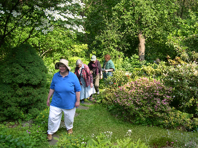 Helen Mills leading group through garden on
Iroquois bluff.
Helen Mills leading group through garden on
Iroquois bluff.
Monday, June 7, 2004, 6:45, Original Shoreline Meet at Sherbourne and King. Leader Ian Wheal. Attendance 9.
Sunday, June 13 , 2004, 1:30 p.m. The Thistletown Oxbows on The Humber River, a walk for Canada Rivers Day. Includes a visit to an ANSI, wetlands and an exellent example of stormwater natural purifying area. Leaders Luciano Martin and Joan O’Donnell. Meet at Albion Rd, & Irwin Rd. NE corner, next to tennis courts. End Finch and Islington. About two hours, moderate difficulty. Attendance about 10; pleasant day, ptly cloudy.
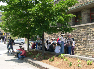
Sunday, June 20, 2004, 2 p.m. Lower Don Walk Plans for a new mouth, the Don Narrows, Flood Control and prevention. In conjunction with TRCA. Leader Don Haley. Start & end at the NE corner Queen and River Streets. City streets and pedestrian / bycycle path; two Hours Plus. Sun and clouds 20 degrees breasy 23 people.

Gathering for walk on June 20
Monday, June 21, 2004, 6:45 An evening ramble to mark the solstice. Meet at Roncesvalles Ave. and King St. SE corner. Walked to mouth of Humber. Leader Helen Mills. City streets; two hours. Overcast, 20 degrees, some sprinkles with heavy downpour later in evening, 13 people.
Sunday June 27. 2004, 2 p.m., Withrow Park - Ecosystems, Parks and Gardens. Meet at Chester Subway Station. Walk ends in the gardens of Bain Coop. Leaders John Wilson and Dagmar Baur friends. Easy walking on city streets and in parks. Attendance 8, a pleasant day seasonal temperature.
Sunday June 27, 2004, 6:45, North Toronto’s First Water Pipeline. Meet at SW corner of Montgomery and Yonge. City streets about two hours. Leader Ian Wheal. Attendance 17.
Saturday July 10, 2004, 2 p.m. Circle tour of Lawrence Park. Meet and end at Locke Library (SE corner Lawrence and Yonge). Leaders Helen Mills and friends. City streets and park trails; two hours. Mostly sunny, 20 to 26 degrees C, light brease,** 48** people.
Gathering at Locke Library for July 10, 2004, walk.
Sunday, July 18, 2004, 2 p.m. Old Growth Forest Along The Don (Hinder Property). Meet on the east side of Bathurst Street at the road to a parking lot opposite the Jewish Community Centre of Toronto. Walk to end at the start point. Walk difficulty is moderate, with some wooded steep slopes. Leader Peter Hare. Attendance 25, Cloudy humid 23C, light breeze.
Saturday, July 24, 11 a.m. Lady Edgar’s Rosedale Camping and Landscape. Meet at Castle Frank Subway Station. Leader Ian Wheal. Attendance 12.
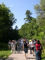
Sunday, July 25, 2004, 2 p.m. Caves of Riverdale. Start Broadview Subway Station. Leaders Ian Wheal, and Ed Freeman.From the Broadview Subway entrance south along Broadview to Riverdale Park East and then east along Bain Avenue to Logan Avenue and north to Danforth Avenue. Approximately 150-160 people attended; pleasant day, partly cloudy and 21 degrees C. Ian Wheal’s notes follow:
Sites of caves and dens along and near the Don River and its tributaries can be plotted on maps of the Riverdale area. Most sites were gone by 1900. Henry Scadding, in Toronto of Old mentioned natural and human excavations where bears, foxes, wolves, and other animals had dens. Human excavations in the hillsides were common as early as the 1820s and later served as deposit sites for booty and loot from break-ins and robberies by the Brooke’s Bush Gang and others (ie., 1840s ‒ 70s). Animal remains, aboriginal artifacts, and occasional fossils were recovered from the hillside.
The major news event of 1878 was the kidnapping of Toronto merchant, Robert Jaffray in the summer. He was held in a den near Winchester Street. (Winchester Street was Don Mills Road, built in 1842 by William Helliwell of Todmorden Mills and a toll road until 1886. Tolls were about one to three cents. CN Railway closed off Winchester Street, and removed the railway crossing and bridge over the Don River as of July 13, 1957.) Jaffray was roughed up, but managed to free himself from his ropes in the absence of the kidnappers and made his way to the Winchester Street Toll Keeper’s cottage. Here the toll keeper and his wife fed him and took him back to the city. (The area of the kidnapping was outside the city boundaries in 1878.)
The city and Township of York police were alerted by a rider on horse ‒ no phones as yet. The kidnappers were found and sentenced to jail time. Jaffray later became owner of The Globe newspaper, dealer in real estate, and a Senator of Canada. He died in 1914.
Nov. 2, 1907 Evening Telegram School Boys Big Battle
Withrow Ave. schoolboys staged battle on hillside bounded by Sparkhill, Broadview, Hogarth, and Hampton Avenues. Four score warriers fight a sham battle before their Thanksgiving dinner. The defence forces lined up in Winchester Drive and marched up to a position on the hills. The attacking force formed on Hogarth Avenue and proceeded to attack. Every tree and stone and mound that gave cover was used by the eager yet crafty attackers.
“Many invaders found cover in the holes which are the remnants of the big caves when the scene of battle was the ‘notorious Brooks bush.’ In those caves toughs took shelter half a century ago, and as late as 20 years ago thieves ate chicken and other luxuries there and used the caves as storehouses for stolen property.”
“Driven back, the still eager attackers resorted to strategy and to stones. Last year the defence were the victors, but it must not happen this year. Everything being fair in boys’ sham fights the momentarily beaten attacking force, perhaps recalling the story of David and the giant, grab stones from the piles of gravel which have been hauled to the repair of Hogarth Avenue. Stones turned the battle and won the day.”
Sunday, August 1, 2004, 2 p.m. 2004, Wilket Creek (Part 2), continuation of May 30 walk. Leader Peter Heinz. Meet at SW corner Lawrence Ave. and Leslie Street. End at Eglinton Ave. Moderate difficulty. Fine Day 26 degrees sunny light breeze** 32** people
Continuing our May 29 route from York Mills to Post Road, we followed the final stretch from the short-lived mills of Alexander Milne in Edwards Gardens south through the wilds of Wilket Creek Park, up the escarpment of former Lake Iroquois to Sunnybrook Park, and down into Serena Gundy Park where Wilket Creek empties into the West Don. While it was a hot, sunny day, 32 walkers enjoyed cool shade provided by the valley.
The Wilket Park Trail was busy that Sunday
Sunday, August 1, 2004, 6:45 p.m. On Toronto’s Pack Horse Trail (the actual trail) Meet foot of Bathurst and Lakshore Blvd. Leader Ian Wheal. Attendance 11.
Saturday, August 7, 2004, 10 a.m. Rockcliffe Walk Start NW corner Gunn’s Road and Weston Rd. We go along Lavender Creek to the Rockcliffe greenhouses and community gardens where heritage vegetables are grown. Leaders Dagmar Baur and Beatriz Alas. Walk difficulty largely city streets. 40 people attended the walk on an intermittently cloudy / sunny day in the low twenties. Between 15 and twenty people showed up separately to the Rockcliffe Greenhouse Presentation. So around 60 people.
We started at Gunns and Weston Road two busstops north of St. Clair. Our group consisted of a Mandarin Chinese social group from Dixon Hall. There were many young parents and also young children in prams. There were alsoLatino Gardeners from Chalk Farm Gardens at Jane & Finch. I believe and miscellaneous people, of whom some had attended the same walk last year. Beatriz Alas, Steven Jeaudry and myself led the walk. After taking the path down North of Lavender Creek we did not circle around to climb to the park above the homes on Terry Drive. Instead we followed Lavender Creek North in a green corridor with mowed grass to where it met Black Creek and the Bridge. Along the way is a huge old wiillow, maybe 100 years. Stephen J. showed us several successful native plantings along the way. It’s a much nicer jaunt. We walked to Rockcliffe and doubled back to the Greenhouses. I did geologic history and plant identification. At Rockcliffe we toured the gardens. Keisha Morgan gave the little ones a special children’s tour through the garden. We had sandwiches and fruit juices, courtesy of the Hispanic Council. Karen Sun, Planner from the TRCA had a power point presentation of Urgan Agriculture and Beatriz Alas made the presentation on future plans for agricultgural development in the city of Toronto by Parks and Recreation. Ken Jeffers, Parks and Recreation manager of access did the introductions. A good time was had by all.
Dagmar Baur
Sunday, August 8, 2004, 6:45 p.m. Gallows Hill Meet at Summerhill Subway Station entrance. Leader Ian Wheal. Attendance 13.
Saturday, August 14, 2004, 2 p.m. Go For The Gold. Toronto’s Gold rush 1824, along the Credit River. Meet at Dundas Street West and Mississauga Rd. U of T Erindale campus. Leader Ian Wheal. Attendance 8; good weather.
Sunday, August 15, 2004, 2 p.m. East Don Garden Tour. Start NW corner Victoria Park and Jonesville Cres. (one block north of Eglinton). Leader Helen Mills and friends. Walk difficulty largely city streets. Partly cloudy 22C humidex 26 attendance 31.
Sunday, August 22 2004, 2p.m. Mud Creek Garden Tour. Includes rooftops, the Eglinton Park Heritage Community Garden, and other surprises. Leader Helen Mills. Meet at the SW corner of Yonge St. and Broadway Ave. Walk difficulty largely city streets. Attendance 38,sunny and warm 26 C, light breaze.
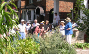
Helen Mills discusses garden on Glengrove.
Sunday, September 19, 1:30 p.m. Equinox, Iroquois Shore and Wychwood Creek. Start Dupont Subway Station NW corner. Where did the Wychwood Creek go? Mark the Equinox. Small ravines along the old bluff. Walk difficulty light to moderate. Leaders Peter Hare and Dick Watts. Twenty three people attended this sunny warm day in September.
Sunday, September 26, 1:30 p.m. Scarborough’s Skeleton Coast. Meet at Lawrence and Beechgrove Avenues. Leader Ian Wheal. Attendance 8; pleasant day.
Sunday, October 17, 1:30 p.m. Terry McAuliffe Memorial Walk. Meet at Heath St. entrance to St.Clair West Subway Station. An exploration of Cedarvale ravine and woodlands, Castle Frank Brook, land modifications for the TTC Subway, proposed and abandoned Pellatt Estates, restorations of Glen Cedar Bridge and the Connaught Gates. Walk leaders: Dick Watts, Peter Hare, Alan Seymour, Howard Katz, Robin Pacific and Joe Mihevc. Walk difficulty: moderate; mainly on park trails and city streets; some steep and rough terrain. Walk duration: about 2 hours. The walk ends where it began. Attendance 40 Mostly cloudy cool.
Saturday, October 23, 2004, 1:30 p.m. Lady Edgar’s Rosedale Camping and Landscape. Meet at Castle Frank Subway Station. Leaders Ian Wheal and Ed Freeman. Attendance 25; cloudy some sun; 13 C; raw NW wind gusting 30 k.
Sunday, October 24, 2 p.m. Restoration Projects along Castle Frank Brook. A joint walk with the Task Force to Bring Back The Don to see and discuss several small restoration projects in Cedarvale and Nordheimer Ravines. Meet in front of Eglinton West Subway Station. Walk difficulty light, park paths and city streets, some slopes. Leaders John Routh and Peter Hare. Attendance 14; cloudy dull; threatening rain came as walk ended. 10 C.
Sunday, November 21, 2 p.m. Rouge Valley Geology. Starting point Pearse House ( the Rouge Valley Conservation Centre) adjacent to the road entrance to Beare Road Landfill just off of Meadowvale Road immediately south of the Metro Zoo. Free parking. The Rouge Valley contains a wealth of landforms and sediments that record changing environments in Southern Ontario over the past 100,000 years from warm so-called interglacial climates (similar to the present) to full blown glacial climates when ice from Labrador swept over Southern Ontario a part of a thick continental ice sheet. The valley aso contains evidence interpreted to record evidence of past earthquakes. These and other aspects will be demonstrated on a 3 km long walk on Sunday 21st Novemeber by Professor Nick Eyles of the University of Toronto’s Geology Dept. We will walk to the top of Beare Road Landfill, now abandoned, which affords excellent views of the valley and its surroundings and gives an opportunity to discuss issues such as impacts on groundwaters etc and historic uses of the valley. We will then walk downstream looking at the sidewalls of the creek before returning to the Pearse House.
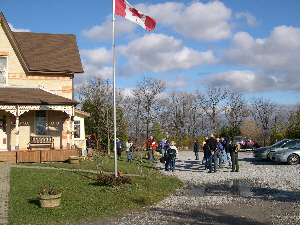
The Group meets at Pearse House
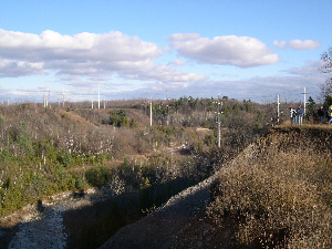
The valley of The Little Rouge
A fine day, some clouds, but mostly sunny, 10 C, light wind, 35 attended. The walk was taken in reverse order and Beare Road Landfill was only looked at in the distance.
Sunday, December 19, 2 p.m. Taddle, Corktown and Sumac Creeks, an easy seasonal walk. Start Richmond and Sherbourne (Coffee Shop close by) end at Riverdale Farm for refreshments. Leaders Peter Hare, Ian Wheal and Helen Mills. 24 started this walk but half dropped out due to bitter cold, wind chill -24; Sunny and bitter cold -14C.
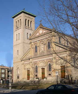
St Paul’s Roman Catholic Church was on the route