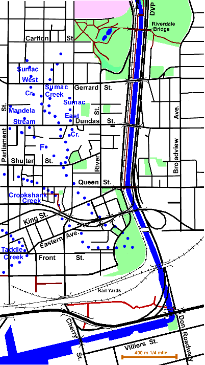
3 km (from Riverdale Bridge to the mouth) plus Sumac Creek 1.7 km, its small tributaries 1.5 km and Crookshank Creek 1.4 km
This is the most abused part of the Don River. It has been put in a rectilinear channel and its marshes have been poisoned and filled. It wasn’t always like this. In the late eighteenth century this was a paradise. Mrs. Simcoe, describes in her diary (1793) a very different territory from what is today mostly a run down industrial district. See below. This is a large and complex area. The points of interest and other details can be found on precinct and stream pages.
Click here to see sewers. Double click to remove.
The Precinct pages link to point of interest pages and provide more detailed detailed descriptions. Click here to see the precincts on the map. Double click to remove.
Click here to see the course of the former river and its tributary streams. Double click to remove.

- Cabbagetown (the present “Cabbagetown”)
- Riverdale (parks, zoo/farm, hospital & Don Jail)
- Regent Park (the original Cabbagetown)
- Don Narrows (the most restricted stretch of the Don)
- Corktown
- West Don Lands (originally part of Corktown and at one time called Ataratiri)
- Don Mouth (mostly made land, formerly Ashbridge’s’ and Toronto Bays)
The two tributaries: Sumac and Crookshank Creeks are followed on their own pages.
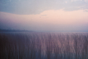
In the late eighteenth century this was a paradise. Mrs. Simcoe, in her diary (Sunday August 11, 1793) describes a very different territory from what is today mostly a run down industrial district. “This evening we went to see a creek which is to be called the River Don. It falls into the bay near the peninsula. After we entered we rowed some distance among low lands covered with rushes, abounding with wild ducks and swamp black birds, with red wings. About a mile beyond the bay the banks become high and wooded as the river contracts its width. (Tuesday August 13) An Indian named Wable Casigo supplies us with salmon with which the rivers and creeks on this shore abound.”

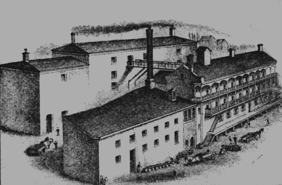
What happened? First, industries were established along the Don. It was a natural transportation route and also supplied power. Todmorden Mills, now a Heritage Museum and Art Workshop was one of the early industrial sites developed. http://www.toronto.ca/todmorden/index.htm More came: mills, quarries and factories, providing the lumber, paper products, flour, bricks, beer, liquor, meat and tallow which helped our city to grow. Gas works, petrochemical plants and others followed. Pollution from these industries found its way into the Don. Much of the valley was used as a dumpsite.

By 1900, Ashbridge’s Marsh had become filthy, brackish and unhealthy. The river flooded nearly every spring, knocking out bridges and menacing buildings. To minimize flooding, to provide a shipping channel and to create additional industrial land, “the Don Improvement Project” was established. This would straighten the river south of Gerrard Street, create room for the railroads, roads and other urban infrastructure we see today. Ashbridge’s Marsh was filled, eliminating public concern about health and making space for new industry. The river was constrained and the natural mouth destroyed.
Today steps are being taken to rectify some of the damage. For almost two decades the Task Force To Bring back The Don has been planting trees and carrying out other projects to bring nature back. Visit the Task Force site to see some of its accomplishments. www.toronto.ca/don/taskforce.htm. The Task Force has been encouraging improvement of this area for some time. See Riverdale, Don Narrows and Don Mouth Precincts.
A new park is being constructed in the former Ataratiri Site (now West Don Lands), which will bring a green space to the area between Queen Street and the railway tracks and at the same time provide a buffer to prevent flooding there. Planning has started to limit flooding south of the tracks and at the same time renaturalize the mouth of the Don River.
Walking along the Don here is often difficult and its original route is obscure. It is not possible follow the Don closely all the way. On the west side there is a good trail from a little north of Riverdale Foot Bridge to Queen Street. If one is coming from the north, at the end of Rosedale Valley Road, take the path up through Wellesley Park to Amelia Street and follow Sumach Street to Riverdale Park. At Queen Street, the Don Trail is temporarily closed to Lakeshore Boulevard, while the new park and flood control berm are being constructed. The Lower Don trail can be followed through former industrial lands north of the Keating Channel from Lakeshore and Don Roadway to Cherry Street. It is expected that when the new parks are completed for the West Don Lands and the Don Mouth together with a recommended connecting trail to Rosedale Valley Road, there will be good foot access to the west side of the Don River for the full length of this Reach.
On the east side, access to the Don River is blocked for most of this reach by the Don Valley Parkway. There is a good pedestrian and bicycle path along the Don from The Forks to the Riverdale Foot Bridge. From here south, one can follow park paths and local streets to Queen Street; here it becomes difficult; there are no paths nor even close by streets. One can follow the south side of the Keating Channel by walking along Villiers Street. The channel itself is accessible through the small park at the NW corner of Villiers and Don Roadway. It is hoped that the projected improvements for Don Mouth Park will greatly improve the situation.
