Some time between thirteen and twelve thousand years ago, the ice disappeared from the Lake Ontario basin and the lake waters which had had to use southern and western outlets at a higher level, found an outlet into the Hudson River near Rome, New York. As this was higher than today’s St. Lawrence outlet, a high level lake we know as Lake Iroquois formed.
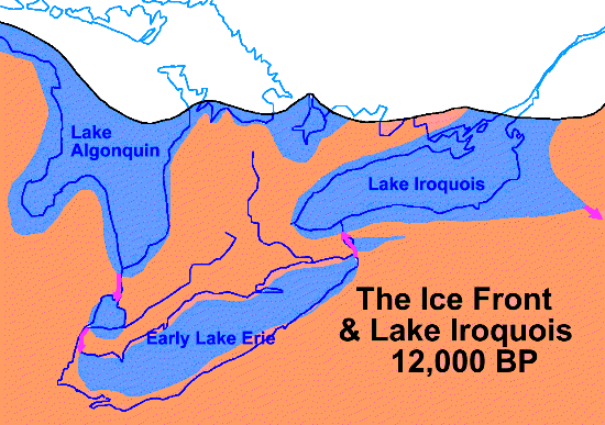
The crustal block that underlies most of The Province of Quebec and north- eastern Ontario,together with the eastern end of Lake Ontario and the St. Lawrence valley had been under as much as 2 km of ice for over 100,000 years and thus had been pushed hundreds on metres down into the mantle. The western end of the lake was freed from the ice several thousand years earlier than the eastern end, and probably had only been under the ice sheet for a small part of the Wisconsinan iceage. As a result it rebounded first, tilting that end of the Lake Ontario basin up at the time of Lake Iroquois (and for some time after). The eastern end of Lake Ontario and the St. Lawrence valley, having been depressed more, have rebounded more; thus the present in level of the Lake Iroquois shoreline varies from 55 metres above sea level near the Humber to 68 metres at the east end of Scarborough.
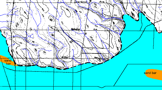
Into that cold glacial lake flowed a number of streams which are now tributaries of the Don River, including Castle Frank Brook, Yellow Creek and Mud Creek. See above map of the Toronto shoreline 12,000 years ago. All of downtown below Davenport Road was under the icy waters of Lake Iroquois. Much of Leaside was covered by a shallow bay, some times referred to as a lagoon, because it was cut off from the lake by a sand bar along today’s Danforth Ave.
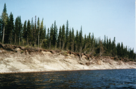
The old shore cliff has weathered a lot over the last ten thousands years or so. This picture of the banks of the Albany River gives some idea of how it might have looked when lapped by the glacial lake and of the sort of forest that might have covered the land. Pollen from Crawford Bog in Halton Region indicates a boreal forest. It likely took some time to get fully established. First would be aspens and other poplars as can he seen in Tommy Thompson Park. Then Spruces, Jack Pine and other Boreal trees would move in.
Other Pages in this Series
- Don Valley Brick Works Quarry - North Wall
- Before the Ice Age
- How The Glaciers Started
- The Great Delta
- Maximum Extent of the Ice Sheets
- The Story From The Lakes
- The Story of the Trees
- Early Stages of the Retreat of the Ice Front
- Drumlins and Flutings
- The Wide Valley of the Lower Don
- Geology References