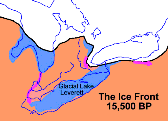
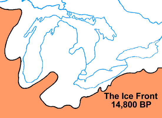
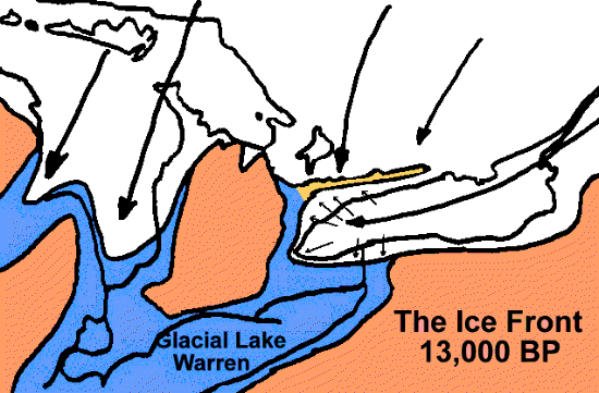
While 18,000 years ago the ice sheet reached its maximum and shortly began to melt back, the retreat was a complicated story that is not always clear. The maps below give only three examples of a continually changing picture. At times it was advancing in the west when it was retreating in the east. There were pauses and readvances.

About 15,500 years ago, the ice front had cleared the Lake Erie basin, but advanced again to recover that area and more by 14,800 years ago.

During this period of advances and retreats a space opened up between the Lake Ontario lobe and the main sheet to the north. Into this gap flowed meltwater from the glacier loaded with debris. The sands and gravels dropped out in this gap, while the finer particle escaped into a high level lake then filling the lake Erie basin and the south end of the Lake Huron basin and which probably fed the Ohio River. The sands and gravels that were dropped in the gap became a major ridge, that blocked the direct route of the Laurentian River, and which is now known as The Oak Ridges Moraine.

The Lake Ontario Ice Lobe came down the lake basin from the north-east, but it fanned out at the end of the basin so that in the Toronto area it was pushing in a north west direction up towards the moraine. Thus it left the ridges and grooves orientated north-west to south-east, that our steam valleys and ravines have followed. Resulting in the general south-eastern of most streams. The ice front apparently pushed forward and melted back at least twice as its till deposits override the Oak Ridges sands and gravels in places. This is discussed in more detail in the next page in this series: Drumlins and Flutings
Other Pages in this Series:
Don Valley Brick Works Quarry - North Wall
Maximum Extent of the Ice Sheets
Lake Iroquois & its shore cliff
