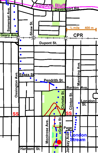
2.3 km of Garrison Creek & the tributary London Stream 0.7 km
The Christie Reach follows the course of the former Garrison Creek from Davenport Rd. and the Iroquois Escarpment to Harbord Street. It flowed south through the former hamlets of Dovercourt and Seaton and a bit of early Toronto. Shadows of its former ravine can be seen in Christie Pits Park and Bickford Park. At the south end of the latter at Harbord Street, the railing of a buried bridge can be seen. The tributary, London Stream is briefly described. The area is residential except for commercial strips along arterial roads. Sanitary Sewage flows to the Ashbridges Bay Sewage Treatment Plant. Some storm and combined sewer overflow water flows to Exhibition Park where it is held temorarily in the Western Beaches Storm Water Storage Tunnel. The balance flows to a combined sewer overflow outlet at the west end of Toronto Bay. Tree cover is fair in spots, but light to absent inn others especially along Ossington north of Pendrith St.
Click here to see sewers. Double click to remove.
To follow the course of Garrison Creek here as closely as possible, walk along Somerset Ave. to Gerry Ave.; to Ossington Ave. and the latter to Essex St. which can be followed to Shaw St. and down to Pendrith St., where there is a bit of valley. Take the lane to Barton Ave. and walk through Christie Pits Park to Boor St. The Garrison valley has been greatly changed by quarrying and fill.
One of Toronto’s Discover Walks traces the rout of Garrison Creek from Bloor St. to Toronto Bay. Its route markers will be a help in following this creek from here south.
Cross Bloor St. to the low spot between Grace St. and Montrose Ave. and walk south through Bickford Centre walkway into Bickford Park and south through the park to Harbord St.
Tree cover in Bickford Park is generally light; there are however, a number of old Crack Willow with some younger Linden, Norway and Silver maples, Ash and Honey Locust. There are tree small naturalized areas with small White Birch, Silver Maple, Willow, Beech, Sumac, Ash and one Tulip Tree. This was probably a quarry; was it one of Henry Butwell’s brick yards?
London Stream
London Stream started near London St. and Manning Ave. and joined Garrison Creek near the north end of Bickford Park. Its course is hazy, but can be inferred by slight dips in the topography. It crossed Bloor St between Manning Ave and Clinton St. and Clinton at Page St. which it followed to Jersey Ave. and over to Grace St. There is a noticeable dip in Grace St. where once there was a ravine leading to the Garrison Ravine now marked by the Bickford Park hollow. Because they were built on fill, some of the houses facing Grace St. here are not quite straight. Unstable foundations are among the hazards of building on filled ravines. This is a residential area with light tree cover, except for the commercial strip along Bloor Street.
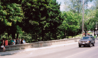
At the south end of Bickford Park, along Harbord St, there is a railing. This is all that is visible of a bridge, now buried, that used to span Garrison Creek.
Cross Harbord Street to continue along the Trinity Reach.